Sunday, January 29, 2006

01/29/2006 – Chickasaw Creek

Launch: Tucker’s Launch aka Brooks Park. The office appears to be abandoned, succumbing to the high water surges from last year’s hurricanes. Launch Cost: Free. Route: East on Chickasaw Creek, then about 1.5 miles into the Pumphouse Canal and back. Distance: 5.0 miles. Average Speed: 2.5 mph. Time: Approx 2 hrs. Pace: Slow. Weather: 60 degrees, mostly cloudy, slight wind, relatively little change in tide and almost no current.

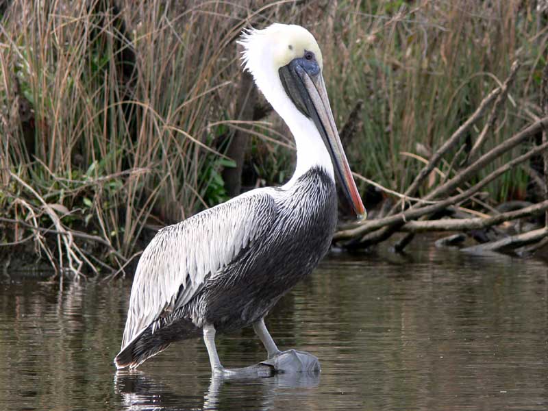
(1) Above left. Today was another one of those dark, cloudy, dreary winter days, but not very cold. This pelican was eyeballing the human in the boat with no motor. (2) Above right. While passing the Chickasaw marine industrial area, a barge with no shame kept on leaking.

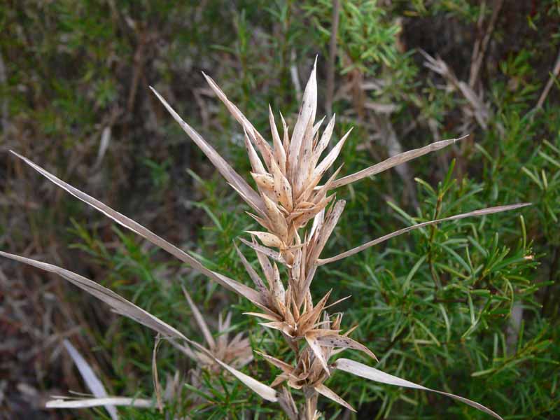
(3) Above left. Up in a little slough, it looked like the algae were having a bad hair day. (4) Above right. This mushroom, spreading out its wings, looked like a good texture photo. If you want to see some awesome photos of mushrooms, check out Taylor Lockwood’s mushroom photos.

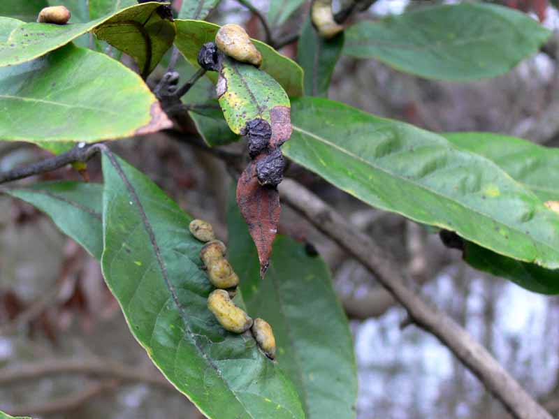
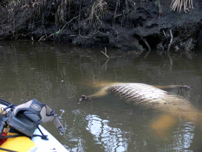
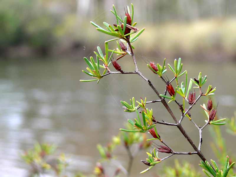
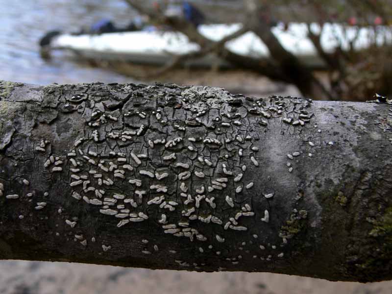
(5) Above left. In the Pumphouse Canal, one tree looked unusual. Upon closer inspection, what appeared as buds from a distance, were actually leaf galls. To learn more about leaf galls, check out Wayne’s Word. (6) Above right. Kayaking in the Pumphouse Canal always puts me on edge. If it isn’t the insects, it is the critters, however, this one was not moving.

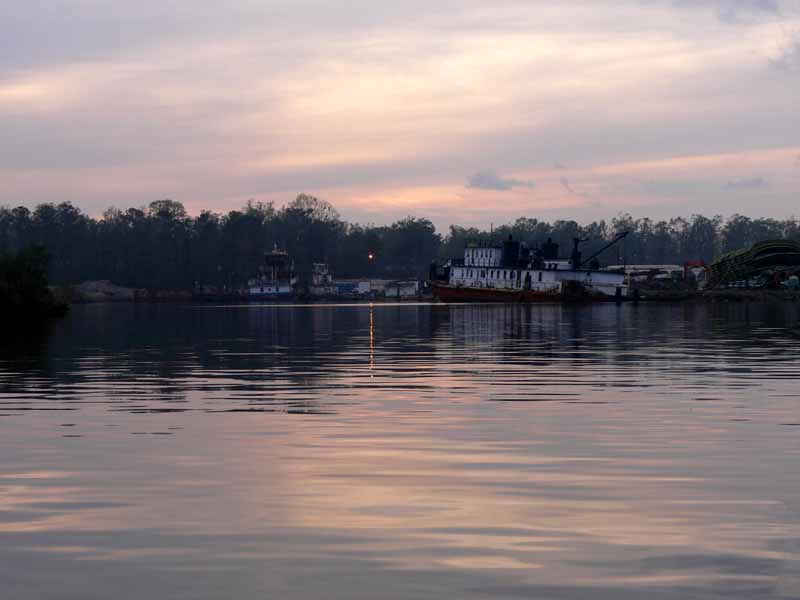
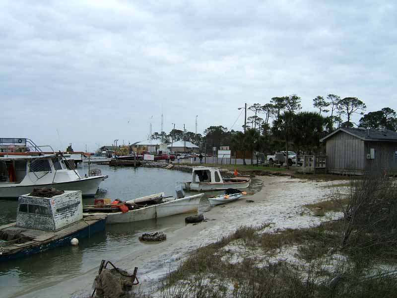
(7) Above left. While in the Pumphouse Canal, the mosquitoes were having a field day with my blood. Next time I’ll bring some repellent! Here, upon exiting the Canal, the sky started changing colors. I thought this was the sunset. Wrong! Sadly, while driving home after loading up the kayak, the real sunset started to display some beautiful colors that lasted for 20 minutes. Sure wish I’d been on the water during that display. (8) Above right. This is where the LST-325 used to be. If you want to see the LST-325 now, you’ll have to go to Evansville, Indiana.

(9) Above left. Up in Black Bayou, some of the bare trees were loaded down with Cormorants or Anhingas. (10) Above right. This woodpecker was noisily looking for food while there were a few moments of light left in the day.

Note: The last time I went down Chickasaw Creek, there was green water bubbling up that smelled like raw sewage. I thought a sewage pipe might have been broken. To update, there is a sewage disposal site just south of the creek. There was green flow from the pipe today, just like in the past and apparently that is normal. However, today, there was no smell of sewage in the air. Ahhh.

Saturday, January 28, 2006

01/28/2006 – Bay Minette Creek

Launch: Buzbee’s. Launch Cost: $3. Route: I chose to pedal around Bay Minette Creek since the waterway would be perpendicular to the strong southeast winds. Distance: 5.8 miles. Average Speed: 2.7 mph. Time: Approx 2 hrs. Pace: Slow. Weather: 45 Degrees, mostly cloudy, high humidity, breezy winds out of the southeast, low tide and minimal current.

(1) Above left. I bundled up on this chilly and breezy morning to enjoy the sunrise. While witnessing the colorful hues, flocks of blackbirds passed overhead. Some of the birds can be seen on the right above the tree line. (2) Above right. Shortly after sunrise, a bank of low clouds swept across the sky blocking the sun.

(3) Above left. Occasionally, the sun could be seen behind the clouds. (4) Above right. An Osprey Eagle and his family kept a keen eye on me until I passed by their territory.

(5) Above left. Only during low tide can you hear the trickle of this small waterfall on Bay Minette Creek. (6) Above right. Seeds from last years flowers are still abundant.

(7) Above left. Got out of the kayak and took a few photos while walking along the stream bank. Here, the little seed pod looking structure with the needle like tip looks menacing. (8) Above right. A dried-up piece of grass against the greenery seemed like a nice contrast. Soon, everything will turn green again. Yea!

(9) Above left. Tree limbs are often hosts for a variety of life. Here, it looks like something laid sacks of elongated eggs. Maybe this is a blight is attacking the tree, or maybe it is a form of lichen. (10) Above right. It isn’t often I see a mat with bumps on it coating a tree limb. I don’t profess to know much about nature, but I do enjoy the beauty and textures it displays. Can’t wait for the colors of spring to begin.

Sunday, January 22, 2006

01/22/2006 – Dauphin Island

Launch: Northeast end of island by the Restrooms next to the Ferry. Launch Cost: Free. Route: Because of the winds, I decided to stay inland and pedal around Dauphin Island Bay because I just didn’t feel like getting soaked today with the choppy waves in the open waters. Distance: 10.0 miles. Average Speed: 3.3 mph. Time: Approx 3 hrs. Pace: Leisurely. Weather: Mostly cloudy, 95 percent humidity, breezy with winds steady about 15-20 mph. Was fighting a little current on the way back by Pass Drury.

(1) Above left. The beach launch area was a bit crowded today with several fishing boats in various stages of repair lining the beach. For those interested, the white Mobile Bay Ferry is in operation now. (2) Above right. After going northwest about three quarters of a mile, there was a dredge boat in the process of pumping sand on Little Dauphin Island with the goal of closing off Pass Drury – a cut in Little Dauphin Island. The pass was opened up because of previous hurricanes. Enough current rips through there to silt up the boat channel. The dredging was being done by Dredge America out of Kansas City, MO.

(3) Above left. One of many interesting homes. I liked the unique lattice work on this home. (4) Above right. I kept out of the winds by pedaling around Confederate Pass and Indian Bay, both which are off of Dauphin Island Bay. If you want to learn and see more of Dauphin Island, I suggest you check out Mark Ewers’ Dapuhin Island Times link.

(5) Above left. Down near Chugae Point (the north side of the entrance to Dauphin Island), the framework for the boat storage facility is up. The old boat storage building was destroyed by past hurricanes. This new building, with its little beams, looks like hurricane fodder. (6) Above right. To the northeast of the new building lies an old sunken barge. Oyster Catchers, Egrets, and Pelicans were sharing the little bit of barge left above water.

(7) Above left. Last year’s hurricanes ruined the motel that sits next to Indian Bay. It now sits gutted and vacant with all the doors open, with no tresspassing signs posted on the property. (8) Above right. Also in Indian Bay sits a fleet of Auburn University Department of Fisheries & Allied Aquacultures boats. If you are interested in fisheries, Aqua Network Information Center has many power point slide sets, including several from Auburn University for you to peruse.

(9) Above left. There were plenty of birds and ducks for the viewing pleasure on this trip. Here, mallard ducks were congregating around the white goose for protection. (10) Above right. Out beyond the east end of Dauphin Island, there were flocks of ducks that looked like Cormorants that stretched for miles. Soon as one flock would pass, there would be another line following the same path, again, a single line stretching for miles. Wonder where they were all migrating to or from? Dauphin Island is the place to be to watch bird migrations!

Saturday, January 21, 2006

01/21/2006 – Chacalloochee Bay

Launch: North side of Causeway by the triple public boat ramps. Launch Cost: Free. Route: Pedal northeast up Chacalloochee Bay, aka Chocalata Bay and back. Distance: 6.0 miles. Average Speed: 3.0 mph. Time: Approx 2 hrs. Pace: Slow. Weather: Cloudy, in the 60s, winds calm, humidity 100 percent, foggy drizzle. No current and little change in tide.

(1) Above left. Though the clouds looked threatening on this late afternoon pedal trip, the waters were slick as glass and the temperatures were warm. After starting out, a boat ripple enticed me to take a photo. (2) Above right. The boat ripple, merging with my kayak wake, made for an interesting ripple design.

(3) Above left. Looking west, a photomerge of the land area dividing Chacalloochee Bay and the Tensaw River. The clouds and their reflection on the smooth quiet waters were mesmerizing. (4) Above right. Further up in Chacaloochee Bay, looking toward the northeast, this is another photomerge that just doesn’t capture the full scope of the beautiful sky at that moment.

(5) Above left. Cypress tree knees out in the middle of the water. (6) Above right. Grass near the entrance to Savage Ditch. The clouds merged with mist and fog turning the sky into one color.

(7) Above left. Conditions were good shortly after staring this trip as the skyline can be seen in the background. (8) Above right. On the way back the skyline was no longer visible. Even the tree lines in the horizons became difficult to see. Cars going across the causeway could be heard, but not seen. Conditions can deteriorate rapidly. Fog can come rolling in so fast that you won’t see it until you are in it and everything disappears. When kayaking, you should always take a GPS with you that has a Waypoint from where you started. This was my first trip of the year. Sadly, the mosquitos are alive and hungry in January. Jeesh.