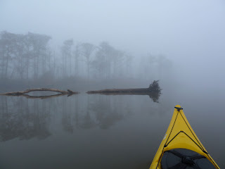
Launch: Shirley's (US Hwy 90 across from battleship USS Alabama)
Launch Cost: Free
Destination: Mobile River going south around Pinto Island. You can't get all the way around Pinto Island because the upper side is blocked by vegetation.
Distance: 12 miles (round trip)
Paddle time: 3-1/2 hours
Weather: Cloudy, 70 degrees, winds 10-20 mph. Tide rising and current about 1 mph.
GPS Track: To view or download the GPS track of this trip, Click Here.
 |
| Header Image |
 |
| 1) Today's destination was over near those buildings on the skyline. |
 |
| 2) Down around the corner of Pinto Island are some massive cranes that move a lot of bulk steel using powerful magnets. The steel is probably headed up Mobile River by barge to the steel plant ThyssenKrupp. |
 |
| 3) When current and wind are going in the same direction, the waves are smaller than if they were opposite. Even though winds were gusting up to 20 mph and there was a small craft advisory, conditions were fine for kayaking in Mobile River. |
 |
| 4) The USS Alabama. Despite its tourist attraction, kayaking around the Battleship north to just past the Hwy 90 bridge can be unusually choppy, rough, and unpredictable. I consider it one of the more dangerous places to kayak in this area. |
 |
| 5) If you have every tried to buy a plane ticket for a flight that leaves out of the Mobile Airport, then you know if you fly from Mobile, you will get definitely get "Poor Faster." This is a takeoff on the Mo Faster ad. |
 |
| 6) For you poor people with snow on the ground, good news - spring green is on the way. |
 |
| 7) A different perspective on the roads used to drive across Mobile Bay. |
 |
| 8) Bet that bird will be in for a surprise when a maintenance person lowers the light housing to replace a bulb. |
 |
| 9) A rather cloudy sunset. |
 |
| 10) Conditions did deteriorate between the Battleship and the Hwy 90 bridge where the wild confused waves with the current stir up a froth. Plus, waves hitting the Battleship bulkhead also cause froth. This is the incoming current froth line. |
 |
| 11) I mentioned a few possibly dangerous areas that can throw you surprises when kayaking the Mobile River loop. Thought a graphic of the approximate location of those areas, shown in red, might help. This is the track from this trip. |
There have been times that I paddled all day in wonderful conditions only to approach the above areas in red and was thankful just to get past them without capsizing. It may look like I go kayaking where ever I want when ever I want. This is not true. I do not go kayaking without checking a half dozen different forecasts. I time trips so I pass potentially difficult areas at optimal times. What is checked are tides, current wind from buoy locations, forecast wind speed and direction from the Aviation forecast, water temperature, marine forecast, current forecast for max ebb and max flood, upstream water levels, and if going into the Gulf, I look at swell forecast. Hope this helps new kayakers. Be safe - wear your life jacket and have both plan A and plan B in case there are problems.


