Showing posts with label Oil Rigs. Show all posts

Sunday, April 10, 2016

Dauphin Island

Good News and Bad News.

The good news is the almost $7 million dollar Dauphin Island east end beach restoration project that brought in 325,000 cubic yards of sand is complete. The new beach is proving to be popular.


The bad news is the free east end parking is limited and my favorite east end sheltered kayak launch has moved so far away from the now crowded parking area that it is not worth using anymore. Most of the formerly sandy shoreline is now a kayak un-launchable rock shoreline.

The new long rock shoreline is visible on the right. To launch at the sandy beach visible on the left side of the photo will require carrying the kayak across a painfully long stretch of new sand.

The north side of Little Dauphin Island Bay is enticing.

All the sand that was moved to Sand Island Lighthouse has been swept away.

The Mobile Bay ship channel is next to the lighthouse so you may get to some big ships up close while kayaking near the lighthouse. A porpoise or dolphin jumps out of the water while playing in the ship's bow wake.

Not much of a wake from this big ship hauling railroad cars.

The Fort Morgan ferry passes nearby as I head back across Mobile Bay on this Double Crosser kayak trip.

Pelicans flying nearby with an oil rig visible in the background.

Unique looking beach house.

Nifty looking plant sculpture.

Wednesday, August 31, 2011

08/31/2011 - Mobile Bay Xing

Launch: East end of Dauphin Island
Launch Cost: Free
Destination: Cross Mobile Bay from Fort Gaines to Fort Morgan, then south to the Sand Island Lighthouse, then to Sand Island, and then back to the launch site. I was going to lead this trip on Labor Day weekend but due to the forecast of tropical seas (8-10 foot swells), I chose to do it today due to the ideal conditions.
Distance: 17 miles (round trip).
Trip Rating: Difficult due to distance. Dangerous due to location: Open Water, Big Fetch, Possible strong current, wind and big waves.
Time Pedaling: 5 hours
Weather: Sunny and warm - 85 degrees. Winds out of the east 5 mph increasing to 15 mph in the afternoon. Crossed at Low tide. Current 0.5 to 1.5 mph. Waves increasing to 1-2 feet.
GPS Track: To view or download the GPS track of this trip, Click Here.


Header image - Sunrise near the Double Oil Rig between Dauphin Island and Fort Morgan.

Smoke from the recent Audubon Park bird sanctuary forest fire lingers on the ground near the beach.

Sunrise off Dauphin Island. Note the change in the water surface from waves to slick in this photo. The waters off the East end of Dauphin Island are subject to higher waves due to wind and current interaction. This area can get rough.

The shipping channel has to be crossed to get to Fort Morgan and these ships move fast.

Photo taken from the Fort Morgan beach. A hazardous cargo ship sits anchored in a designated area.

Over a dozen people were removing a lot of tar balls related to the BP oil spill from the beach on the Fort Morgan peninsula. I did not see many tar balls on Sand Island.

The workers scoop up tar balls in a net. The tar balls were about the size of a quarter. I fear that the heavy pounding that the beaches here are about to get will result in even more tar balls.

The trip from Fort Morgan south to the Light House went quick thanks to the aid of current. A crack in the light house running from top to bottom can be seen in the brick. Might as well visit it before it collapses in a storm.

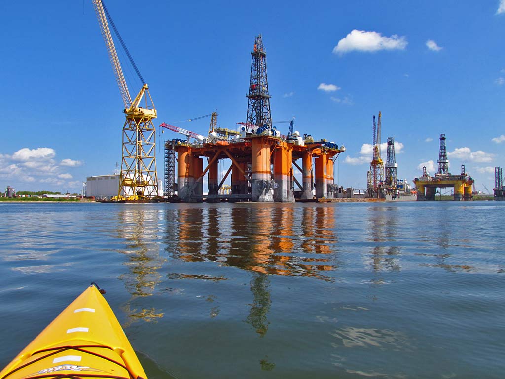
Many of the pipe valves on this rig were rusting. A salt water environment will eventually consume these oil rigs if they are not maintained and I understand many oil rigs are not maintained anymore.

The trip from the Light House to the southeast tip of Sand Island was uneventful and I had the luxury of a tail wind. Sand Island is a bird watcher's paradise. 

The trip from Sand Island back to the Launch Site was more fun because winds picked up to 15 mph and the wave height increased to about 2 feet. I got soaked from waves like this but it felt good.

If any of you are thinking about paddling in the Dauphin Island, Fort Morgan, and Sand Island triangle, I urge you to plan your trip well with respect to wind and tide forecasts. I timed this trip today to cross at Low tide and prayed the morning wind forecast of low winds would be accurate, which thankfully it was. Off the East end of Dauphin Island, the current/wind/water depth interaction causes bigger waves and today I crossed that while it was calm (see photo 2). Same with the Sand Island Shoal (shallow sand bar), and the Dixey Bar. The waves off the West end of Fort Morgan can get ridiculously bouncy due to wind interacting with strong current and deep water. You may find the waters calm for most of the crossing only to see standing waves for the last half mile of the 4 mile crossing. Turn around quickly if you find yourself in challenging conditions that are out of your comfort zone. You can find marine maps like this online - Click Here.

Thursday, July 07, 2011

07/07/2011 - Bayou Casotte

Header image is of a stream of pelicans on a journey. There were a lot of pelican clans headed west to east in this fashion.

1) Sunrise at the Bayou Casotte public boat ramp in Pascagoula, MS. It is the first time I launched from here.

2) Bayou Casotte plays host to a wide array of huge man made objects that dwarf a kayak.

3) Off the southeast tip of Bayou Casotte is the dreaded billion dollar Gulf LNG Energy terminal. Huge 160,000-cubic-meter ships will be transporting Liquified Natural Gas (LNG) from Angola to this facility. It's been said that if a LNG ship is rammed by another vessel (terrorism), the resulting explosion would be equivalent to a small nuclear bomb. Operations of this LNG facility are expected to begin this year.

4) This couple is fishing near the Chevron Refinery effluent channel which flows into the Mississippi Sound.

5) A shrimp jumps through the air. Much of the Chevron Refinery property is undeveloped wetlands. There are many little inlets that wind around in the wetlands. The objective today was to go up one of these little streams with hopes of reaching a large salt flat southeast of the refinery, but it got too narrow and shallow. Objective aborted.

6) So, I removed all the shrimp that had jumped into the kayak, turned around and headed back to Bayou Casotte.

7) This oil tanker was pumping out a powerful steam of water. All the more reason why to stay far away from large ships. I should have been farther away myself.

8) I was surprised to find dolphins up in this major shipping channel.

Sunday, March 20, 2011

03/20/2011 - Dauphin Island Is Back

Launch: Desoto Park (Dauphin Island, AL)
Launch Cost: Free
Destination: Katrina Pass (Now completely closed off)
Distance: 16.2 miles (round trip)
Pedal time: 4 hours
Weather: 65 degrees. Winds out of the south 5-10. On protected side of Dauphin Island, current minimal, tide high at start. Water temp about 65 degrees.
GPS Track: To view or download the GPS track of this trip, Click Here.


Header Image

1) The pile of rocks now spans across Katrina Pass blocking the pass completely. It was only about 6 months ago when they started filling in the pass. Gone are all the oil barriers associated with the BP oil spill. I'm so happy to see the sandy beaches of Dauphin Island back to normal. Dauphin Island is a great place to kayak.

2) Sea Gulls occasionally stalk Pelicans in hopes of getting a free meal.

3) Down by Katrina Pass the shore birds are plentiful and sometimes the birds will let you get remarkably close so you can watch their rituals. Bring binoculars on kayaks trips down here.

4) Two Royal Terns looking at each other with love in their eyes. The mating game is about to commence.

5) Two kayakers coming back from what appeared to be a camping trip to the west end of Dauphin Island. What an absolutely beautiful day to be out kayaking or enjoying the beach.

6) In some of the pools and along the shorelines, like that in the previous photo, the water was teeming with tiny fish.

7) Speaking of fish, two youngsters were in a small boat trying their luck.


8) Out at the west end of Katrina Pass, the fish were biting as quick as you could bait a hook and cast. This little girl hooked something so big it eventually broke her line. Barely visible in the background are the houses on the west end of Dauphin Island.

9) This fellow is reeling in a little one. It was exciting to watch these people reeling in fish after fish.

10) More proof that the fish were biting.

11) While Dauphin Island is beautiful to kayak around again, there were still signs of the BP oil spill. Crews still work the beaches looking for any signs of tar balls or oil. I guess while they wait for tar balls to roll onto shore, they fish. Notice the fishing poles hanging off one of the vehicles? Or, maybe the public can motor down the beach in these battery powered vehicles now...

12) This oil rig sits in salt water, no security to protect it, deteriorating to the point that the ladder is already rusted in half. Wonder what will happen when all the nuts and bolts on the high pressure valves also break after the rust eats through them... I feel sorry for future generations as the decaying oil rigs start falling apart. I also wonder if all the oil rigs near the shore have been constructed to withstand a tsunami wave. After all, the Gulf of Mexico is subject to earthquakes... You did know there was an earthquake just south of Mobile Bay not long ago, right? With oil companies ignorantly manipulating the inner contents of the earth, who knows what is next...

Sunday, July 18, 2010

07/18/2010 - Dauphin Island

Launch: Desoto Park (Dauphin Island, AL)
Launch Cost: Free
Destination: Katrina Pass
Distance: 17-18 miles (round trip)
Pedal time: 4 1/2 hours
Weather: Hot and Humid. Winds out of the south 5-10.
GPS Track: To view or download the GPS track of this trip, Click Here.


Header Image

1) This was my first trip to Dauphin Island since the oil spill. Was worried they might not allow kayaking in the area. No problem launching at Desoto Park. Note the startling new look of the beach on the north side of Dauphin Island.

2) Life goes on during this oil spill crisis - here parents are swimming with their kid near an oil boom.

3) There are several canals on the interior of Dauphin Island to paddle, sheltered from the wind, which seem to be unaffected by the oil fiasco.

4) A front end loader is pulling out a National Guard Humvee stuck in the sand. The natural beach has been replaced with lined units that will absorb any oil that might reach the north side of the island. The units are made by Hesco Bastion and the wall, miles long, extends all the way to Katrina Pass.

5) Tourists - if you are thinking about coming to Dauphin Island to take a walk along the beautiful north beach, you might want to go elsewhere.

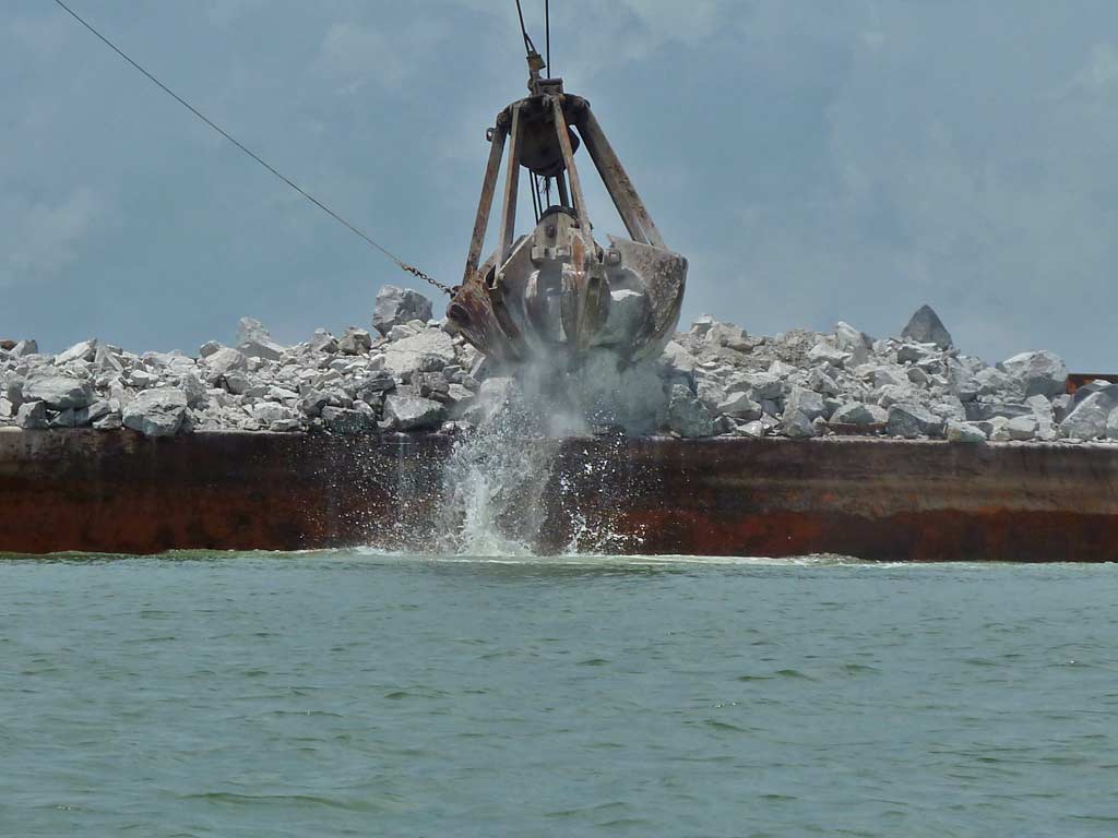
6) Hurricane Katrina washed out 1.5 miles of Dauphin Island in 2005, leaving it split into two pieces. Five years later, Dauphin Island will get it back free of charge, thanks to the kind $15,000,000 donation from BP. Rocks are being off loaded from a barge to a pile on the beach.

7) The rocks on the beach get put on a big dump truck which backs very carefully down a narrow ramp of previously dumped rocks, where it dumps more rocks on the edge of the water.

8) I kayaked about a half mile out into Katrina Pass where another pile of rocks are, looked back and took this photo. Eventually the rock piles will connect together.

9) The pile of rocks offered some protection from the wind and waves.

10) There is some beach area open at the west end of the island where you can land your kayak and get out. Inner island pools are marked with row after row of tire tracks. The dark color is not oil.

11) For the birds, it is business as usual.

12) On the way back to Desoto Park, the smell of petroleum filled the air. Not sure if it was related to boats working the oil spill or whether it came from the Gulf. Either way, it was a nauseating odor.

13) Tar Ball poo or Sea Gull poo? Some people are dealing with nasty booms to help keep the Island free of crude. A big "THANK YOU" to them for all they do.

14) No security at this rig. Anyone in a boat can pull up and do what ever they want. Guess the oil companies save money by not hiring security personnel to protect their sensitive and dangerous infrastructure meaning more profits. Let us not forget that oil wells were the target of terrorists in Kuwait back in 1991.