Launch: Mt. Vernon Landing on the Mobile River.
Launch Cost: Free.
Route: Southeast for about 1.5 miles down the Mobile River to where it splits with the Tensaw. Then about 2.5 miles southwest on the Mobile River to the entrance of Cedar Creek. Up Cedar Creek about 2 miles until it got too shallow for the pedal kayak, then return.
Distance: 16.1 miles.
Average Speed: 2.8 mph.
Time: Approx 6 hrs.
Pace: Leisurely.
Weather: Party cloudy with mild temps, slight wind from northeast, an afternoon thunderstorm forced me to end the trip early.
River: Current was running about 1 to 1.5 mph, water levels normal.
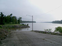
 (1) Above left.
 The radar showed thunderstorms around Dauphin Island, so I decided to explore Cedar Creek. Drove to Mt Vernon, about 12 miles north of I-65 on US-43, and went to the public boat ramp. Boat ramps in the Upper Delta are typically longer and steeper than those in the Lower Delta. You can barely see the kayak at the bottom of this long boat ramp. (Click on individual photos for an enlarged view.)
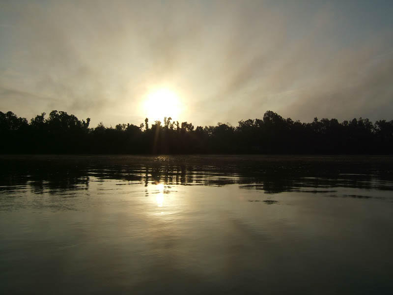
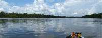
(2) Above right. The sun peeks over the tree tops while heading south on the Mobile River. The water finally slicked off after a parade of speeding bass boats went by.
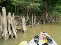
 (3) Above left.
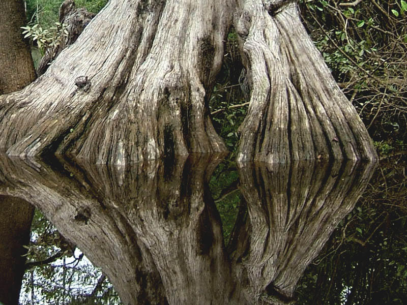
 On thing you’ll notice when kayaking in the Upper Delta along the big rivers are the Cypress Tree Knees. Knees are plentiful and some are several feet high indicating the higher changes in river levels as compared to the Causeway area. Some of the knees take on interesting shapes, but no one knows for sure the purpose the knees serve. More
CypressKnee photos.
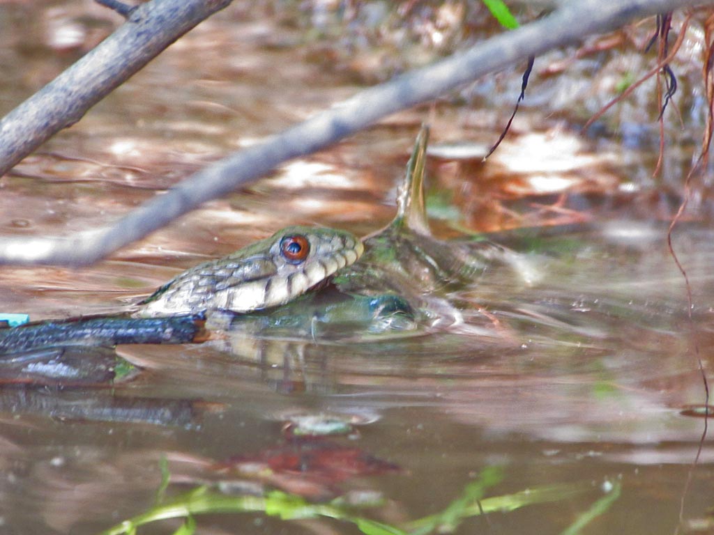
(4) Above right. Phone home. Huh? I swear, if you turn this photo sideways (Tilt your head to the right), you might see an alien’s head or maybe an evil looking ET. What do you think? Now tilt your head to the left. Alien with a different expression? Am I spending too much exploring the Delta?
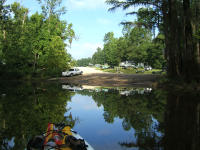
 (5) Above left.
 About 1.5 miles up Cedar Creek is a the Cedar Creek Boat Launch (Sign said launch cost $4.) This might be a better launch site for those looking for a short kayak trip and for those wishing to avoid the open waters of Mobile River. It is just east of the little town of Movico (1.5 miles south of Mt. Vernon).
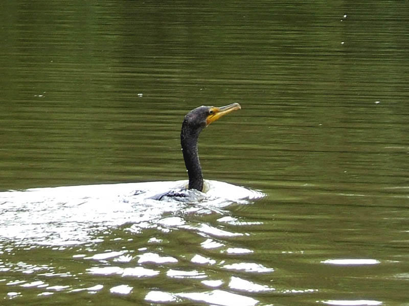
(6) Above right. This Cormorant surfaced right in front of me while I was exploring a channel just south of Meaher Landing off Mobile River (not to be confused with Meaher’s Park.) For more on Cormorants, click
here or
here.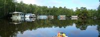
 (7) Above left.
 Photomerge of a group of houseboats nestled close to Cedar Creek Landing.
(8) Above right. Photomerge of the view on Mobile River about a mile south of the Mt. Vernon boat ramp. Going upstream means a slower pace because of the current, so it took about half an hour to go one mile. By that time, a thunderstorm was only a mile or two away. Good timing to end a wonderful trip. If you are looking for a change of scenery, Cedar Creek is a nice place to kayak.
"Twenty years from now you will be more disappointed by the things that you didn't do than by the ones you did do. So throw off the bowlines. Sail away from the safe harbor. Catch the trade winds in your sails. Explore. Dream. Discover." -Mark Twain