Showing posts with label ASRT. Show all posts

Sunday, May 20, 2012

05/20/2012 - ASRT Black Warrior Nature Paddle Event (Day 2 of 2)

Header image is a photo of the morning sun lighting up a fog fire on the surface of the Tombigbee River.

I camped out in a tent at Foscue Creek Park for the ASRT Black Warrior Nature Paddle event and the loud cacophony of the singing birds at first light served as an alarm clock. What a wonderful way to wake up. I was quickly off on a solo paddle to experience sunrise on the Tombigbee River as ASRT activities started later in the morning. There was a slight fog on the water surface.

Sunrise with the White Bluffs of Demopolis Alabama in the background - near the Riverside Cemetery.

A kayaker's view of the White Bluffs along the Tombigbee River.

The mayflies were out in mass again this morning, seen in this photo as light colored specks. Blackbirds like this one were devouring the tasty insects and feeding their young. Also seen eating mayflies along the bluffs were cardinals, mockingbirds, and blue jays. If you look closely, you can see a fishing line with a worm lure left dangling from the branches in this tree.

A grackle with a brilliantly deep bluish head was forging for mayflies.

The only bird that was not eating mayflies was this deep brownish-red necked Green Heron who was fishing along the bank.

Saturday, May 19, 2012

05/19/2012 - ASRT Black Warrior Nature Paddle Event (Day 1 of 2)

Event: Alabama Scenic River Trail (ASRT) Black Warrior Nature Paddle. Birding kayak trip lead by avid birder Don Self.
Launch:
Early morning sunrise launch at Backbone Creek after being shuttled from Foscue Creek Park by the US Army Corps of Engineers.
Destination: Backbone Creek to Runaway Branch to Demopolis City Landing where participants are shuttled back to Foscue Creek Park.
Paddle Distance: About 14 miles.
Paddle time: Approx 8 hrs
Weather: Sunny, winds calm. Air temp cool in the morning to hot in the afternoon. Currents minimal. Wonderful weather for kayaking.
GPS Track: To view or download the GPS track of this trip, Click Here.


Header image is a photo merge.

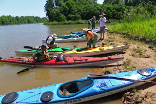
Participants of the ASRT Bird Watching paddle eagerly prepare to launch at Backbone Creek while listening to a briefing.

The sounds of birds were permeating through the air as the sun rose. For those who camped out at Foscue Park, the pre-sunrise bird chatter was the alarm clock.

Paddling was not the objective in this bird watching and bird listening adventure as Don Self educated everyone with his substantial knowledge about birds.

It was quiet except for the sound of excited birds and excited participants asking, "What's bird is making that sound," or pointing and asking, "What's bird is that?"

Beautiful Cypress trees were growing in the shallow water of some of the backwater sloughs we kayaked in. Don, on the left, is wearing Hunters Ears headphones which provide sound amplification.

The kayak birding adventure eventually moved out into the big water of the Black Warrior River.

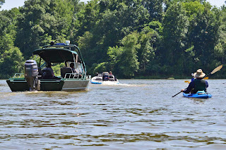
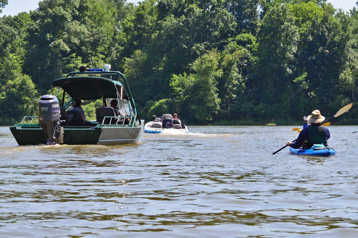
The US Corps Of Engineers had a support boat on the water for safety. Most motor boats slowed down or stayed far away and boat wakes were minimal. Thanks!

One motor boat operator alerted the COE safety boat that a bird was caught on a fishing line further downstream. It was a great egret with its left wing hooked on a fishing lure left hanging in a tree. Today was the egret's lucky day as friendly help was nearby when it needed it.

Our fearless leader Don Self was quick to the rescue, seen here reaching for a tool to help remove the lure from the egret's wing. What you don't see in this photo is the egret is biting Don on his left arm.

Don quickly freed the egret. The injured bird hobbled off like it was drunk, obviously in a great deal of pain and distress. I hope the poor bird heals well enough to fly again.

We took a short lunch break at Runaway Branch Park which is north of Demopolis.

We also took a short break on the Black Warrior River.

In one of the sloughs we kayaked in, a boater pulled in about an 18" Grinnell Fish also known as a Bowfin from his floating fishing line.

That is the BN Rail Road trestle in the foreground. The US 43 bridge with a barge beneath it is visible far in the distance. Both are crossing over the Black Warrior River.

Judy gets a close look at a snake coiled up on some limbs (right side of the photo-center). It was a harmless water snake.

The generous Park Rangers of the USCOE provided shuttle for the kayaks in addition to support on the water. Many thanks!

Kevin and Debbie relax on a bench along the Tombigbee River at the Demopolis City Landing park.

Today was an interesting day of bird watching. I saw at least a half dozen bird species I've never seen before. The total number of birds identified today was close to four dozen species.

We all got cleaned up after the paddle and proceeded to Lyon Hall in Demopolis, Alabama, which is a historic home owned and operated by the Marengo County Historical Society where we were treated to a tour of the home and then a hearty all you can eat catfish dinner. 

Kirk Brooker with the Marengo County Historical Society delighted everyone with interesting stories on both Friday and Saturday evening. The desserts were scrumptious. This was a wonderful day.

Sunday, November 08, 2009

11/08/2009 - ASRT Ghost Paddle

Launch: Isaac Creek Campground River Bank
Event: ASRT Ghost Paddle


1) Sunrise on our last day.

2) Superb cloud work. Little did we know a storm was brewing in the Gulf of Mexico.

3) Fog on the Alabama River burnt off quickly.

4) Jacquemontia densely absorbed the morning dew.

5) Everything was wet with dew including this rattlebox wildflower.

6) Golden rod seeds with the damp kayaks in the background.

7) Cleanup after the breakfast. What is missing from these photos are the meals and entertainment both of which were good. I was too busy eating the good food to take photos.

8) Kayakers were beginning to launch and were ready to experience today's dam paddle.

9) The park manager in his power boat cautiously led everyone toward the Claiborne Lock and Dam.

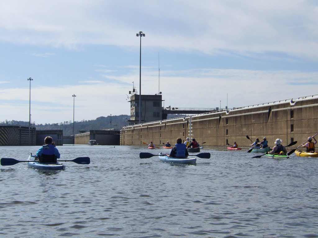
10) Approaching the Claiborne Lock entrance.

11) Entering the lock via the large open doors. Note the waterline color on the wall.

12) Gathering for a group photo. Waters started to recede quickly.

13) The exit doors open inward. Note the water line level now. For perspective, one of the dam workers can be seen on the upper right part of the structure. 

14) The last of the kayaks were exiting the lock.

15) Now on the downside of the dam looking up, you can see the water flowing over the submerged dam on the left.

16) Once past the dam, there were occasional sandbars but for the most part, the banks were very silty mud.

17) Unlike the Alabama Port where dock bumpers are relatively low, docks on the Alabama River in this area must tall to accommodate all the different river levels.

18) It is amazing where plants will try to grow.

19) Underwater pipe flow coming from a local paper mill left the water smelling like exactly like a paper mill. (Phew)

20) The US Hwy 84 bridge over Alabama River. It is also the location of the Claiborne Boat Launch which was our exit point and sadly the end of our journey.

21) On the top of the Claiborne boat launch.

So, what was the deal with the Ghost Paddle? If you weren't there, you missed hunting for the Ghost of Nancy on Haines Mountain with real paranormal investigators and yes, we had unexplainable occurrences that were not fabricated.

This three day paddle up around Claiborne Lake on the Alabama River is not really part of the Mobile-Tensaw Delta so it is a bit off topic from the theme of this blog. It is actually part of the Alabama Coosa Tallapoosa Basin. The area is quite remote and beautiful, only about a two hour drive from Mobile and well worth taking a weekend camping trip to explore. For more about this basin, read this PDF by clicking here.

Video from the Ghost Paddle

Saturday, November 07, 2009

11/07/2009 - ASRT Ghost Paddle

Launch: Haines Island Park / Davis Ferry Boat Launch
Event: ASRT Ghost Paddle

Header Image

1) The Haines Island Park / Davis Ferry launch site. Boat ramps in the Clairborne Lake area are long because river levels can fluctuate as much as 50 feet.

2) The kayak group is underway. The Davis Ferry cable can be seen overhead. (The 1 or 2 car ferry apparently operates only on week days.)

3) Headed toward the south side of Haines Island.

4) This is the narrow cut around the south side of Haines Island. There are several creek branches to explore off this cut. The group only went up one. Three members paddled up one of the other branches and got separated from the main group. The main group had to wait for them to catch up as two kayakers when back looking for them.

5) Motorboat's dog owner trying to get his dog to see the dog in the kayak. His dog was more interested in the camera.

6) One dog joined us on the kayak trip.

7) Starting up Cane Creek. There was reluctance on which way to go as the creek splits into Cane Creek and Camp Creek. We were looking for a lunch site.

8) Thinking that everyone was in agreement to go up Cane Creek, several of us kept paddling only to realize after about ten minutes that the rest of the group stopped and turned around to go back to the main river.

9) Four of us found the boat ramp and camping shelter and proceeded to have a quick lunch there.

10) We started seeing some birds when we entered the Stump Lake area.

11) Starting to enter the wider area of Stump Lake which isn't that big.

12) The fall colors in Stump Lake were beautiful.
13) Looking at yellow Bur-Marigolds. The grayish color on the leaves is where the waters had been just a few days earlier - about 4 feet higher.

14) The colors in the back of Stump Lake were beautiful.

15) This was one of the few areas with signs of civilization. Claiborne Lake is the most remote of all the Alabama River Lakes.

16) Some areas of the river banks are steep with 50-100 foot sheer drop-offs.

17) The ASRT kayak group was shadowed by a park ranger in a power boat.

18) It was quite chilly at the beginning of the trip but by late afternoon, it turned out to be a perfect day for paddling.

19) If you look closely (click on thumbnail image for larger view), you can see a motorboat on the right side.

20) Here is what it looked like when the power boat took off. (Phew)

21) Our takeout point was a fairly steep bank just south of the entrance to Isaac Creek, which was next to our camping area.

22) After a nice shower, it was time to relax and watch the sunset.

23) Sunset across the Alabama River.

24) Just when it looked like the ten minute sunset was over, the gray clouds started to colorize and it lasted for another ten minutes. Awesome!