Launch Cost: Free
Destination: Explore Little River and also Grand Bayou. The trip (my first) up Little River was well worth it. To paddle all the way up Little River is an 8 mile round trip from Bayou La Batre. The paddle up Grand Bayou was a waste of time.
Distance: 18 miles (round trip)
Paddle time: 6-1/2 hours
Weather: 80-90 degrees. Winds variable with occasional gusts during storms. Current was minimal, tide was going out with minimal change. Water temp about 86 degrees. Seas 1 at the start and eventually slicking off.
Caution Note: Portersville Bay (Mississippi Sound) is open water and strong winds can create choppy seas. Take a spray skirt!
GPS Track: To view or download the GPS track of this trip, Click Here.
GPS Track: To view or download the GPS track of this trip, Click Here.
 |
| Header image is a photo of yet another storm. This one produced lightning. Time to get off the water! |
 |
| 1) Photomerge of a wild looking sunrise as seen from Portersville Bay. If you squint at the distant horizon on the right side of the photo, you can see a couple of kayakers who were fishing. This was a superb sunrise. |
 |
| 2) There was typical low growth grasses and needle rush in the salt marsh near the entrance to Little River. I was surprised to see an alligator in this area. Saw quite a few alligators today. |
 |
| 3) After about a mile up Little River, the salt marsh grasses are replaced by a low pine tree savannah with palmettos - part of the Grand Bay Swamp. |
 |
| 4) Further up Little River is a forest of dead pine trees. Little River is quiet little jewel, beautiful, and very clean. Only saw one RV home - the rest is all nature. |
 |
| 5) Based on the forecast, I brought the umbrella and it came in handy a few times during brief showers. |
 |
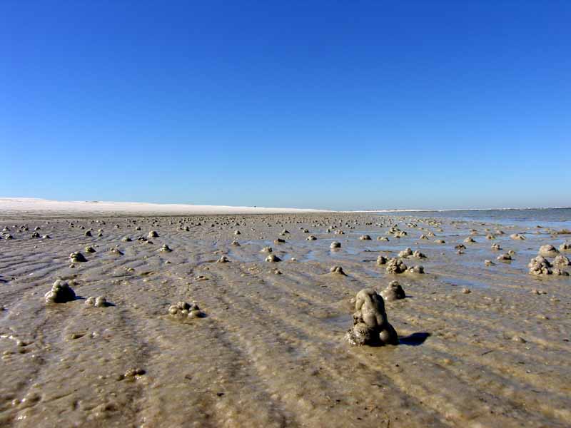
| 6) This is a salt flat area with a lot of crab activity. Crabs create tiny sand balls as they clean the sand. The balls help them identify what sand has been cleaned and what needs to be cleaned. |
 |
| 7) The sun finally came out (along with the heat) and the waters slicked off making for a pleasantly hot paddle. |
 |
| 8) Sometimes distant storms made the horizon blend in together so it was hard to tell where the water ended and the sky began. |
 |
| 9) What you see here is a double row of wave attenuator units that is part of the Little Bay Marsh Restoration Project. The attenuators help protect the Little Bay area, now restored, which was devastated (washed away) by Hurricane Katrina. |
 |
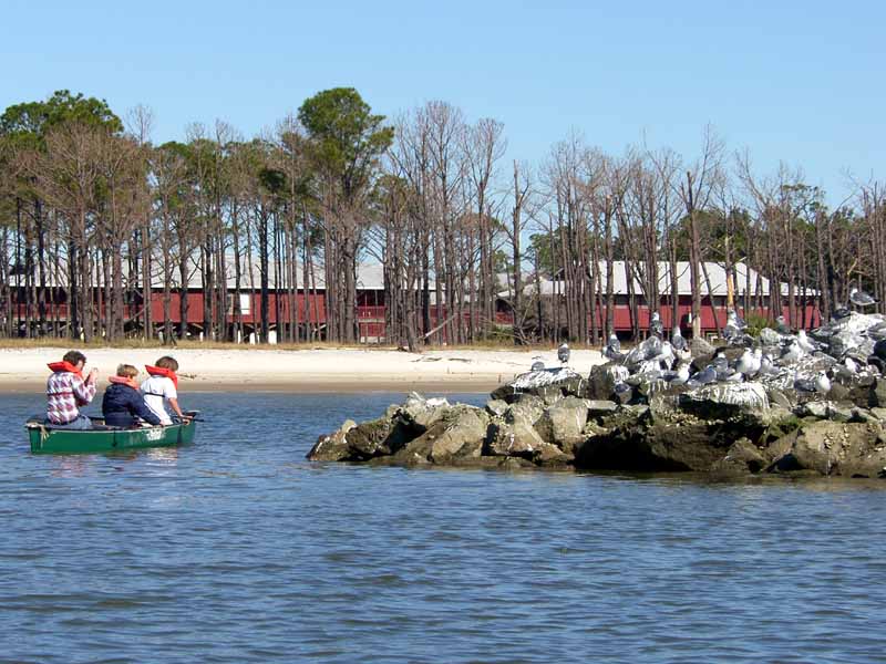
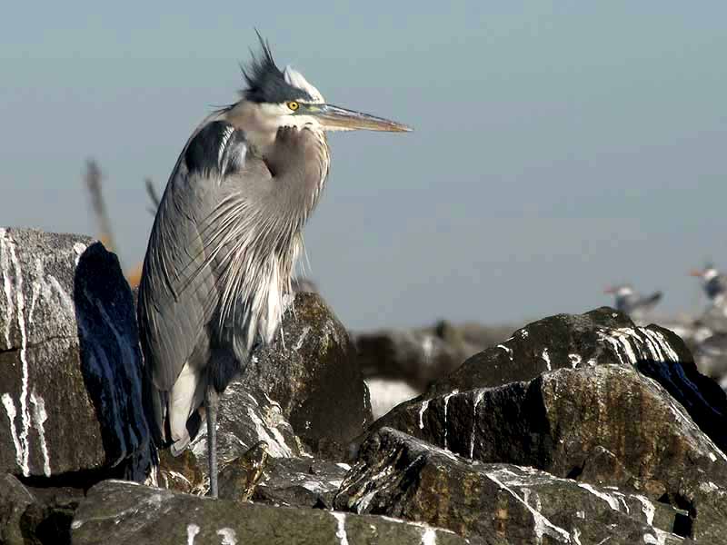
| 10) If you like birding, the area behind these wave attenuators provide sanctuary to a wide variety of shore birds. Take your binoculars. |
 |
| 11) This oyster catcher can thank the Alabama Department of Conservation and Natural Resources and Volkert Engineering for its restored habitat. |
 |
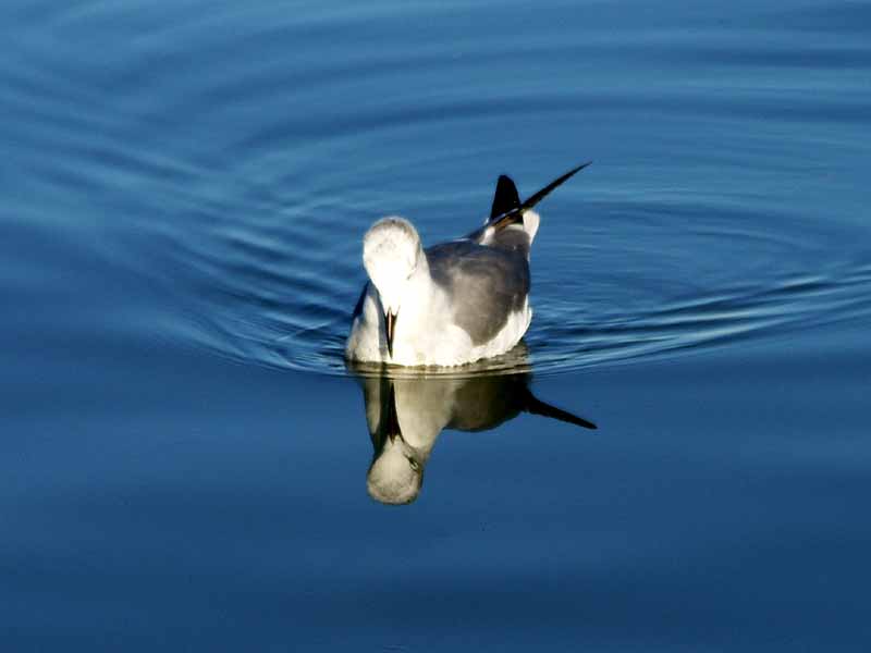
| 12) A tern speaking ternese and roughly translated it said, "It is hot." |
 |
| 13) A tenth of a mile up Bayou La Batre River a multitude of little crabs were cleaning the sand, at least the area that wasn't covered with trash. |
 |
| 14) Of course, when it comes to Bayou La Batre, much of the shoreline will be trashy. |