Sunday, March 20, 2011

03/20/2011 - Dauphin Island Is Back

Launch: Desoto Park (Dauphin Island, AL)
Launch Cost: Free
Destination: Katrina Pass (Now completely closed off)
Distance: 16.2 miles (round trip)
Pedal time: 4 hours
Weather: 65 degrees. Winds out of the south 5-10. On protected side of Dauphin Island, current minimal, tide high at start. Water temp about 65 degrees.
GPS Track: To view or download the GPS track of this trip, Click Here.


Header Image

1) The pile of rocks now spans across Katrina Pass blocking the pass completely. It was only about 6 months ago when they started filling in the pass. Gone are all the oil barriers associated with the BP oil spill. I'm so happy to see the sandy beaches of Dauphin Island back to normal. Dauphin Island is a great place to kayak.

2) Sea Gulls occasionally stalk Pelicans in hopes of getting a free meal.

3) Down by Katrina Pass the shore birds are plentiful and sometimes the birds will let you get remarkably close so you can watch their rituals. Bring binoculars on kayaks trips down here.

4) Two Royal Terns looking at each other with love in their eyes. The mating game is about to commence.

5) Two kayakers coming back from what appeared to be a camping trip to the west end of Dauphin Island. What an absolutely beautiful day to be out kayaking or enjoying the beach.

6) In some of the pools and along the shorelines, like that in the previous photo, the water was teeming with tiny fish.

7) Speaking of fish, two youngsters were in a small boat trying their luck.


8) Out at the west end of Katrina Pass, the fish were biting as quick as you could bait a hook and cast. This little girl hooked something so big it eventually broke her line. Barely visible in the background are the houses on the west end of Dauphin Island.

9) This fellow is reeling in a little one. It was exciting to watch these people reeling in fish after fish.

10) More proof that the fish were biting.

11) While Dauphin Island is beautiful to kayak around again, there were still signs of the BP oil spill. Crews still work the beaches looking for any signs of tar balls or oil. I guess while they wait for tar balls to roll onto shore, they fish. Notice the fishing poles hanging off one of the vehicles? Or, maybe the public can motor down the beach in these battery powered vehicles now...

12) This oil rig sits in salt water, no security to protect it, deteriorating to the point that the ladder is already rusted in half. Wonder what will happen when all the nuts and bolts on the high pressure valves also break after the rust eats through them... I feel sorry for future generations as the decaying oil rigs start falling apart. I also wonder if all the oil rigs near the shore have been constructed to withstand a tsunami wave. After all, the Gulf of Mexico is subject to earthquakes... You did know there was an earthquake just south of Mobile Bay not long ago, right? With oil companies ignorantly manipulating the inner contents of the earth, who knows what is next...

Saturday, March 19, 2011

03/19/2011 - Pass Picada

Launch: Mobile Causeway aka US Hwy 90 at the Triple boat ramps
Launch Cost: Free
Destination: Pass Picada to watch the Moonrise
Distance: 10 miles (round trip)
Paddle time: 3-1/4 hours
Weather: 70s. Winds out of the south at about 5-10 mph. Current was strong in the Apalachee River. Water temp was about 65 degrees. Paddling on the sheltered side of the Causeway.

I had planned to join the Mobile Bay Canoe and Kayak Club moonrise paddle and for some reason, thought it was on Saturday. It was on Friday... Oh well, I got to see some photographers at the Riverdocs and enjoyed talking to someone who went on the paddle I missed.

Header Image

1) First thing noticeable thing on this paddle was loud noise. An airboat was running a regular route from the Bluegill restaurant. It did however, run at idle speed in Pass Picada.

2) The airboats have cut their own paths through the vegetation. With vegetation on the left and right, it gives riders the experience of speed. Unfortunately, when airboats run in places like Savage Ditch, which was once deep enough to take my pedal boat the whole way through it, it is now so shallow due to the shoreline erosion filling in the ditch, that I can't use a pedal boat in it anymore.

3) Another airboat path. You might want to avoid paddling in these paths. The good thing is the paths the airboats have created, have no erosion.

4) A bird was watching the kayak pass by with keen eyes.

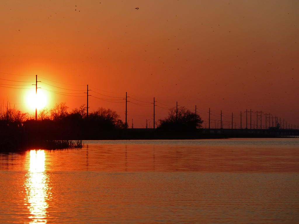
5) A bird squawking about the beautiful sunset.

6) Indeed, a beautiful sunset. If you notice the specks in the sky, there were a lot of birds flying overhead.

7) The stump in Pass Picada, enhanced by a flash.

8) It wasn't long after sunset that the big moon rose over the horizon. The moon had a tint of red as it rose. What does a red moon mean?

9) The Bluegill restaurant provides live music starting at 6:00 pm most evenings to adjust your paddle cadence to. You can paddle right up to the dock, kick back and listen. Beverages are available if you are so inclined. You'll want to paddle with a visible light in Pass Picada at night so the airboat can see you.

10) Approaching the crossing of Interstate I-10 and US Highway 90 at night. I love night paddles and the moon provided so much light it actually cast a shadow.

Saturday, March 12, 2011

03/12/2011 - Battle On The Bayou, Ocean Springs, MS

Launch: Washington Street Bridge (Hwy 609) at Old Fort Bayou
Launch Cost: Free
Destination: Old Fort Bayou to watch and take photos of the race.
Distance: 20.5 miles (round trip)
Paddle time: 4-1/2 hours
Weather: Clear, winds calm. Air temp perfect. Tide coming in. Current 0.5 mph. Sunny.

Battle on the Bayou race results: CLICK HERE


Header Image
1) There were a lot of participants in the Battle on the Bayou kayak race.

2) The start of the first group - recreational racers. The starting cannon was LOUD - look at the smoke.

3) And they are off!

4) The racer kayaks are of all types - canoes, sit-in kayaks, laid back sit-on-tops, surfskis and more.

5) The start of the second group (fast kayaks) and they are off!

6) The kayak traffic was busy at the very beginning but kayaks spread out quickly.

7) Capsize mishap on the first curve.

8) The Washington Street bridge.

9) Bright Orange is an eye-catcher.

10) A Hobie pedal boat with an outrigger.

11) Racers chatting as they pass each other.

12) The Party Boat - Mardi Gras inflatable kayak.

13) Unless you were in first place, there were always kayaks in front of you as far as the eye could see.

14) I love this photo. Is she dead tired or catching some of the nice rays of warm sunlight?

15) A patriotic racer. Check out the interesting anchor for the flag.

16) There were a lot of different agencies helping out with the well organized race which draws a lot of participation. Young, old, fast, slow - this is a race everyone enjoys.

17) Go Tom Go!

18) The end of the race was at The Shed BBQ. Despite the steady stream of finishers, the exit out of the water was well organized.
If any of you find a particular race photo bothersome and you want me to remove it, email me and tell me which one. Thanks.

03/12/2011 - Mobile River

Launch: Shirley's (US Hwy 90 across from battleship USS Alabama)
Launch Cost: Free
Destination: Mobile River by Downtown Mobile
Distance: 9.4 miles (round trip)
Paddle time: 2-1/2 hours
Weather: Clear, winds calm. Air temp 55 degrees. Tide was low. Current in Mobile River about 1.5 mph. Water temp 55 degrees.

Header Image

1) Kayaking and sunrises together are one of my favorites things to experience in life.

2) Soon as it started getting light, the birds became active.

3) Notice the blurry right edge in this sunrise photo? It's fog.

4) There was no fog when I started kayaking, but a fog bank formed quickly. This is why I never go on a kayak trip without a GPS and spare batteries. Happily, the fog disappeared as quickly as it formed so I didn't have to make changes in the route.

5) A tugboat about seven stories tall.

6) The Mobile skyline. Paddle conditions on Mobile River were excellent.

7) The Carnival Cruise Ship company pulls out of Mobile leaving Mobile with an empty 20+ million dollar terminal that costs a fortune every year because it was purchased on credit. Apparently the city leaders didn't think a contract was necessary to make sure Carnival stayed at the Mobile terminal which was built for them. Are you serious? Who makes a 20+ million dollar deal without getting something in writing to protect your investment?

8) As I was headed south in Mobile River, tugboats turned around a huge ship and were guiding it to the Mobile Container Terminal for unloading. Containers were stacked about 6-7 high.

9) When is the last time you visited the USS Alabama? Lots of new things to see...

10) When I got to Mobile River, I reached for the VHF radio to turn it on and couldn't find it. I felt naked without a VHF radio on the river. When I got back to the launch site, the VHF radio was laying in the sand on the edge of the water. It must have accidentally fell overboard undetected during the launch in the dark. What a lucky day to be gone for about 3 hours. The radio was still there. Had I launched at a regular boat ramp, it would have been gone...