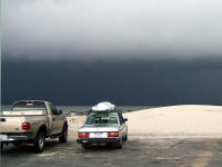

(1) Above left. The original plan was to go kayaking, sailing, and fishing off Dauphin Island. At sunrise, clouds were lighting up and thunder was heard off in the distance south of Dauphin Island. I patiently waited. An hour later, this was the view toward Sand Island. The storm was almost stationary. After some turbulance, the rains started. I waited another hour. Radar showed a big blob of green and yellow on Dauphin Island and it wasn’t moving, lightning was still flashing, thunder rumbling, so I made a change of plans. Rice Creek was the place to be, so I packed up the kayak and moved to the northern creek. (2) Above right. The weather at Rice Creek launch site was beautiful and sunny, although three of the cooler morning hours were now gone. It was hot and sunny the rest of the day.
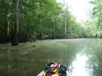
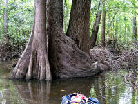
(3) Above left. There was a green organic film on the surface of the water which gave Rice Creek a swampy atmosphere. (4) Above right. Not far from the launch site, on the south side, the middle tree has wrapped itself all the way around the tree trunk on the right. We’ll never know if this tree hugging is a tender gesture of love, or whether it is choke hold to strangle it’s neighbor.
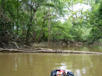
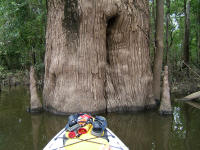
(5) Above left. The new destination for the day was Bayou Tallapoosa, which is a beautiful, narrow winding creek about 3 miles long, that usually has a some current running through it, so it never clogs up with vegetation. After going only about a quarter of a mile, there was a fallen tree blocking the way. If there is one tree down, how many more had the storms blown over? Not feeling up to tree jumping, I chose to turn around. (6) Above right. On the way to Dead Lake, my new destination, there are some nice sized trees.

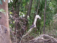
(7) Above left. A little blue heron cautiously watches as I cruise by. (8) Above right. A dead branch caught my attention because with a little imagination, it looked like a camel’s head.


(9) Above left. The Dead Lake Bartram Canoe Trail platforms are about a half a mile northwest of the entrance to Bayou Tallapoosa. These platforms are built solid and the composite surface slats are smooth enough to walk around barefooted on. If you plan to stay on a platform for any length of time, I’d advise bringing a can, or two, of wasp spray. The platform was at a perfect height for me to get in and out of the kayak and had places to tie off several kayaks. (10) Above right. If I’m reading the sign correctly, I was tresspassing when I took this photo because I didn’t have a reservation to stand on this platform. Sorry – I needed to get out to stretch the legs and no one was around.
This subject, though crappy, will hopefully be useful to new kaykers and campers. Each platform has a privacy curtain, but no outhouse. If you are going to camp out on these platforms, what are you going to do if nature calls? The nearby land is swampy and is no place to make a cat hole. I’d suggest reading up on Leave No Trace principles, Click Here or Click Here. It is not healthy to be sending fecal matter in the water around your living area, (our living area), so what can you do? Pack it out with Ziplocks. If you wish to be safer, there are products like Restop 1 and 2, which are sanitary, spill proof, disposable bags that neutralize waste so you can dump your dump in the trash when you get back. There is also such a thing as a kayaker’s Poop tube. For more straight scoop on back country sanitation, Click Here.
No comments:
Post a Comment
Note: Only a member of this blog may post a comment.