Saturday, June 26, 2010

06/26/2010 - Douglas Lake

Launch: Upper Bryant Landing
Destination: Douglas Lake and Watson Creek
Distance: Approx 11 miles (round trip)
Paddle time: Approx 4 hours
Weather: Sunny, 80s to 90s, winds calm.
Track: To view or download the GPS track of this trip, Click Here.


Header Image

1) The launch site at Upper Bryant Landing.

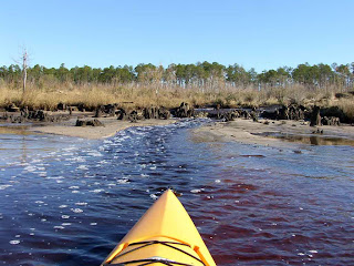
2) About 1.25 miles north of the launch site is Douglas Lake which is marked by a sign on a big bald cypress tree at the entrance.

3) Cypress knees make for interesting reflections.

4) If it wasn't for its tail, this gator might not have been seen.

5) A white egret or heron was chowing down on shrubs loaded with Mayflies.

6) A closer look at a Mayfly.

7) The easy to identify shape (bell shape) of the Swamp Leather-Flower (Clematis crispa).

8) The easy to identify balls of the common Button Bush flower (Cephalanthus occidentalis).


9) A Banded Tussock Moth seen in Watson Creek. The hard to see head is on the right side hidden by the bristles.

10) Knowing what is going on along the Gulf Coast, one might think this is oil on the water. Here is how I determine if it is petroleum: If it smells like petroleum, it is petroleum. If it smells like pond scum, it is pond scum. This was pond scum in upper Watson Creek.

Wednesday, June 23, 2010

Misinformation Effect

1) This photo above (actual photo source unknown) along with about a dozen more similar photos were emailed to me by an excited individual who went on to say how sad it was to finally see the Mobile Bay shoreline inundated by the oil spill as evidenced in the photos. Isn't the internet great for witnessing the Misinformation Effect?

2) The first photo above was misinterpreted by someone accidentally or on purpose and passed on via chain email. Now many unsuspecting people viewing the chain email photos believe the dark looking color is actually oil. Not True! Natural tannic waters flowing from acidic wetlands mix with turbid waters of Mobile Bay in stark contrast with each other. This photo taken back in January, shows dark brownish red waters draining from the Bon Secour NWR which is the same color water you see draining from the wetlands in the above left photo. It isn't oil at all.

3) This photo above that I took shows the distinct contrast of darker water flowing out of Dog River mixing with the milky tan waters of Mobile Bay along with some foam spray generated from strong winds and boat propellers.

4) A further example of contrasting waters mixing together was taken back in October 2009 along the Intercoastal Waterway near the Alabama-Florida state line. It is all natural.
Unfortunately, there is sure to be plenty of actual photos of oil on water posted soon as sadly, the winds are starting to blow the oil slicks toward the beaches. Contrary to what Alabama Governor Bob Riley said six weeks ago, I don't think Alabama is in good shape at all to deal with the oil. We do not have enough skimmers to catch all the oil before it reaches the beaches and marshes. Small waves render the oil booms useless. This oil spill reminds me of the Bible. Nothing is new under the sun. History repeats itself. Watch the following video and shake your head in disgust:

Sunday, June 20, 2010

06/20/2010 - Mobile River and Chickasaw Creek

Launch: Was going to launch at Arlington Park but the entrance gate was locked. Launched at the Causeway Boat Ramp (just west of Oysterella's restaurant) instead.
Destination: Mobile River and Chickasaw Creek looking for signs of oil contamination on the shoreline, wildlife, or birds. No signs of oil contamination were seen.
Distance: Approx 26 miles.
Paddle time: Approx 7 hours.
Weather: Hot and humid (90s) with a heat index eventually going over 100 degrees.
Track: To view or download the GPS track of this trip, Click Here.


Header Image

1) A bold alligator that wasn't shy of the kayak snuggled up close for a photo.

2) Dragon flies dominated the airway along the top of the big cane grasses.

3) A big osprey eagle is dive bombed by a small blackbird over and over. It just goes to show you that bigger is not always better.

4) I noticed oil booms had been removed from Spanish River and a new one here was being placed across from the Battleship.


5) There were about a half dozen humongous tires washed up along the shoreline of Chickasaw Creek. The Chickasaw Creek is also contaminated with tons of abandoned tugboat rope.

6) It was a hot one today and when I needed it most, Pepsi was there on Mobile River.

7) Shore erosion leads to falling trees which eventually end up downstream along the shoreline like here along Mobile River.

8) Some rednecks have never heard of taking home picnic trash and disposing of it properly. Thanks to the misfits, this plastic trash may be around another 500 years as a hazard with the potential of killing wildlife and marine life.

9) With very little wind (did I say how hot it was?), Mobile River was calm.

10) Transocean's Deepwater Pathfinder is docked in Mobile, probably undergoing an intensive inspection. It was the Deepwater Horizon that exploded in the Gulf of Mexico. This vessel is supposed to be able to drill in water 10,000 feet deep and has been working off the coast of Nigeria. The potential for oil rig disasters is not just a Gulf of Mexico concern - there are thousands of them scattered around the world. To visualize the size of this vessel, note the size of the tugboat and barge in the photo.

Thursday, June 17, 2010

06/17/2010 - Bayou La Batre (2 of 2)

Launch: Was going to launch free at Bayou La Batre but it was bustling with oil spill related activity so I launched at nearby Bayou Coden. Launch cost had gone up from $3 to $5 thanks to the oil spill profiteering opportunities.
Destination: Bayou Coden, Bayou La Batre and Coffee Island.
Distance: Approx 16 miles.
Paddle time: Approx 6 hours.
Weather: Hot and humid (90s) with nearby thunderstorms.
Track: To view or download the GPS track of this trip, Click Here.


1) Just south of Bayou La Batre is a some sort of waste water outlet that attracts fish and birds. Booms that have failed have washed ashore. I did walk some of the shoreline and saw no oil or tar balls.

2) BP is good for the economy. I've never seen so many working boats in the Bayou La Batre area. A steady stream of boats were coming in and they definitely did not care about their wakes nor how close they come to kayakers.
The new Looksha 17 Outfitter kayak rode the waves very well but the rear hatch had water in it at the end of the day - no doubt due to the poorly sealed rudder lines. The quality of workmanship on my last two Necky kayaks has been very poor with reference to leaking hatches - this will be the last Necky I ever buy.

3) As usual, it didn't take long to smell petroleum fumes and see petroleum sheen on the water in Bayou La Batre (not related to the Gulf oil spill). Ironically, there are dozens of environmental response boats about a mile away, oblivious to the petroleum pollution already present in Bayou La Batre. Why is BP's money being wasted to protect the most polluted waterway that Alabama does not one cares about? 

4) Guess they are waiting for the oil to coat the shorelines or the next hurricane to hit before bothering to pick up the trash in the Bayou La Batre shorelines - the nastiest place I have ever kayaked. No wonder why there is no tourism here.

5) Bayou La Batre is one staging area for the oil spill crisis equipment. Here are anchors ready to be used with the oil booms. Notice what is used as a surface float - plastic Gatorade bottles held in place with a zip-tie. This has to be a joke, right?


6) Here is where you can expect to eventually find the plastic Gatorade bottles - the shoreline of Bayou La Batre.

7) Despite all the trash and petroleum spills in Bayou La Batre, you can still manage to find pleasant things to look at. Shoreline asters were abundant.

8) A mimosa tree added to the beauty of the shoreline.

9) One minute it was sunny, the next minute the sun disappeared. I looked up and discovered why.

10) Sea roaches are commonly seen scurrying along the waterside docks.

06/17/2010 - Bayou Coden (1 of 2)

Launch: Was going to launch free at Bayou La Batre but it was bustling with oil spill related activity so I launched at nearby Bayou Coden. Launch cost had gone up from $3 to $5 thanks to the oil spill profiteering opportunities.
Destination: Bayou Coden, Bayou La Batre and Coffee Island.
Distance: Approx 16 miles.
Paddle time: Approx 6 hours.
Weather: Hot and humid (90s) with nearby thunderstorms.
Track: To view or download the GPS track of this trip, Click Here.


1) While at Coffee Island, an oil spill worker on a boat called me over and advised me that although it was okay to be padding inside the booms today, tomorrow all this area may be off limits to recreational boat use.

2) When these oil booms get coated with oil, kayakers will have to find somewhere else to paddle. I saw streams of light brown particles getting past these booms but it didn't appear to be oil so I didn't take a photo. According to another photo seen on the web on this web page, the light brown substance is indeed oil related. No petroleum fumes could be smelled.

3) Like Bayou La Batre, Bayou Coden is another waterway that leaves boat wrecks in their waterway that are navigational hazards.

4) An abandoned building is slowly overtaken by growing vegetation.

5) A photo taken along Bayou Coden's shoreline. I recently paddled in the northeast and never saw trashy shorelines like this, even in working harbors.

6) A shorebird feeds among crab trap material, plastic trash and rope. Bayou Coden was very trashy.

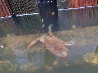
7) A crab feeds along the edge of a pier.
8) A cat looking for fresh fish.

9) Swallows in their protective nest under a bridge.

10) Further up in Bayou Coden, it is much prettier.

Tuesday, June 15, 2010

06/15/2010 - Whiskey Ditch

Launch: Riverdocs on the Causeway
Destination: Whiskey Ditch
Distance: Approx 5 miles
Paddle time: Approx 2 hours
Weather: Hot and humid (90s) with nearby thunderstorms.
Track: To view or download the GPS track of this trip, Click Here.


Header Image

1) Picked up the Necky Looksha 17 Outfitter kayak that I ordered back in March today and had to try it out despite nearby thunderstorms. There was a distinct and sickening smell of petroleum in the air related to the BP oil spill.

2) A yellow crowned night heron on a post in Pass Picada with the Oyster House Restaurant in the background.

3) An eye catching wildflower in the Pea Family on the bank of Pass Picada. 

4) The flower of the Swamp Dock in the Buckwheat Family (Rumex verticillatus) which had many medicinal purposes in the past.

5) Higher up on the stream bank the white flowers of the Crimsoneyed Rosemallow are visible.


6) A closer look at the Crimsoneyed Rosemallow (Hibiscus moscheutos). It is a large sized flower.

7) Peering inside the flower, you can see where the Crimsoneyed Rosemallow gets its name.

9) Floating Primrosewillow or Water Primrose (Ludwigia peploides) - this plant can literally clog streams. The color of the Water Primrose flower matches the color of the new kayak.

10) At the end of Whiskey Ditch is a small pond and at times it is full of surface scum that is teaming with microscopic life.

11) Another thunderstorm forming nearby meant it was time to head back to the launch site. Overall the Looksha Outfitter handled well although I need to make some adjustments to improve seat comfort. I got this kayak to use in open waters with larger waves. It is suppose to handle a 4 foot chop.