Saturday, December 10, 2005

12/10/2005 – Bon Secour River

Launch: Bills Seafood at the end of Baldwin County Road 10 in Bon Secour. Launch Cost: $5, but you might get a discount if you point out that boats have motors on them and a kayak doesn’t. Route: Pedal northeast up Bon Secour River to the bridge and back. Distance: 8.6 miles. Average Speed: 2.6 mph. Time: Approx 3 hrs. Pace: Slow. Weather: Partly cloudy, in the 50s, winds calm to variable. Very little tide or current.

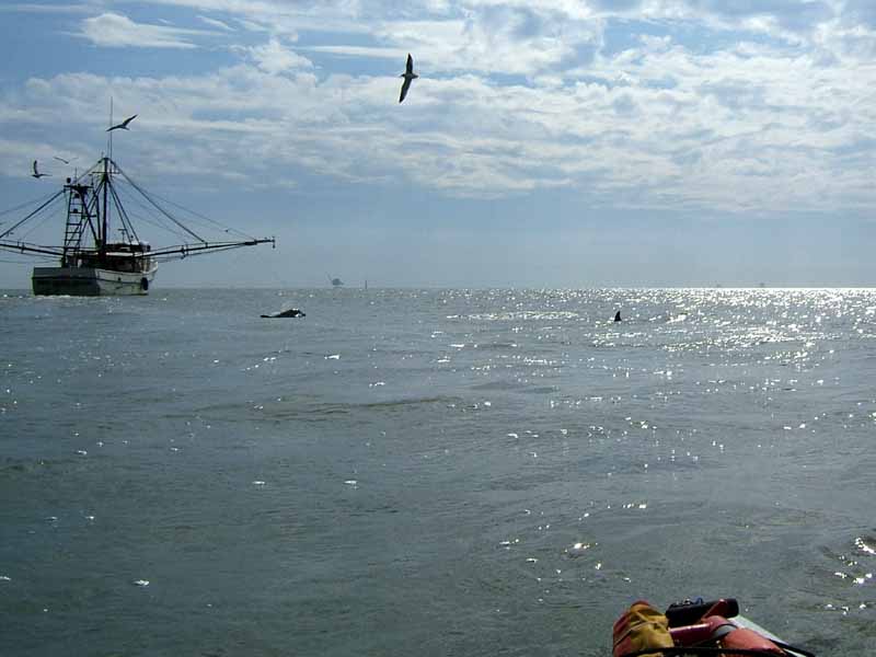
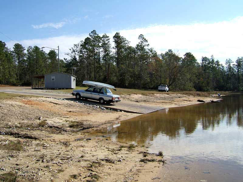
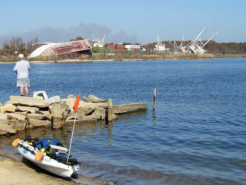
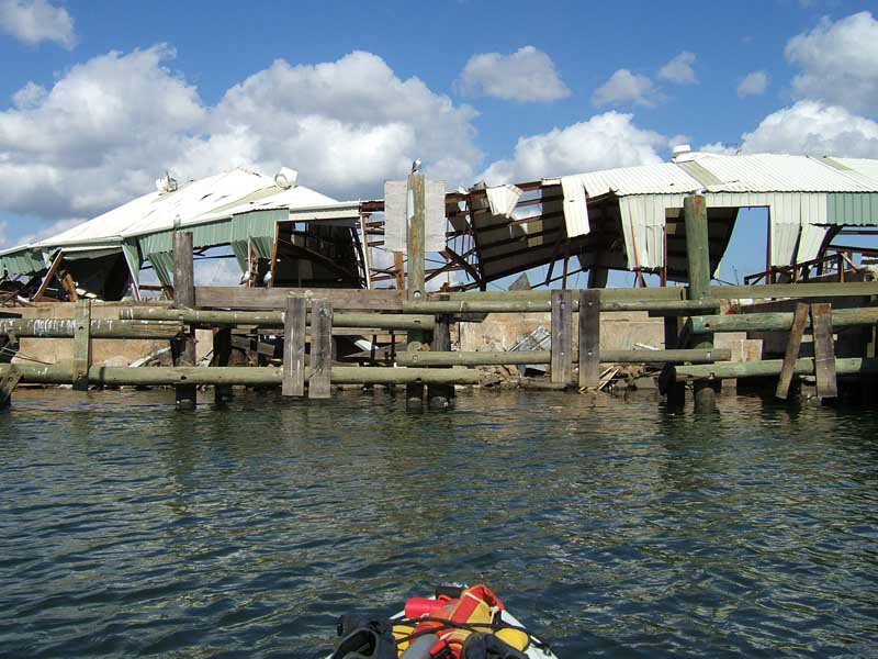
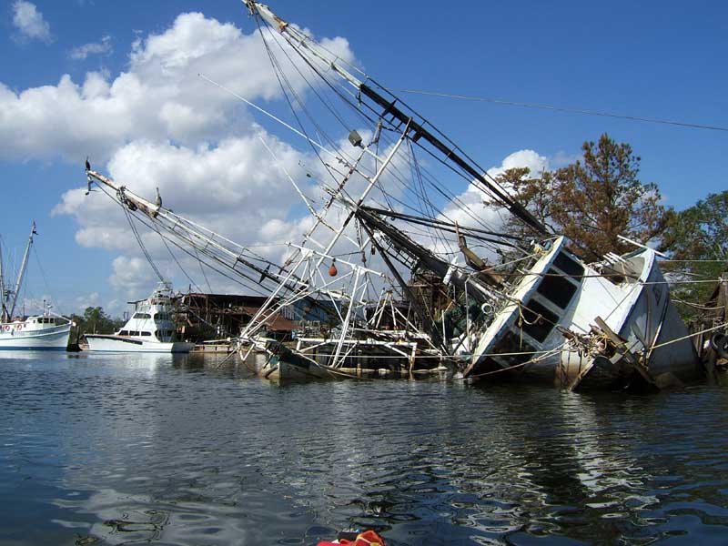
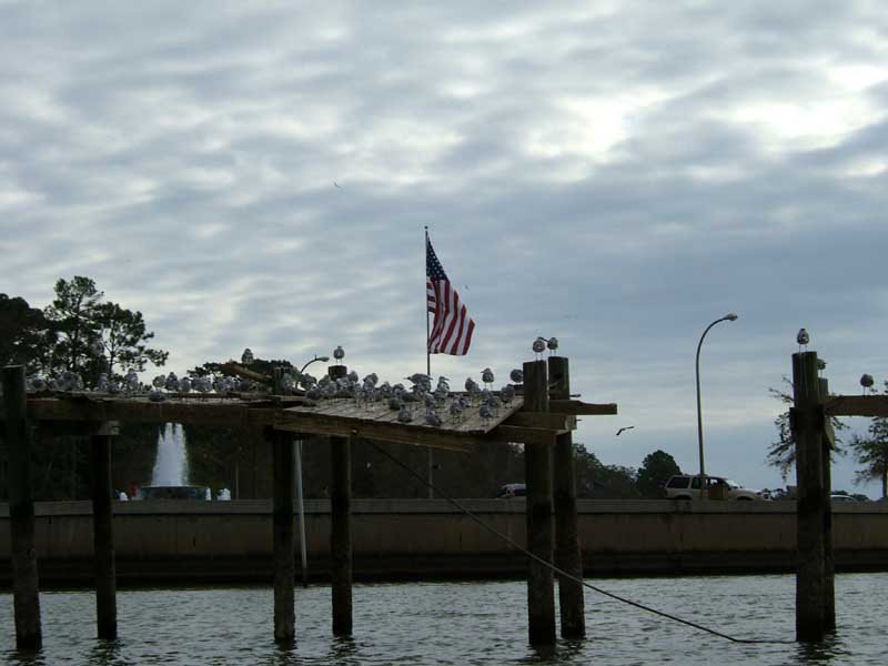
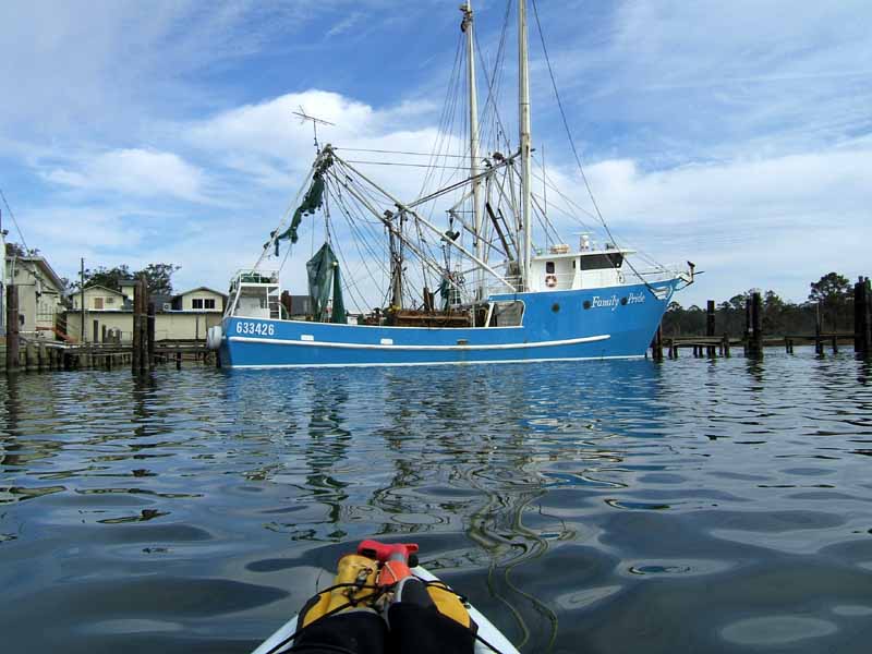
(1) Above left. Today I decided to explore Bon Secour River, a place I’d never kayaked in. Choose the Bill’s Seafood launch site. Plenty of room, but for those concerned with little scratches on their kayak, the launch area is full of oyster shells. (2) Above right. Upon starting out, Bon Secour looked a little similar to Bayou La Batre as there were many shrimp boats.

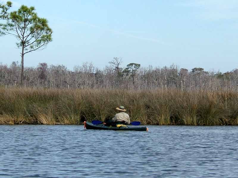
(3) Above left. Guess who has gotten started in the shrimp business? (4) Above right. I enjoyed meeting David, an avid kayak fisherman who is new to the area. It was his first time on Bon Secour River, too.

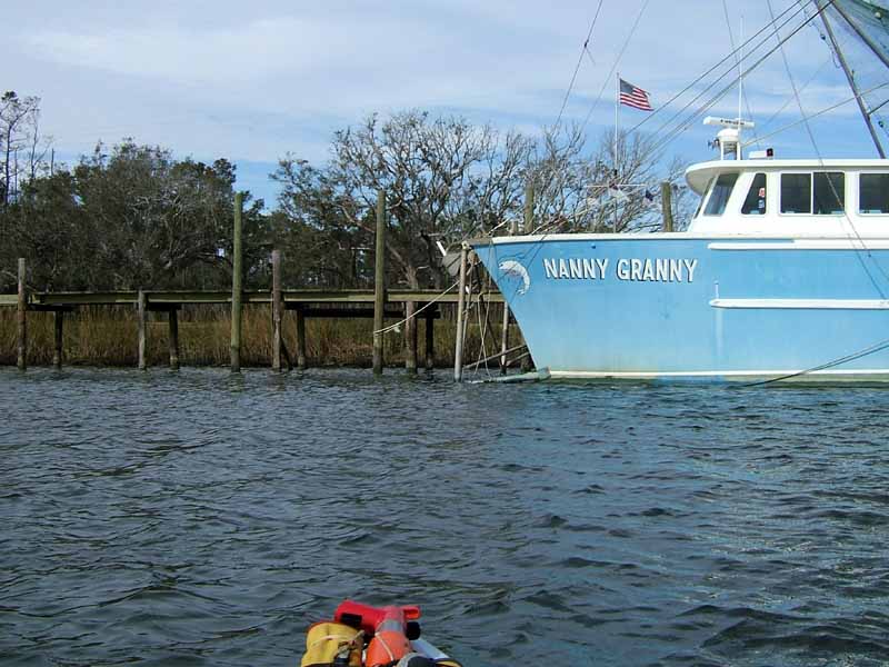
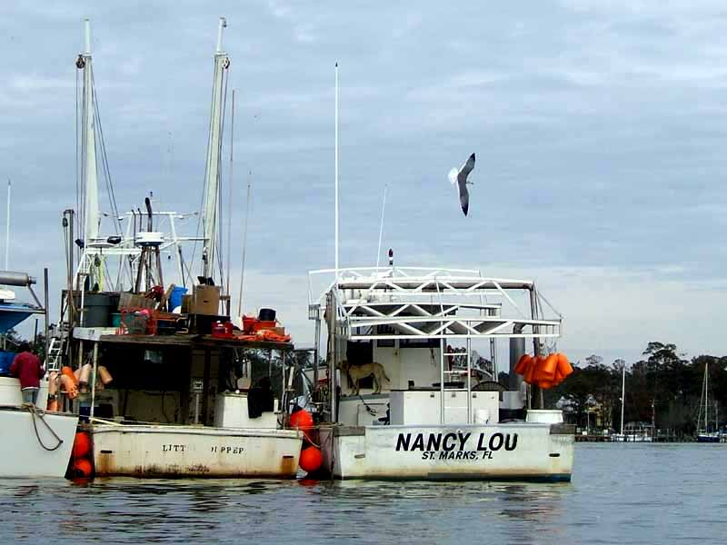
(5) Above left. Today, the shrimp boat names kept reminding me of someone. (6) Above right. It appeared the boat on the right was being manned by a dog.

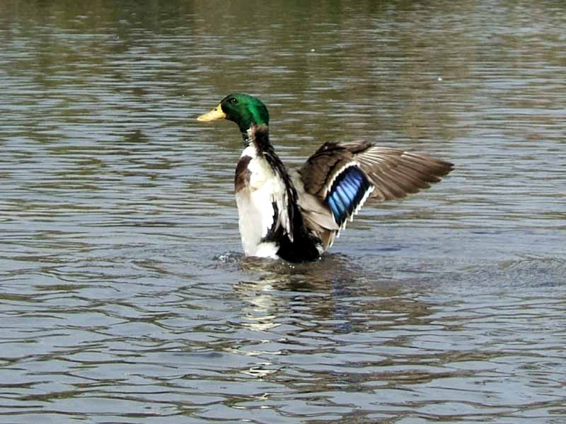
(7) Above left. Couldn’t tell if these birds were Cormorants or Anhingas, but one thing for sure, they were very abundant in Bon Secour River and in the trees. (8) Above right. Mallards are very beautiful ducks.

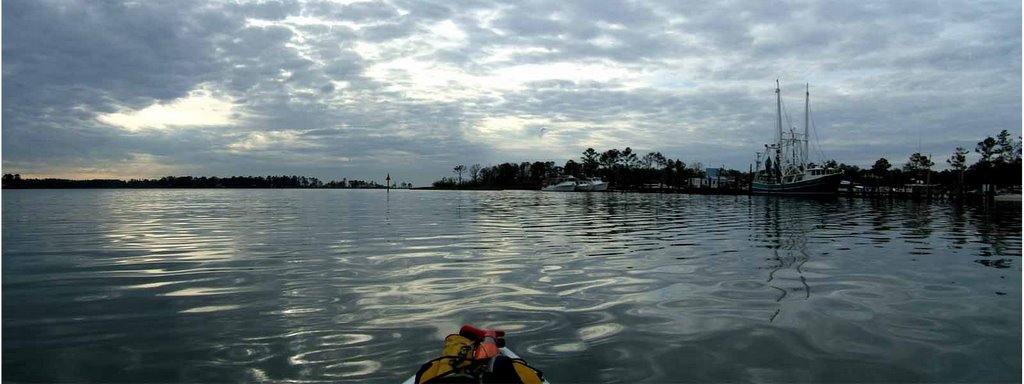
(9) Above left photomerge. On the way up river, the draped rippled clouds were ever changing, which of course, photos are never able to capture the magnitude of the visual delight. Upper Bon Secour river reminded me of Fowl River with its marsh grasses and beautiful homes. (10) Above right photomerge. On the way back, the blue sky gave way to wintry clouds. Would have liked to stuck around for the sunset, but it was time to go home. Thumbs up on Bon Secour. Not only is it pretty clean, it also offers a wide variety of scenery.

Sunday, November 20, 2005

11/20/2005 – Dauphin Island to Sand Island

Launch: Southeast end of Dauphin Island by the rock jetties. Launch Cost: Free. Route: Pedal and sail around in Pelican Bay – no route. Distance: 9.1 miles. Average Speed: 3.7 mph. Time: Approx 3 hrs. Pace: Leisurely. Weather: Sunny and warm 65 degrees, winds from the north 5-10 mph, tide very low, minimal current.

(1) Above left. This shrimp boat from Bayou La Batre is called “Papa’s Little William” and it was dragging its nets at 3-4 mph. It was nice to see the shrimp boats back at work. (2) Above right. If you kayak behind a shrimp boat you’ll see plenty of birds and dolphin.

(3) Above left. Dolphins are the main reason why I keep going back to kayak at Dauphin Island. If you want to learn more, check out this dolphin info. Want to see more, check out these dolphin photos. (4) Above right. A few times the winds picked up enough to be able to do a little sailing.

(5) Above left. Kayaking Dauphin Island is also appealing to me because of the white sands and contrasting blue skies. Saw only 3 private boats today and the only person on Sand Island was another kayaker. (6) Above right. Motor boats cannot get around the Dauphin Island pier anymore. This means the gap between Sand Island and Dauphin Island is no longer a boat freeway. That is great for kayakers! With the addition of some steps at the end of this pier, people could walk from Dauphin Island to Sand Island. Will they add steps to the end of the Pier? Time will tell.

(7) Above left. A trip to DI wouldn’t be complete without seeing coastal birds. If this sea gull, who was eagerly eyeing the kayak, had any muscles in its legs, it would be pedaling in a Hobie. (8) Above right. Sea gulls were upset that I disturbed their afternoon siesta on the rock jetties as I returned to the launch site. The gull on the right spewed out a load of excretment which was unexpectedly caught on film. That reminds me of the book, "White Rain" by Gull Dung'it.

(9) Above left. An unusually low tide thanks to winds out of the north, highlight where and where not to launch by the rock jetties. It is best to walk a few hundred feet west to launch, especially if you have a composite kayak. These rocks are usually hidden under water. You can see my Hobie Outback in the distance where there are no rocks. (10) Above right. Conditions, like these 2 inch waves, made it perfect for kayaking. I sure didn’t want to end this kayak trip as it was another barefoot and t-shirt day. Happy Thanksgiving Holiday!

Saturday, November 19, 2005

11/19/2005 – Converse Reservoir (Big Creek Lake)

Launch: End of Howells Ferry Road (East Side Landing). Launch Cost: $5. Route: Pedal south to the Tanner Williams Road dam and back. Distance: 9.7 miles. Average Speed: 3.2 mph. Time: Approx 3 hrs. Pace: Leisurely. Weather: Sunny, in the 60s, winds calm to variable - perfect kayaking day. No tides or current.

(1) Above left. At the launch site there is ample parking and a nice firm sandy bottom to launch kayaks. It is a pretty safe area too, because, the building has multiple security cameras recording activity and there is a clean porta-potty. I was impressed with the cleanliness of the waters. (2) Above right. Yellow aster like flowers blooming on the bank in late November – I love Mobile! The water here is still warm enough to wade around in your bare feet.

(3) Above left. End of the trip south - Tanner Williams Road dam. (4) Above right. Every time I kayak it is like spending time with the Creator. This unusual clump of grass added to the spiritual experience.

(5) Above left. Converse Reservoir has many branches, nooks, and little forks all over the place. Most forks lead to shallow areas with clear water allowing you to see fish and turtles. (6) Above right. This little turtle was getting a little sun.

(7) Above left. I saw a wide variety of birds, including Killdeer, Hawks, Gulls, Sparrows, Wrens, and plenty of Coots. Wish I had brought binoculars… (8) Above right. Hamilton Creek was off limits to boaters for unknown reasons.

(9) Above. Wish I had not waited so long to try kayaking Converse Reservoir. I highly recommend this beautiful lake to kayakers! Its pine tree boundary offers a different backdrop to the usual cypress trees or marsh grasses. At the current water level, you can get out to stretch the legs almost anywhere as the banks are of solid sand. It is really a clean place with very few boats, yet it is big enough that you can get lost.

Saturday, November 12, 2005

11/12/2005 – Bayou La Batre

Launch: Bayou La Batre public boat ramps. Launch Cost: Free. Route: Pedal a little over 4 miles up Bayou La Batre and return. Distance: 8.5 miles. Average Speed: 2.9 mph. Time: Approx 3 hrs. Pace: Leisurely. Weather: Sunny, in the 70s, with light winds from the east and southeast - a beautiful kayaking day. Minimal tides and current.

(1) Above left. View from the launch site showing boats off in the marsh on the west side of Bayou La Batre. Removing the boats from land has been postponed until it is decided on who is going to pay for their removal. Removing the beached boats might cost as much as $60,000 each. (2) Above right. A warehouse that was demolished by wave action. You can see more photos of the damage to Bayou La Batre, including another shot of this warehouse by clicking here, and here. Also, this site has some interesting slide shows.

(3) Above left. One sunk shrimp boat and one leaner boat. I expected to see trees leaning in the water and more sunken boats and was pleased to see only a few boat casualties and almost no downed trees. Most of the damage I saw in Bayou La Batre looked to be surge and wave related. (4) Above right. The Bayou La Batre lift bridge is still in working order.

(5) Above left. The New Orleans Lady shrimp boat looks in pretty good shape and provided a nice reflection on the water. (6) Above right. An interesting looking boat. The IX-514 is a Helicopter Landing Trainer (HLT) ship that has been around since the late 60s and Viet Nam. It was also known as the YFU-79.

This was a beautiful day to kayak. Bayou La Batre is in good shape for kayaking if you don’t mind oil sheens on your kayak. My white kayak had a black bottom after taking it out of the water. At home it took some serious cleaning with detergents to get the black oil off the kayak. There has been oil and chemicals leaking from sunken shrimp boats in Bayou La Batre for as long as I’ve been kayaking there. I don’t anticipate that addition of a few new sunken boats will change the government’s view on hazardous materials leaking into those waters. What a shame.

Sunday, November 06, 2005

11/06/2005 – Mobile River

Launch: Public boat ramps in the middle of the Causeway on the North side. Launch Cost: Free. Route: Cross the Tensaw River, across Delvan Bay, up Spanish River, down Mobile River, around Choctaw Pass, and then back up to the Causeway via Tensaw River. Distance: 19.0 miles. Average Speed: 3.5 mph. Time: Approx 5.5 hrs. Pace: Leisurely. Weather: Misty and very humid 65 degrees in the morning and a warm 77 degrees by afternoon with very little wind.

(1) Above left. There is always something magical about sunrises as the morning hues splash across the awakening waters. (2) Above right. Across the Tensaw River, Coot were abundant on the lazy hazy waters as shown in this skyline photo.

(3) Above left. Further up along the edge of Spanish River, with the humid haze still clinging to the air, Coots went about their business while keeping a watchful eye on this passing kayaker. Trees in the background were filled with Ibis. (4) Above right. Along the upper part of Spanish River’s mud flats, Ibis were keeping a nose out for their breakfast.

(5) Above left. The first sign of the recent hurricanes came in Mobile River. Between Spanish River and the Cochran Bridge, barges can be seen beyond the banks of the river on the other side of the railroad tracks, nestled against a tree line. (6) Above right. Not only are barge companies faced with a monumental dilemma, many dream boats have gone where no boats have gone before.

(7) Above left. I like kayaking down Mobile River because there you can see different things every trip down the river. Have you ever seen a barge hauling railroad cars? You would think the cars could roll off or tip over if the barge rocks. (8) Above right. Sea gulls line the rim of barges. They must enjoy watching the boat traffic.

(9) Above left. Shot of the RSA building under construction as it towers over the huge multi-story cargo ship unloading at the State Docks. (10) Above right. The storm surge in Katrina caused the USS Alabama’s moorings to break and as a result the waters moved the ship and eventually left it tilted a few degrees. How are they ever going to move it back? One of the reasons I stay in Mobile is because of days like this in November – nice, sunny, warm, 75 degrees, wonderful!

Saturday, November 05, 2005

11/05/2005 – Eastern Shore of Mobile Bay

Launch: Public beach access next to Fairhope Yacht Club (Volanta Street). Launch Cost: Free. Route: South a few miles along the Eastern Shore, turn around, up to Fly Creek and then return to launch site. Distance: 7.4 miles. Average Speed: 3.3 mph. Time: Approx 2,5 hrs. Pace: Leisurely. Weather: Overcast, short sleeves and shorts weather, breezy from the southeast. Perfect day for sailing!

(1) Above left. Fixed up the Hobie Pedal Drive unit and decided to escape for a few hours on Mobile Bay to test it out. The pier to the little Fairhope Yacht Club Boathouse is gone. The Fairhope Yacht Club building is gutted and unsuable. (2) Above right. We may get Hurricanes along the coast, but today, I’m in shorts and a t-shirt, all nice and warm. I put up the sail on the way back and enjoyed some gusty speeds at times.

(3) Above left. The sea gulls enjoy their unlimited privacy on the little wooden pier that is no longer used by people for obvious reasons. (4) Above right. It looks like it will be a long time before the fisherman will be back on Fairhope Pier because most of the concrete deck slabs are in the water.

(5) Above left. The shoreline on the Eastern Shore is teeming with the remaining pilings of boathouses and wooden piers as far as the eye can see. (6) Above right. Contrary to the belief that all is devastated along the shores, it looks like business as ususal in the Fairhope Yacht Club Marina. The smooth waters and striking reflections as seen by kayak are most enjoyable.