Saturday, June 24, 2006

06/24/2006 – Dennis Creek Tributary

Launch: Cliffs in Baldwin County off Hwy 225. Fee: Free. Route: North about 2.5 miles on the Tensaw River, then split right into Dennis Lake, then about 2 miles to an unnamed tributary branching off to the left, then back to the launch site. Distance: 11.5 miles round trip. Average Speed: 2.5 mph. Time: Approx 4.5 hrs. Pace: Slow. Weather: Warm temps, partly cloudy early, then mostly cloudy. Tide low.

(1) Above left. An early morning start allowed me to experience another nice sunrise. (2) Above right. After the sun had finally risen over the tree tops, the sky turned a beautiful gold color.

(3) Above left. Nothing much to report on this paddle except for the high number of wasp nests clinging to branches in the trees and swarming yellow flies at the end of the tributaries. (4) Above right. Some trees appeared to be sad today. (Turn your head sideways to the left to see the sad looking tree).

(5) Above left. Yellow pond lilies were out in large numbers along the Tensaw. (6) Above right. There were also signs of how dry it is around here by the dry, cracked soil. Going very slowly along the banks made this an enjoyable paddle.

Sunday, June 18, 2006

06/18/2006 – Bayou Tallapoosa

Launch: Rice Creek which is about 4 miles north of I-65 and northwest of Stockton. Launch Cost: Free. Route: Rice Creek to the Dead Lake platforms, then west on Bayou Tallapoosa to Tensaw River. Then south on Tensaw to Two Rivers WMA campground, then east a short distance to Bottle Creek, then south to Bayou Jessamine, then to the Jug Lake platform, then back to the Rice Creek launch site. Distance: 19 miles round trip. Average Speed: 3.0 mph. Time: Approx 6.5 hrs. Pace: Slow. Weather: A little bit steamy in the morning again, sunny until about 10:00 am when it started clouding up keeping the temps more tolerable. Tide was low and the rivers were lower than normal, very little in way of current. Deer Flies (Yellow Flies) persistantly buzzed me but rarely tried to bite.

(1) Above left. The sun starts lighting the day on Briar Lake. (2) Above right. Later in the afternoon, after exiting Bayou Jassamine, the clouds start taking on more serious characteristics. I drove through a little rain storm ten minutes after leaving Rice Creek. Good timing!

(3) Above left. Having not seen these Dead Lake platforms since before last year’s hurricanes, it was a surprise to see them still standing. It was even more surprising to see the platforms still looking almost new. (4) Above right. This is the typical scene for Bayou Tallapoosa and Bayou Jessamine. Both are relatively narrow with mud banks and have plenty of fallen trees to navigate around. I had to do one portage on Bayou Jessamine.

(5) Above left. To be in a narrow bayou with banks high enough that you can’t see what may be standing 10 feet into the woods leaves me on edge, expecially in Bayou Tallapoosa and Bayou Jessamine. Things seem more alive in these areas. The signs of life are all over the mud banks so you will never know what you might see. These look like racoon tracks. (6) Above right. I didn’t see any big ones today, but because of tracks like these, I know there are some gators around.

(7) Above left. Also surprising was Two Rivers campground was still intact and accessible. It is a great place to get out and stretch the legs. (8) Above right. Swamp Mallow flowers were abundant.

(9) Above left. I also checked out Jug Lake platform and took a break there. (10) Above right. One of the things I like about kayaking in Rice Creek and Jug Lake are the cypress trees. A photomerge isn’t even able to capture the immensity of this cypress tree base.

(11) Above left. This is the Rice Creek landing. Launching here when it is dark in the morning is an experience. (12) Above right. Some butterflies laying eggs next to the launch site. If you have never been through Bayou Tallapoosa, I highly recommend it. There is a sandy beach and solid land to get out on where Bayou Tallapoosa (west side) meets the Tensaw River.

Saturday, June 17, 2006

06/17/2006 – Owl Creek and Maple Creek

Launch: Cliff’s Landing in Baldwin County off Highway 225. Launch Cost: Free. Route: Across the Tensaw about 1.25 miles southwest to Negro Lake, then north about 2.5 miles to Owl Creek. Expore Owl Creek, back to Negro Lake, then about 1.5 miles north to Maple Creek. Then back to the launch site. Distance: 24.0 miles round trip. Average Speed: 3.6 mph. Time: Approx 7 hrs. Pace: Leisurely to fast. Weather: Steamy in the morning and sunny all day low tide and minimal current.

(1) Above left. The morning was hot and steamy – so hazy that photos on the Tensaw did not turn out worth posting. This photo was taken on Negro Lake. (2) Above right. This was also taken on Negro Lake. I was attempting to get the sunrise showing behind the osprey eagle nest and just as I snapped the shot, a large spoonbill catfish jumped out of the water, as shown in the lower right of the photo. You wouldn't want one of these fish jumping into you while kayaking!

(3) Above left. The waters of Owl Creek were still at low tide with plenty of surrounding green, birds, fish, and alligators. (4) Above right. Even though the sun was out, trees kept me shaded until about 11:00 am. This shot was from the upper end (lower end) of Maple Creek.

(5) Above left. There were lots of cypress knees on today’s paddle. (6) Above right. A cute baby alligator. Momma was nearby. It is really sad to hear that Alabama is going to start allowing hunting of alligators again.

Sunday, June 11, 2006

06/11/2006 – Big Bay John and Mobile River

Launch: Public triple boat ramps in the middle of the Causeway on the North side. Launch Cost: Free. Route: Cross the Tensaw River, across Delvan Bay, up Spanish River, up Raft River to explore Big Bay John, back down Raft River, across Grand Bay, up Spanish River, down Mobile River, around Choctaw Point, and up the Tensaw River back to the launch site. Distance: 32.8 miles. Average Speed: 3.6 mph. Time: Approx 10 hrs. Pace: Leisurely. Weather: Sunny & hot. Had decided to do the Mobile River loop at the end of exploring Big Bay John figuring it shouldn’t add too much time to the trip. I hadn’t anticipated the Mobile River current to be flowing up river during a falling tide. A tropical storm in the Gulf of Mexico along with an increasing flow of southerly wind was pushing water up Mobile Bay. This fact turned what I thought would be a quick trip down Mobile River into a much longer trip where I was fighting current and wind. But the payback was some nice surfing waves along Pinto Island and the Battleship where the kayak was reaching speeds over 8 mph.

(1) Above left. Sunrise across Delvan Bay. (2) Above right. Near the entrance to Raft River, conditions became foggy. This tree stump eerily stands out in the middle of the water with a near invisible background.

(3) Above left. Incoming tide helped speed up the kayak. In areas of Raft River, fish appeared to be in a feeding frenzy with hundreds of them jumping into the air near the shore. (4) Above right. Big Bay John was quite scenic with the still waters making beautiful reflections.

(5) Above left. There were numerous varieties of birds along the way. (6) Above right. The greens and blues were absolutely mesmerizing today.

(7) Above left. Lily pads were more plentiful in the upper reaches of Big Bay John but because there were so many other things to see, one hardly noticed them. (8) Above right. A photomerge taken in Big Bay John on my way back out to Raft River.

(9) Above left. This photomerge, was taken at the north end of Spanish River near the entrance to Mobile River which is just beyond the two power pole towers. (10) Above right. Conditions after entering Mobile River were quite favorable. Tide was just starting to go out and there was no wind. The waters were nice and slick. Why was my speed slow going down river though?

(11) Above left. Up goes the new RSA tower while an old barge deteriorates. Such is life – new eventually wears out and rots away. Enjoy the moment. (12) Above right. By the time I neared Choctaw Point, the wind was really picking up and the current coming up river was getting stronger. Having paddled all day, it was no fun having to paddle so hard to go down river. In the photo (click on photos for larger view), you can see a big ship approaching the entrance to Mobile River.

Saturday, June 10, 2006

06/10/2006 – Dog Paddle Races

Launch: Luscher Park, Dog River. Launch Cost: Free. Route: A little exploring before the races, then around the red buoys and back, several times. Distance: 4 miles. Average Speed: Unknown. Time: Approx 3 hrs. Pace: Leisurely to racing. Weather: Sunny and Hot.

(1) Above left. 
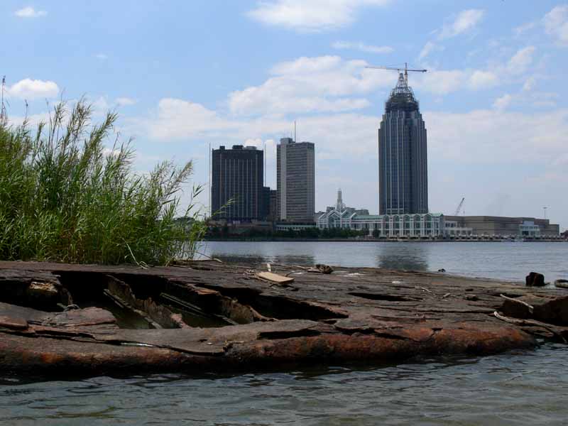
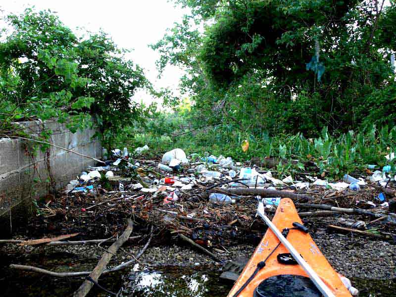
Another year has passed since I paddled from Luscher Park, located on the upper end of Dog River. Knowing that Dog River usually looks like a garbage dump, I got there early and ended up filling a 48 gallon container to the brim three times with trash before it was race time. The photo speaks for itself. 
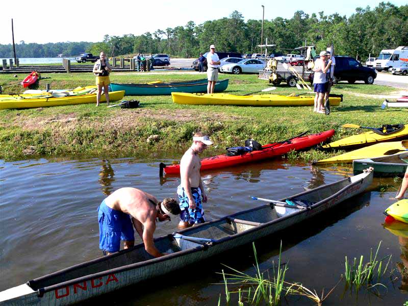
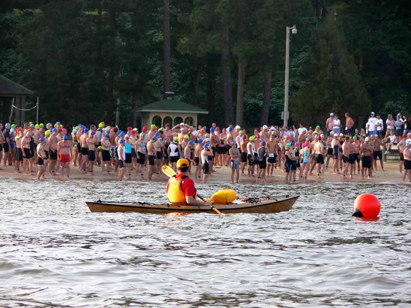
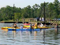
(2) Above right. This event, hosted by the Dog River Clearwater Revival, brings out a wide variety of kayakers and canoeists. Also participating in this year’s event was the University of South Alabama Civil Engineering Department with their ONCA cement canoe. For more photos of the Dog Paddle, click here.

(3) Above left. 
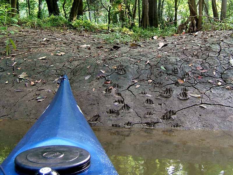
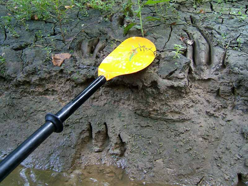
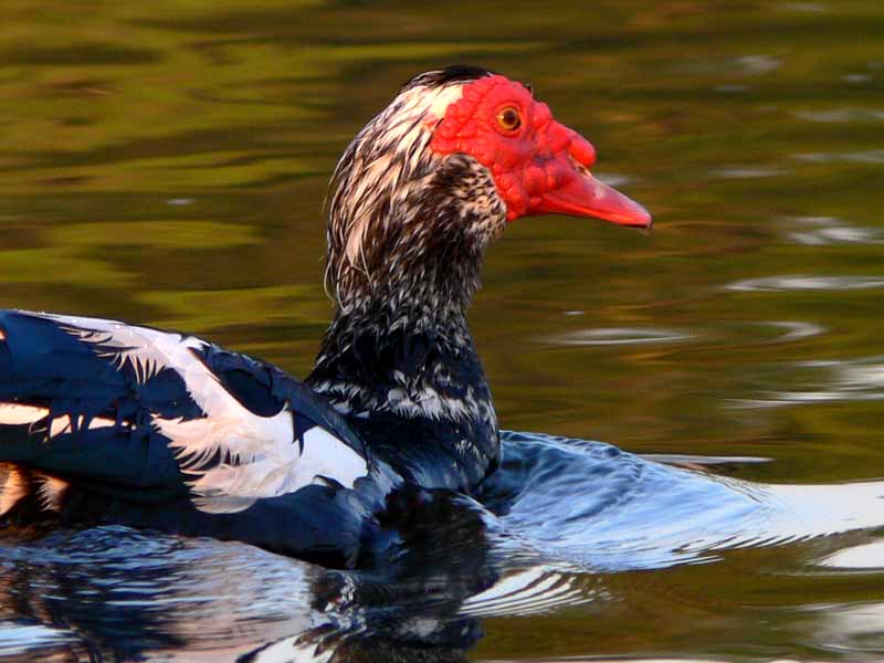
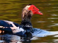
Some of the regular residents were rather red faced to learn their territory was being overrun by so many kayakers. 
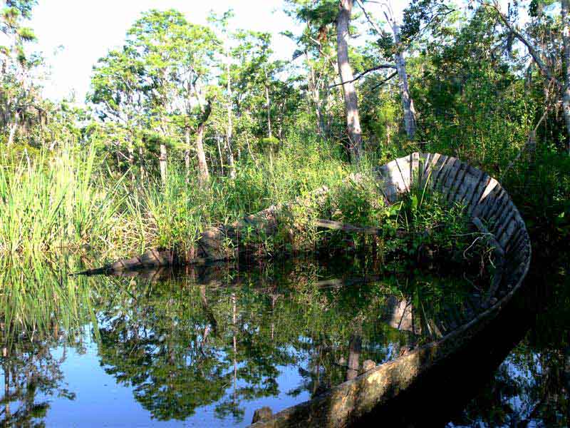
(4) Above right. This sunken boat, not far from the race site, brought to reality the power of hurricanes.

(5) Above left. 
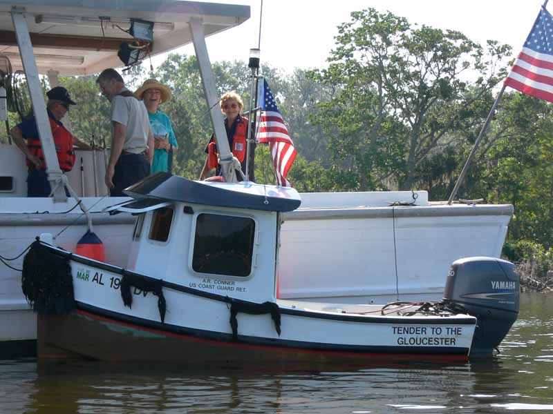
There was plenty of help standing by for any emergencies. You could see that A.R. Connor, retired Coast Guard member, has a passion for boating. His miniature boat, named “Tender to the Gloucester,” hosting a Yamaha 50 engine, couldn’t have been much longer than 14 feet. 
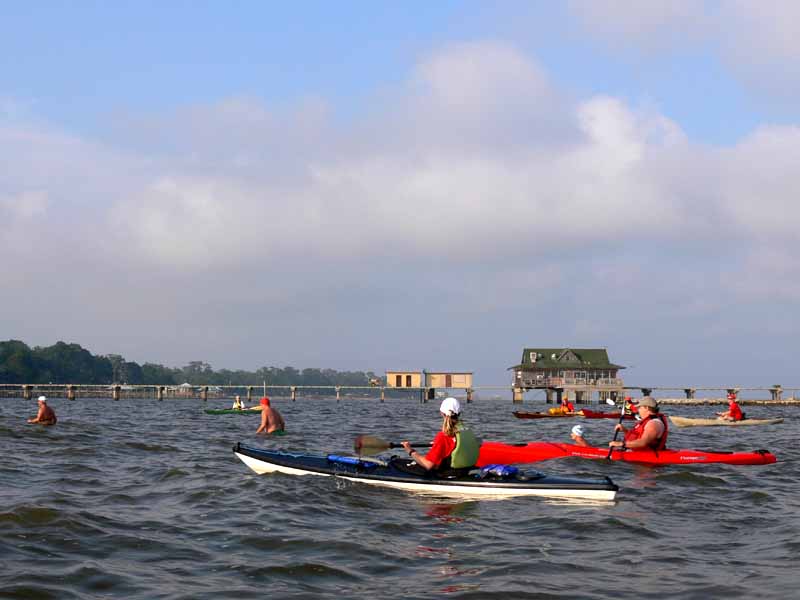
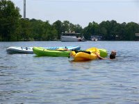
(6) Above right. Some kayakers took advantage of the water to cool off from the late morning heat. No rescues necessary.

(7) Above left. 
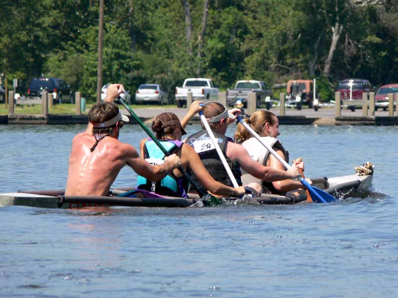
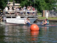
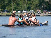
In the ladies race, the University of South Alabama concrete canoe crosses the finish line ahead of a tandem kayak. (8) Above right. You have to wonder how this concrete canoe, manned by four Civil Engineering students, manages to stay afloat.

(9) Above left. The ladies Dog Paddle race gets underway. 
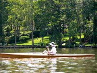
(10) Above right. Mimi Fearn snaps a few photos while sitting in a finely crafted wooden kayak.

(11) Above left. 
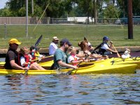
The Dog Paddle Races had events for kayaker and canoeists of all ages. 
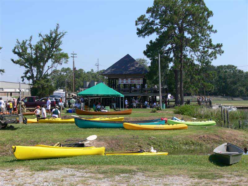
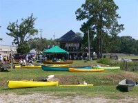
(12) Above right. Luscher Park is a nice facility for hosting events such as the Dog Paddle.

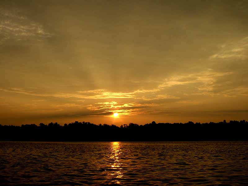
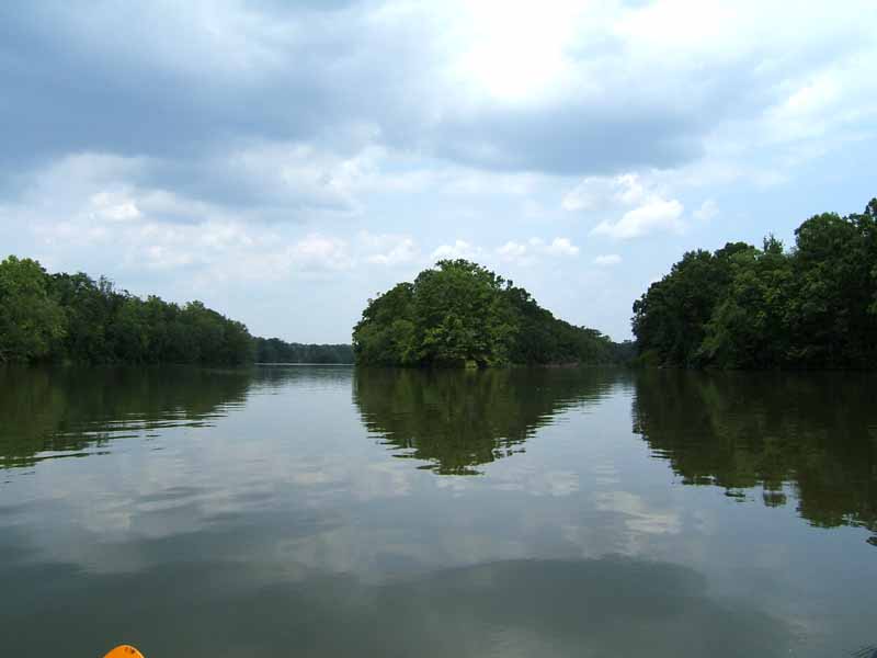
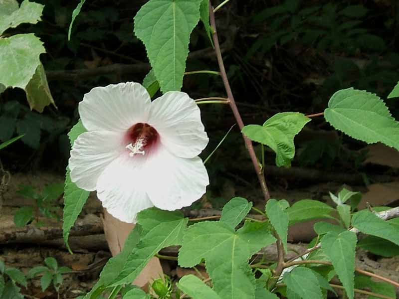
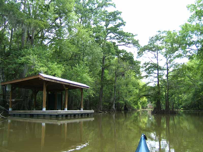
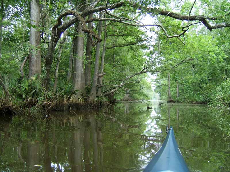
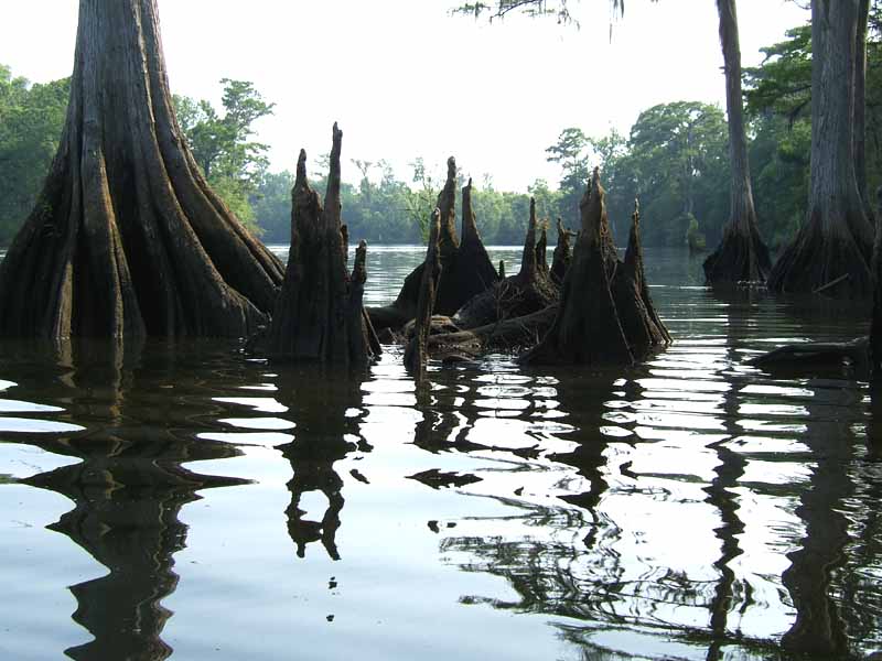
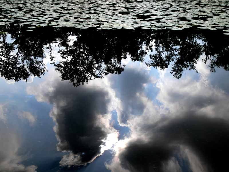
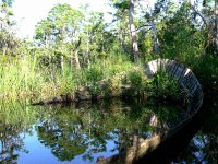
A year or two ago I voiced my worry over cars parking on the edge of the woods, speculating that people were up to evil over there. I did a little exploring this year and feel it necessary to report how ignorant my pessimism was. People are driving to the west edge of Luscher Park because there is water on that side of the park, too, and that is where they fish. In my short paddle before the races began, I explored a few areas and realize there is much more beauty to Dog River than meets the eye. I’ll be launching more often from Luscher Park and will post visual reports of the trips right here.

So, how did I do in the races? Since my pedal kayak broke last week, I was forced to use a paddle kayak I hadn’t used in about a year, utilizing muscles I hadn’t used in about a year. How is that for an excuse?

Saturday, June 03, 2006

06/03/2006 – Fairhope (Grandman Trialthon)

Launch: Fairhope Yacht Club. Launch Cost: Free. Route: South about 1.2 miles to Fairhope Pier where I had volunteered to help out with the Grandman Triathlon. Distance: 6 miles. Average Speed: 2.6 mph. Time: Approx 3 hrs. Pace: Leisurely. Weather: Warm and hazy.

(1) Above left. Salmon colored sunrise from near the Fairhope Yacht Club. (2) Above right. Another early morning photo from the Eastern Shore near Fairhope.

(3) Above left. Steve in his sharp looking homemade kayak gets into position as race time nears. The swimming portion of the race is broken up into different groups, each group wearing a different colored swimming cap. (4) Above right. Harriet, coordinator for the kayak volunteers, keeps her eye out for any struggling swimmers. Kayakers approach struggling swimmers and let them grab onto the end of the kayak until they are rested enough to start swimming again.

(5) Above left. Since a large portion of the swimming event is in shallow water, many swimmers walk or bounce most of the distance. Here, several kayakers are following the last wave of swimmers who are walking in waist deep water. (6) Above right. Two kayakers are heading south after the event, passing the Martin House Condominiums. The pier in the background, damaged by last year’s hurricanes, is still being repaired.

I started surfing some small waves on the way back to the Fairhope Yacht Club in my Hobie Mirage pedal boat, with the brand new Turbo flippers. Sadly, the composite plastic housing on the pedal unit broke during a quick sprint to catch a wave. The stainless steel shaft is eroded and squealing. The pedal unit, rusted, is also worn out. It is quite disappointing to have to be replacing half the parts on the pedal unit when it is only a year old. The new unit had already broken several times in the past. 5 weeks later, and I’m still waiting on parts. Hobie Mirage owners, beware – you better take along a spare drive unit or be prepared to paddle back.