Sunday, October 29, 2006

10/29/2006 – Dennis Creek

Launch: Club paddle starting at Cliffs Landing in Baldwin County off Hwy 225. Launch Fee: Free. Route: North about 2.5 miles on the Tensaw River, then split right into Dennis Lake, then take the second tributary (Dennis Creek) to the right then back to the launch site. Distance: 11.2 miles round trip. Average Speed: 3.0 mph. Time: Approx 4 hrs. Pace: Leisurely. Weather: Just about perfect weather for kayaking.

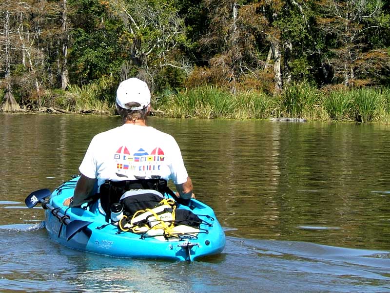
(1) Above left. Jan pedaling his new Hobie Outback on the slick waters of the Tensaw River as he passes close to some seagulls on a log. Jan was quite thrilled with the new kayak that allows you to work the leg muscles or the arm muscles. (2) Above right. Jan looks at an alligator on the river bank. The alligator saw us and slowly started to slither into the waters.

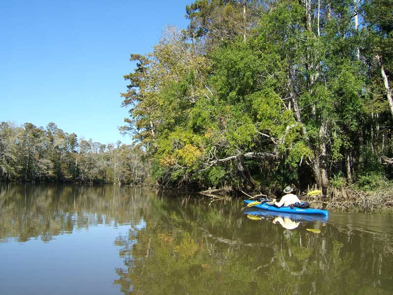
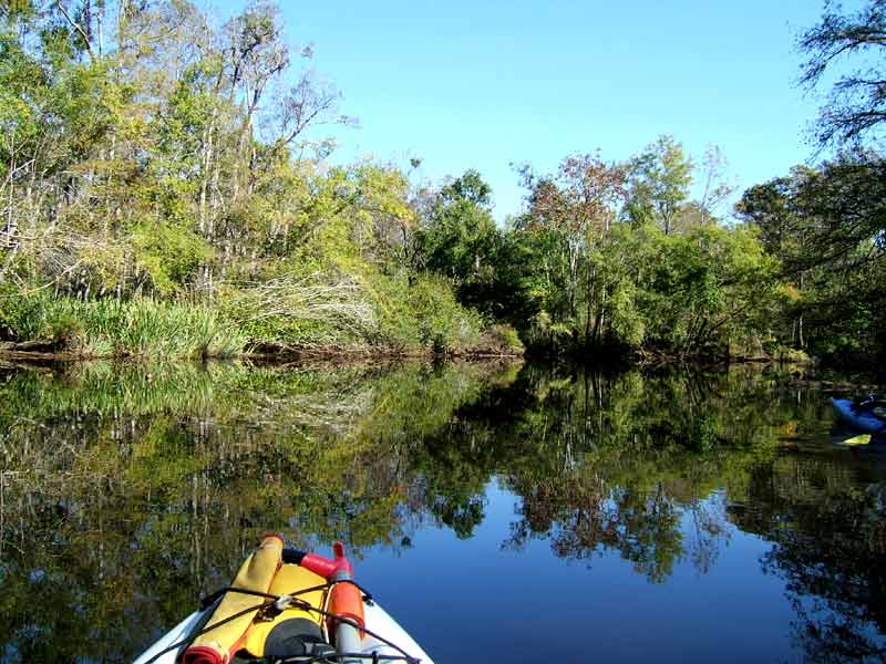
(3) Above left. David glides close to the shoreline in his paddle kayak. The pedal kayaks were limited to pedaling away from the banks to avoid hitting stumps with the underwater pedal boat flippers. (4) Above right. We enjoyed the slick waters that mirrored the deep greens that are soon to be gone until next spring.

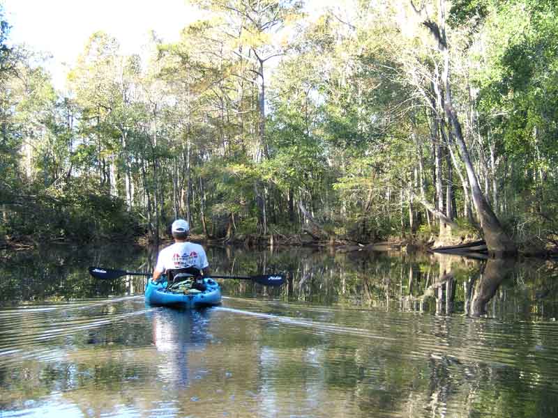
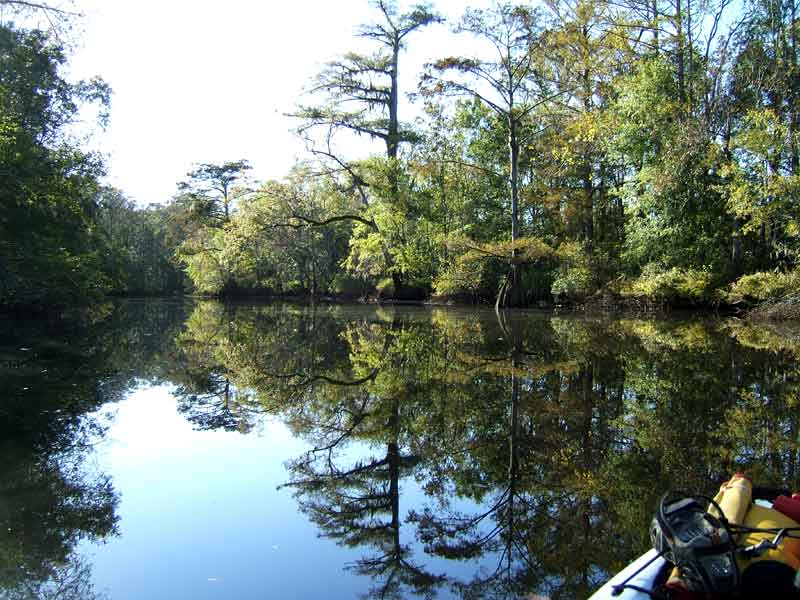
(5) Above left. Everyone got their turn to lead and enjoy the smooth scenery. Eventually pedal boats were forced to remove the pedal drive unit (it takes 20 seconds) and use paddles. (6) Above right. We took a short break and enjoyed some of Jan’s home grown satsumas while sitting on the bank in the narrow upper reaches of Dennis Creek. We had a deadline to keep in terms of turn around time in order to get back before dark, so it was back into the kayaks we went.

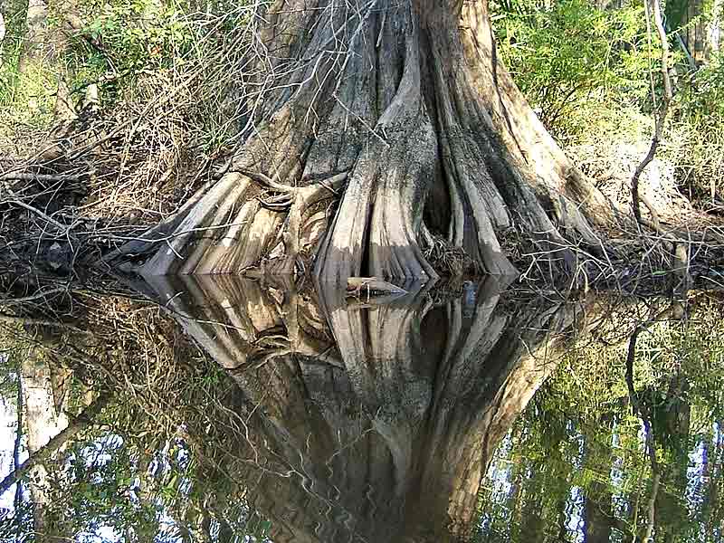
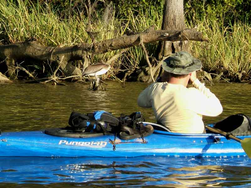
(7) Above left. The eerie bases of cypress trees looked back at us with sideways glances in the mirrored surfaces. Others say the bases remind them of harmonicas. What do you see when looking at this photo? Turn your head 90 degrees to the right and look again. (8) Above right. David takes a photo of the headless looking pelican. The pelican’s head, twisted 180 degrees, was tucked under its back wings and must have been in a deep sleep because it never moved as we passed closely by.

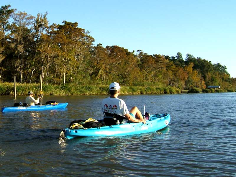
(9) Above left. David on the left, Jan on the right, on the open waters of the Tensaw River, headed back to the launch site. (10) Above right. We returned to the launch site and shortly after we got the kayaks loaded up, the sun set. What a nice ending to a enjoyable kayak trip.

Saturday, October 21, 2006

10/21/2006 – Conway - Lower Crab

Launch: Public boat ramps (triple set) just west of the I-10 crossing on the north side of the Causeway (Highway 90). Launch Cost: Free. Route: Northeast to Conway Creek, then north to Little Bateau, then back to Conway, then cross the Tensaw to Lower Crab Creek, south to Delvan Bay and back to the Causeway. Distance: 16.8 miles. Average Speed: 3.2 mph. Time: Approx 5.5 hrs. Pace: Leisurely. Weather: Started off sunny and nice with calm waters. Not much current or tidal change. Later in the afternoon, it clouded up, winds picked up out of the south producing a nice little chop in Delvan Bay. It started to rain as I was strapping down the kayak on the car.

(1) Above left photomerge. Up near the entrance to Conway Creek looking down toward the Causeway, the waters were nice and calm. The clouds created an attention-grabbing panaorama. (2) Above right. The RSA building is getting nearer completion as seen from across Chacaloochee Bay.

(3) Above left. A big eyed young heron looking as if it has never seen a kayak before. (4) Above right. A great blue heron had its left wing stretched out as it was standing just about as tall as a person.

(5) Above left. I paddled up a little tributary off Lower Crab creek and as was treated to some stunning displays of yellow flowers. It seemed like every corner I paddled around, there was a bigger spread of flowers in view. (6) Above right. I kept mumbling words like, “wow” and “absolutely beautiful” while paddling slower and slower.

(7) Above left. Near the entrance to Conway Creek, the cypress trees were turning a golden brownish red. (8) Above right. By the time I reached Little Bateau, it was starting to cloud up although, conditions were still perfect for kayaking. The ridge of clouds made the reflections on the water quite stunning at times.

(9) Above left. The natural beds of flowers along the banks attracted lots of butterflies. (10) Above right. One needs to be more attentative when paddling in the upper reaches of rivers and creek at this time of year lest you run into a big spiders. For butterflies, a brief error in flight trajectory can be fatal. This was a wonderful wonderful kayak trip.

Saturday, October 07, 2006

10/07/2006 – Mobile River

Launch: Triple public boat ramps in the middle of the Causeway on the North side. Launch Cost: Free. Route: Cross the Tensaw River, across Delvan Bay, up Spanish River, down Mobile River, around Choctaw Pass, and then back up to the Causeway via Tensaw River. Distance: 19 miles. Average Speed: 4.2 mph. Time: Approx 4.5 hrs. Pace: Moderate. Weather: Pleasantly sunny and warm conditions, minimal tide changes and normal current. Calm winds.

(1) Above left. Spanish River is wide but only a small portion of it can be navigated by motor boat because most of the river is very shallow. (2) Above right. Marvels of engineering technology can be seen all along Mobile River.

(3) Above left. The big ship Star Gran heads up the beginning of Mobile River at the #87 buoy. (4) Above right. You would think big ship means big wake, but this particular ship left almost no wake at all due to its slow speed.

(5) Above left. In one of the hidden recesses of Mobile River, golden rod or rag weed was in bloom. (6) Above right. Apparently one of the modern methods of erosion control on stream banks is to use industrial trash as seen in this photo. What do you think of this river bank? Is it beautiful or what?

(7) Above left. Speaking of beautiful river banks, this boat, a victim of hurricane Katrina that passed nearby over a year ago, still sits adorning the shoreline. See old photo here. (8) Above right. After rounding Choctaw Point, old Goat Island comes into view and today the birds were active by it. The surrounding waters are quite shallow.

(9) Above left. There was a mass of white pelicans that carefully watched me as I passed closely by them on the way north toward the Causeway. Wish I had brought the binoculars. (10) Above right. The sun was setting as I passed by the USS Alabama. What a wonderful trip.

Sunday, October 01, 2006

10/01/2006 – Converse Reservoir (Big Creek Lake)

Launch: End of Howells Ferry Road (East Side Landing). Launch Cost: $5. Route: Pedal south to the Tanner Williams Road dam and back. Distance: 7.4 miles. Average Speed: 4.5 mph. Time: Approx 1.5 hrs. Pace: Fast. Weather: Sunny, warm, winds calm - perfect kayaking day. No tides or current to worry about on Big Creek Lake.

(1) Above left. This inland lake is quite beautiful, especially when the waters slick off on a nice sunny day. After working part of the day, I thought a good way to end the day would be with a little pedal boat workout. (2) Above right. This coot was a bit flustered because the Hobie Outback was moving so much faster than it could in the water.

(3) Above left. I wonder if birds use Big Creek Lake as a reference point when they are migrating. (4) Above right. A fly fisherman working the waters as the sun gets lower on the horizon.

(5) Above left. I arrived back at the nice wide sandy beach (perfect for launching kayaks) just as the sun was setting. What a great way to end a kayak trip. (6) Above right. Here the last of the boats are being pulled out of the water. The Howells Ferry Big Creek Lake launch site locks its gate at night. What a shame. Since the lake is inland, the calmer waters would make for excellent full moon kayak trips.