Showing posts with label Flooding. Show all posts

Sunday, January 31, 2010

01/31/2010 - Dog River

Launch: Dog River Park

Header Image

1) There was almost two dozen loose tires along a 100 foot stretch of shore. If this is someone's idea of erosion control, that's sad. The tires are nothing but a mosquito farm.

2) Here is a boat ramp next to a drainage ditch that can't be used due to sedimentation. As Dog River fills up with sediment from illegal storm erosion, the river has less capacity to store water. Boats become more limited as to where they can go. Because the river is filled up with sediment, when there is a big rain event, flooding will be worse than it should be. Eventually the river has to be dredged which is a costly task.

3) River trash like this certainly limits water flow and traps more sediment. 

4) It is almost impossible to paddle this river without taking a photo of some wildlife surrounded by trash...how very sad.

5) Dog River isn't all bad. Here is a red maple flower. Note the twig is covered with scale insects.

6) Alabama Marine Police was running a pretty big boat up Dog River.

7) Two brown pelicans had their mouths open. Check out the veins.

8) White pelicans standing in shallow water - another sign of sedimentation.

9) On a brown and grayish day, this colorful shrub growing out of the root ball of a tree laying down, brightened the day.

10) Oddly, a blackbird flew up and chased off this Osprey Eagle.

11) A great blue heron.

12) A duck was talking her partner's ear off. It must have worked because I can't see the ear any more.

Saturday, January 30, 2010

01/30/2010 - Hurricane Bayou

Launch: Hurricane Landing

Header Image

1) After an smooth launch at Hurricane Landing, also known as Perkins Landing, the Mobile Bay Canoe and Kayak Club group paddled up Hurricane Bayou.

2) This bright Christmas lichen (Cryptothecia rubrocincta) begged to be photographed. It added a little color to this otherwise drab day.

3) At the narrow end of Hurricane Bayou is high enough ground to get out on and take a break.

4) Along the edge of Hurricane Bayou were some small trees or shrubs loaded down with catkins but they also had small cones on the same limbs which seemed odd. There were no leaves on the tree and no one knew the identity. After some research, it appears this tree is in the Birch Family and is called Hazel Alder or technically, Alnus serrulata.

5) We explored some of the backwaters that have beaver dams, but the high water covered the dams.

6) The sun stayed behind clouds and temperatures were in the upper 40s but that didn't stop about a dozen kayakers from enjoying this 6-7 mile trip today.

7) We cut across the gas line canal and went out into the Tensaw River. River current was about 2-3 mph due to recent rains and upstream flooding.

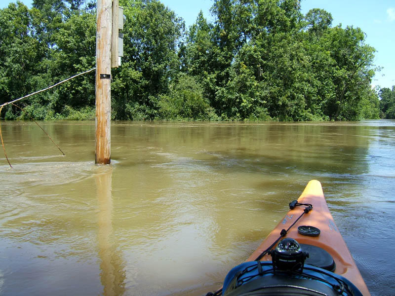
8) It seems like it is always flooding upstream lately causing higher water levels and stronger current in this area. I was paddling down an asphalt road here.

9) Another interesting lichen found blooming so to speak on an old wooden dock. Based on research (always prone to error), I think this is called Jester lichen (Cladonia leporina).

10) Houseboats on Hurricane Bayou. Haven't heard of any Frankenfish horror stories in this area. Frankenfish is a movie filmed nearby in Byrnes Lake back in 2004.

Monday, November 16, 2009

11/16/2009 - Bilbo Creek

Launch: Bates Lake
Route: Down Bates Lake to the Tombigbee, up the Tombigbee to Bilbo Creek and back.

Header Image

1) I've never been to Bates Lake. While river levels were up, I wanted to explore Bilbo Creek. This is the Bates Lake launch site and those trees behind the kayak are not usually in the water.

2) This man didn't seem concerned about his cars that were close to being flooded and the road to drive out on was under water. There are a lot of camps in the Bates Lake area. Despite the camps, Bilbo Creek is one of the most quiet areas I've ever paddled. No cars, no industry, no boats (weekday trip). About the only thing I heard was a plane.

3) Saw some sort of tree growing along the banks with big leaves, a type tree not seen in the lower delta. I think it's catawpa trees.

4) The life of this camp called, "Cotton Mouth" near the entrance to Bilbo Creek is definitely slithering away.

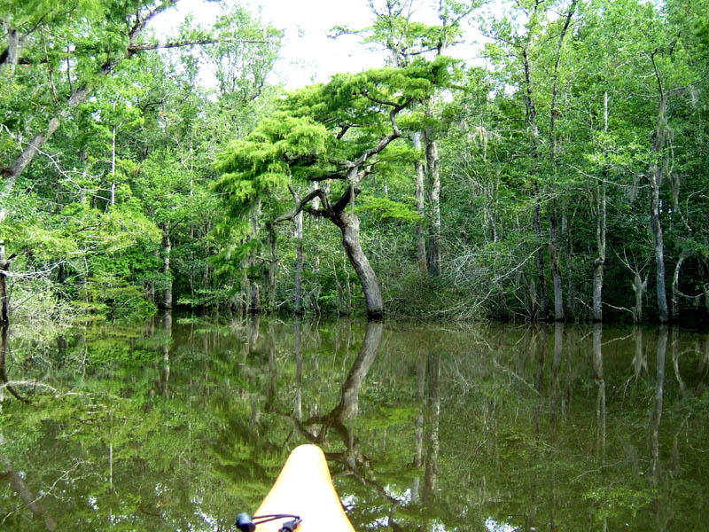
5) There were some beautiful moss draped trees along Bilbo Creek.

6) Despite the high waters, the creek was pretty easy to follow until it got close to the end. The only high ground was at the entrance at Tombigbee and near Laurel Shandy Landing. Saw some turkey and many ducks. There are a ton of "No Hunting" signs along the creek. This might be a good thing for kayakers.

7) This shot was taken near the Laurel Shanty landing which doesn't appear to be a pubic landing.

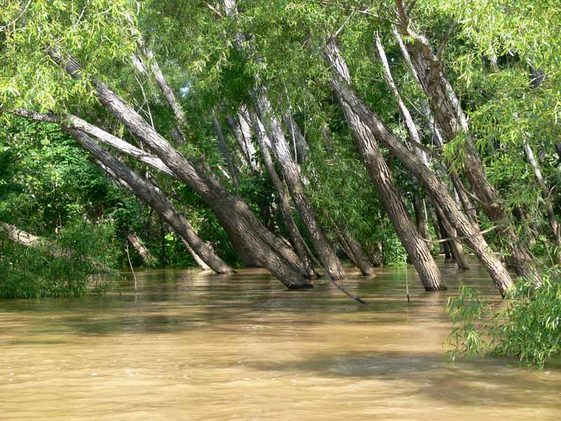
8) Near the end of Bilbo Creek were several areas of cypress trees in their prime foliage state. It was beautiful. Time ran out before I could finish exploring this creek.

9) When there are flooding conditions, the main river current is usually swift. Today it was running 3.5 mph. It took a while to go upstream at 1.5 mph. The return trip was a breeze at 7 mph.

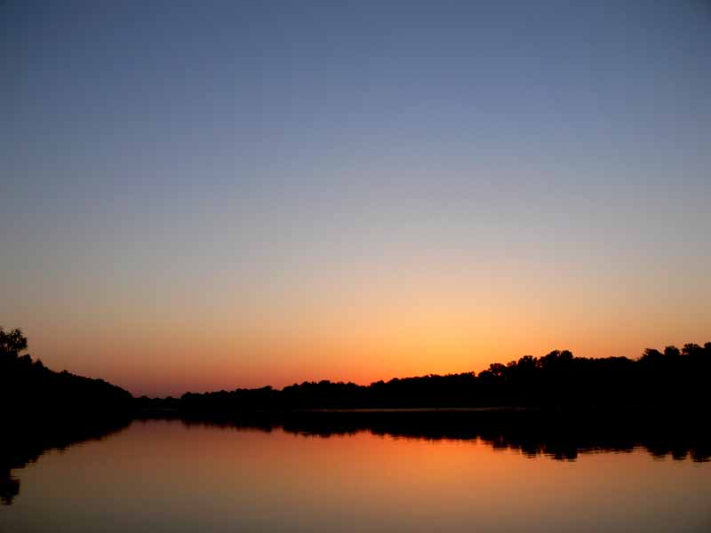
10) Sunset on Bates Lake.

If you are ever looking for someplace new to kayak, consider Bates Lake which is about 45 minutes north of Mobile. There is a lot to explore up in this area. Within 2 miles of Bates Lake, there is Bilbo Creek, Bates Creek, Poll Bayou, Doctor Lake, Jim Burr Lake, Hals Lake and more. When the water level is normal, there are sandbars on the Tombigbee to camp on. Today, there were no sandbars.

Saturday, May 13, 2006

05/13/2006 - McIntosh

Launch: Olin public boat landing in Mcintosh, AL in Washington County off US 43. Launch Cost: Free. Route: Across the Tombigbee to Three Rivers Lake and back. Distance: 15.1 miles round trip. Average Speed: 3.2 mph. Time: Approx 5 hrs. Pace: Hard going upstream, easy going down. Weather: Sunny and warm.

(1) Above left. It was a perfect morning sunrise and the waters of the Tombigbee looked innocent and inviting. (2) Above right. I made one mistake in planning this trip to explore Three Rivers Lake area – I neglected to look at the river levels - it hadn’t rained in several days. Should have known - the rains were torrential further up in the state. Once on the river, it was obvious that the river level was 5-10 feet higher than normal. All the sandbars were under water and the current was flowing at a swift 3-4 mph.

(3) Above left. I fought the current for about 3 hours to go 4 miles upstream to finally arrive at the willow tree entrance to Three Rivers Lake. It is one thing to go upstream into current and turn around to go back. It is another to be pulled into a creek with a 3-4 mph current. Without knowing what the river conditions were going to do (it could get worse), I chose not to explore the Three Rivers Lake. (4) Above right. When areas get flooded, insects and spiders have no choice but to share cramped living quarters.


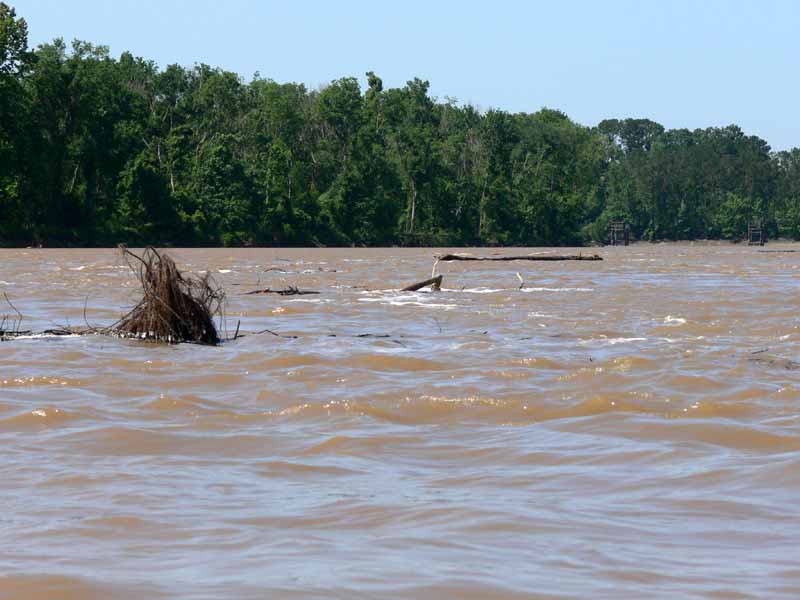
(5) Above left. On the return trip, you could see just how fast the volume of water was flowing when passing by the many river buoys. (6) Above right. When I got back near the launch site, the current was really ripping which allowed me to paddle at 8-9 mph downstream along with the stream of tree debris. Next time I’ll look at the river levels before going into the upper delta so as to avoid tough currents like this.

Sunday, July 17, 2005

07/17/2005 – Boathouse Landing to Pine Log Creek

Launch: Boathouse Landing near Fort Mimms on Boatyard Lake. Launch Cost: $4. Route: Southwest on Boatyard Lake about one and a quarter miles, then left (southeast) into Pine Log Creek. Also, up the Alabama River to Holly Creek Landing and into Holly Creek. Area in minor flood stage. Distance: 13.3 miles. Average Speed: 1.9 mph. Time: Approx 7 hrs. Pace: Leisurely to Struggling. Weather: Sunny, hot, and humid. Widely scattered thunderstorms in late afternoon. Kayak: Paddle (as opposed to a Pedal kayak).
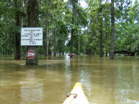
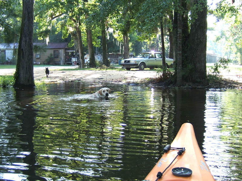
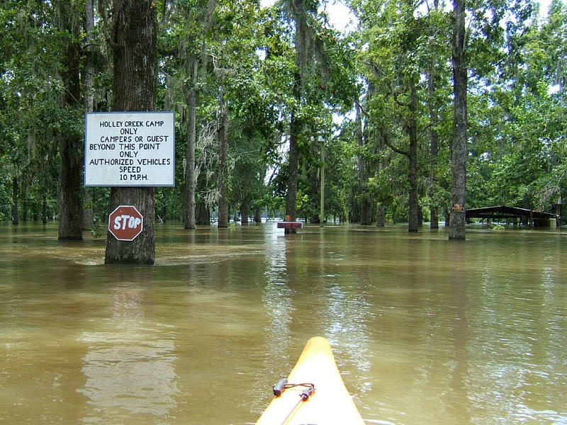
(1) Above left. An energetic dog was sad to see me leave without him. In the background is Boathouse Landing which is the next launch site north of French’s Lake. I quit going to French’s Lake because every time I’ve been there, the narrow streams have been clogged with fallen trees making kayaking impossible, and the currents are nasty. The Upper Delta is known for high waters and swift currents in some areas. I didn’t check the river levels before leaving and was surprised to see them about 4 feet or more above normal since we’ve had little rain in the past week. Pine Log Creek, as locals will tell you, can be an eerie place, and today was no exception, although it is much more beautiful when the tide is low. My car is the only one at the launch site, (that alone is eerie) and management advised me the creek was out of the banks from flooding due to Hurricane Dennis (a week later). “Are you sure you want to go out on the water?” Yup. (2) Above right. Here is a photo from later in the afternoon, from the Holly Creek Landing, which is only about a mile northwest from Boathouse Landing. This was a campsite and notice that the water level is close to the roof on the building on the right. You can also see a little bit of current around the tree with the stop sign.
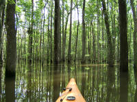
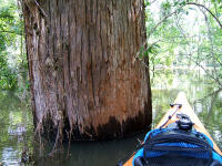
(3) Above left. Deep in Pine Log Creek, there is no creek, just water everywhere. When the water levels are in flood stage, you can kayak almost anywhere in the Delta you want to go. I’ve put two links on the weather category for river conditions. Both SERFC and AHPS indicate the same thing. If Coffeeville, Clairborne, Leroy, or the Barry Steam Plant are in flood stage, you can expect high waters just about anywhere in those vicinities. There are reasons why you might want to know if flood conditions exist in the Upper Delta. Number one: When you can’t see the banks of the creek, which way does it go? I had to backtrack several times today because I lost the path of the Pine Log Creek. It didn’t even look like the one I’d kayaked on in the past. You can easily get lost. Number two: Currents. I fought against 3 to 3.5 mph currents today that were shoving and yanking the kayak in all different directions. It is easy going down river, or across the deep woods, not so easy to go upriver. If you get in the wrong current, you won’t be able go upstream at all. (4) Above right. They grow some big trees in the Upper Delta. It is Sunday and when I pass by huge trees, it feels like I’m on sacred grounds and in the presence of a master Designer of Life.
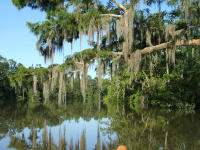
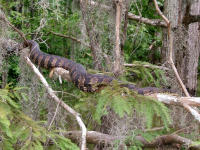
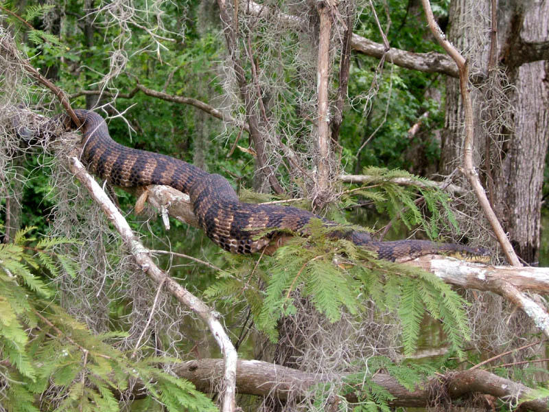
(5) Above left. The upper woodlands provide some gorgeous scenery where outstretched limbs draped with Spanish Moss serve to capture your attention and lure you to go under them. (6) Above right. You do know to look closely at limbs before you go underneath them, right? This snake’s body was as big around as my ankle and perched at a perfect height to fall right into a canoe or kayak if disturbed. In times of flood, when there is no dry ground, you can bet there will be more snakes in the tree limbs than usual – today was no exception.
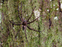
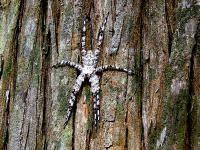
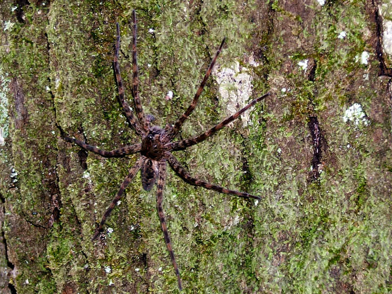
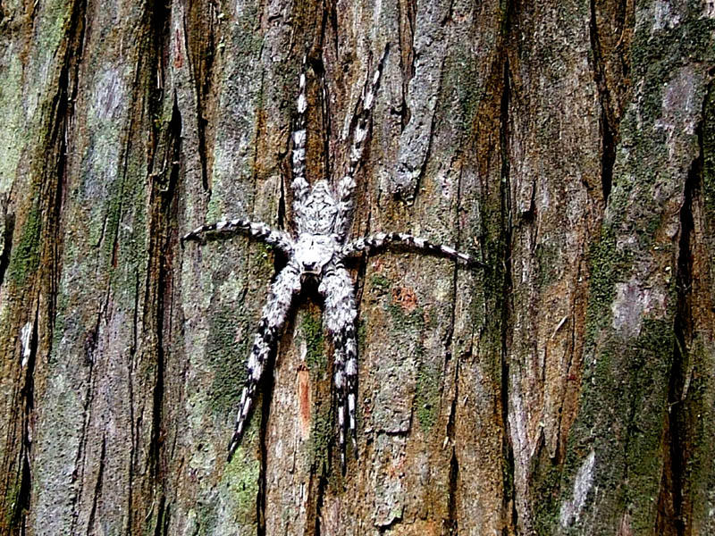
(7)(8) Above left and right. It was very enticing to kayak through the deep woods, blazing trails where no one has kayaked before. While kayaking very close to trees, sometimes something would move across the bark and disappear to the back of the tree. These Houdini critters are spiders and some of them get rather big – a leg span of over 3 inches. They can swim and stay under water for 30 minutes, catch fish, and scare the crap out of you if they bolt when you are right next to them when passing a tree. They are master of disguises and will blend in with the bark. These are Brownish Gray fishing spiders. The one with gray must be an old one.
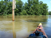
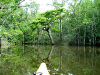
(9) Above left. Holly Creek near Holy Creek Landing – the current became almost impossible to paddle against going upstream. When kayaking in flood conditions, you will generally hear the areas you want to avoid (rushing water). (10) Above right. In contrast to Holly Creek conditions, this is my favorite tree to photograph in Pine Log Creek, where current is almost nil. On this kayak trip, I heard lots of strange noises, including deer and bobcats, something you don’t usually hear in the Lower Delta. I always get on edge when kayaking up in this area. There were sounds of something big slogging through the water in front of me at one time. Could have sworn it was the head of two or three deer in the water, but due to the distance and no binoculars, it was hard to tell.

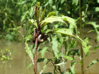
(11) Above left. This flood displaced millions of critters. While weather forecasters can warn us to head to higher ground, the rest of nature is left to fend for itself. I bet you didn’t even know there was flooding going on a week after Dennis only an hour north of Mobile. In this photo, a nest of ants had to crawl up the stalk of a weed and call it home until waters go down. Somewhere in that mass of ants is the queen. (12) Above right. More displaced critters. Just paddling through this one area was nerve racking because the current kept moving the kayak against these weeds and things I’ve never seen before would drop on the kayak or would be inches from my face and body. So, while I’m trying to knock critters off the kayak with a paddle, my face and body would find the big spider webs crossing between the weeds. Felt something crawling on my bare back and I plucked a spider off. Yes, I paid a price to get these two photos, but it was worth it. In this photo, there are about four different kinds of spiders, two centipedes, some odd bug between the two centipedes, and two cricket type bugs. All the vegetation in this area had similar insect zoos living on them. One thing for sure, the spiders were having a field day with the displaced critters and I could have spent all day here taking photos if it weren’t for all the bugs. Hehehe. Another remarkable adventure.