Saturday, September 30, 2006

09/30/2006 – Middle Bay Lighthouse

Launch: Mullet Point Park on the Eastern Shore. Launch Cost: Free. Route: Northwest to the Middle Bay Lighthouse and back. Distance: 13.3 miles round trip. Average Speed: 3.1 mph. Time: Approx 4.5 hrs. Pace: Leisurely. Weather: Sunny and beautiful. Tide going low, current minimal. Initially calm winds picked up out of the south causing 1 foot waves.

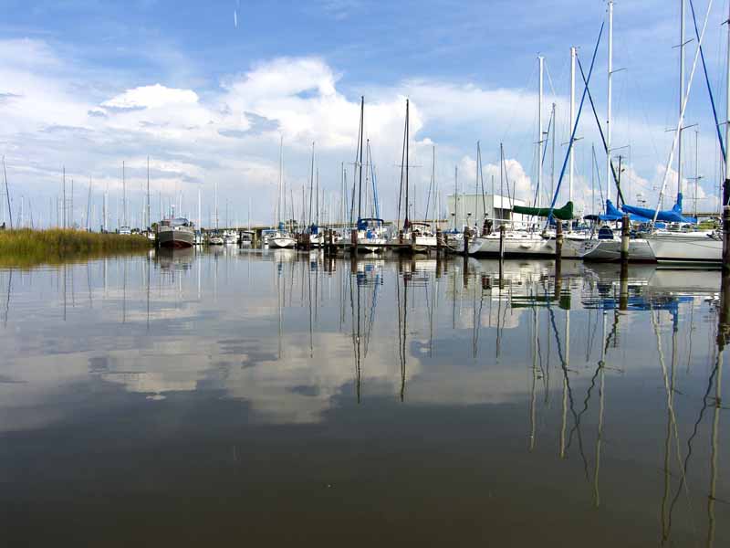
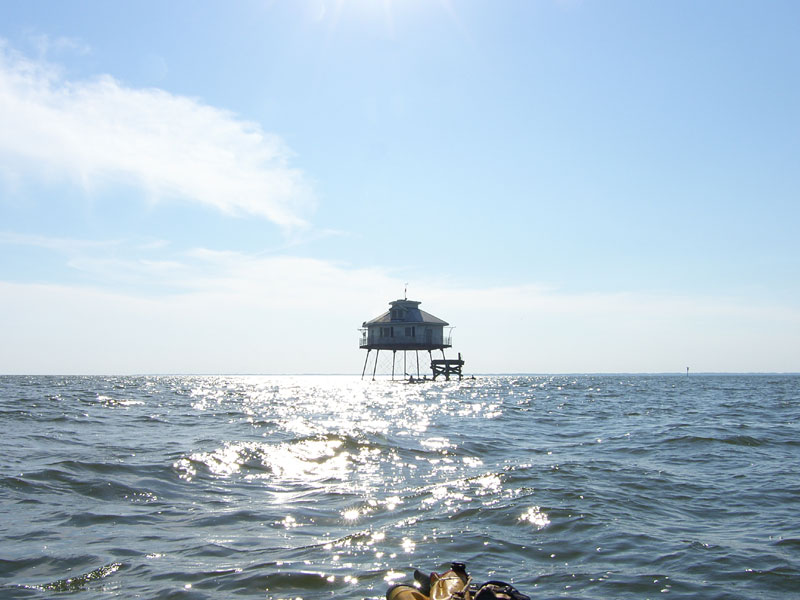
(1) Above left. The Middle Bay Lighthouse approaches very slowly when you are only moving at 3 mph. (2) Above right. The Mobile Bay ship channel lies just to the west of the Middle Bay lighthouse. The land on the horizon is about 6 miles away. See the little kayak nearing the base of the Lighthouse?

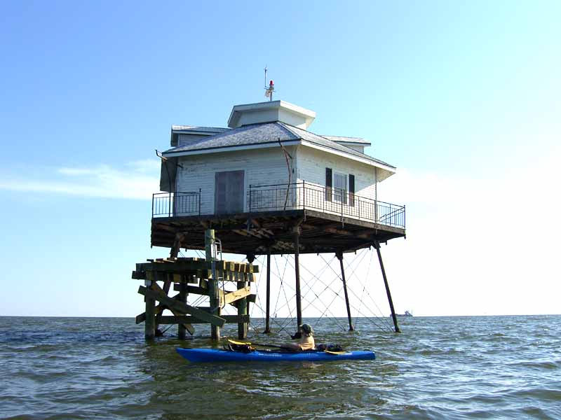
(3) Above left. David checks out the no trespassing sign on the little platform next to the lighthouse. (4) Above right. Of course, there is no kayak friendly platform at the lighthouse. After you have been sitting down for 2 hours, it sure feels good to stand up.

(5) Above left. Terry gets a close up view of the lighthouse. (6) Above right. In the background behind Terry, a tugboat pushes a barge up the ship channel.

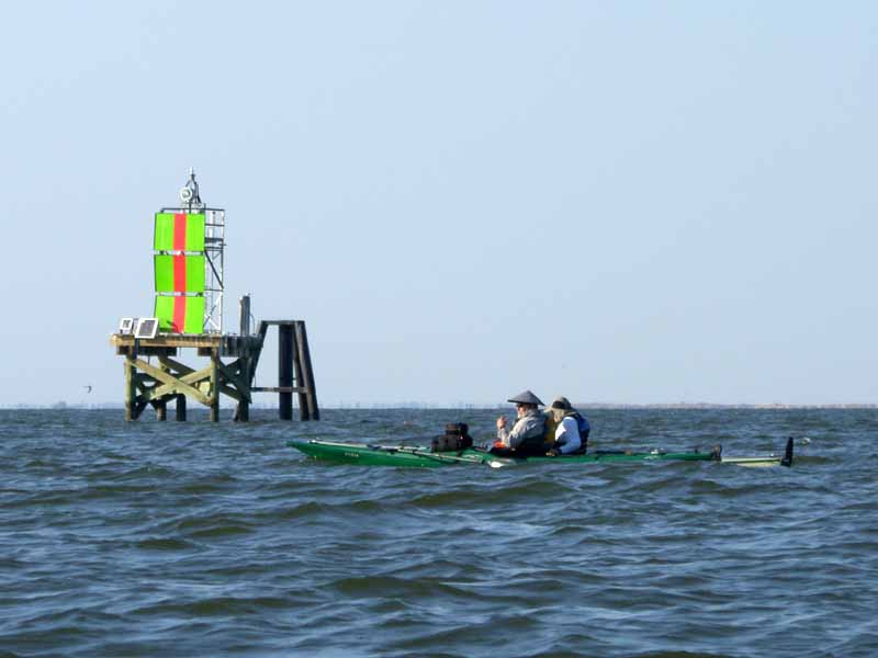
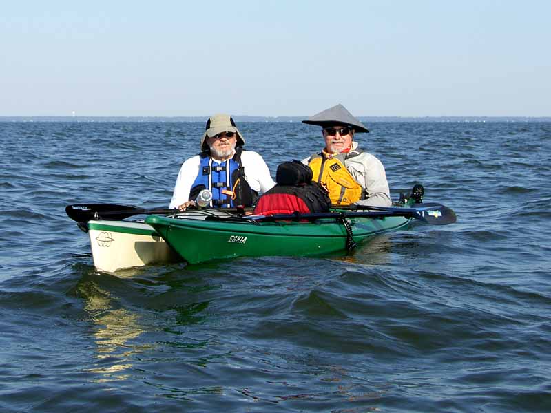
(7) Above left. Tom and Fred take a paddling break. A ship channel marker stands out in the background. (8) Above right. Fred on the left and Tom on the right can now say they’ve been to the Middle Bay Lighthouse. The land in the background is about 6 miles away.

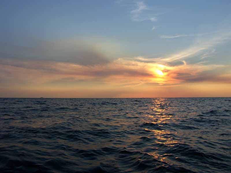
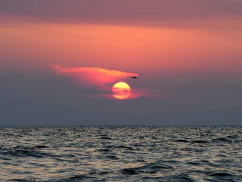
(9) Above left. On the way back, a quick glance over the shoulder yielded sunset images. (10) Above right. Just aas we arrived back at the Mullet Point Park launch site, the sun was setting.

The biggest thrill of this trip came about 30 minutes after we started back to Mullet Point. A passing ship, the cruise ship Holiday I believe, left us an unnoticed present. Without warning, our kayaks gently rose about 3-4 feet on the wake of the passing ship. Then we went down about 3-4 feet, then back up, then down. It was gentle rolling waves, but they moved fast enough it catch us all by surprise and the waves had enough height change that for a minute, some of us were thinking tsunami. This was an enjoyable trip.

Sunday, September 24, 2006

09/24/2006 – Dog River Paddle

Launch: Luscher Park, Dog River. Launch Cost: Free. Route: South on Dog River to the entrance of Mobile Bay. Distance: 15.2 miles. Average Speed: 3.5 mph. Time: Approx 4.5 hrs. Pace: Leisurely. Weather: Sunny and Hot and Cloudy and Rainy, then Sunny and Hot.

(1)(2) Above left and right. On this afternoon, I finally found the real source of the trash problem on Dog River. One week previous, Luscher Park was a zone location for the Coastal Cleanup. Lots of people worked hard to clean up this area and got the trash out of Dog River. One week later, on this day, here is what Luscher Park looked like. Seeing this new trash really irked me. I can confirm this ball park and the related concession stand generate most of the trash that ends up in Dog River. In my humble opinion, Mobile needs to shut down the ball park and close it to the public.

(3) Above left. Not long after getting the kayak in the water and heading down Dog River, thunder started rumbling in the distant. Decisions, decisions, turn around and go back, or continue on? (4) Above right. I continued on and found shelter under covered boat dock that was empty. However, after the winds started blowing almost horizontal, the overhead roof did little to keep me dry.

(5) Above left. After about 15 minutes, the storm was gone and the sun came out. Passed by this nice house on Dog River. (6) Above right. Whoever sculpted this beautiful wooden totem pole with a light house on top, a naked mermaid beneath it, and some dolphin beneath the mermaid is pretty darn good. It was about 20 feet tall and bigger around than a telephone pole.

(7) Above left. This pelican had more than a mouth full - it was losing fish out of its pouch. (8) Above right. There were lots of sailboats reflecting images down near the mouth of Dog River.


(9) Above left. In this marina were several wicked looking boats. The “Spirit of America” looked like a pretty fast sailboat. It had a black sail coming out of a slot in the mast pole. (10) Above right. Also saw an awfully wide catamaran. That is Dog River Bridge in the background. I’m glad I kept going instead of turning due to the thunderstorm – it turned out to be a beautiful day with waters becoming slick. It sure is a shame though, that downstream residents (and kayakers) of Dog River have to put up with the trash flowing down from the Lusher Park, which should be called Pig Park.

Saturday, September 23, 2006

09/23/2006 – Dauphin Island

Launch: Southeast end of the island by the rock jetties. Launch Cost: Free. Route: South to the southeast end of Sand Island, then northwest along the north side of Sand Island, staying on the protected side. Then back along the coast of Dauphin Island to the launch site. Distance: Approx 9.9 miles. Average Speed: 3.7 mph. Time: Approx 3 hrs. Pace: Moderate. Weather: Sunny. The winds were moderate out of the South but Sand Island buffers the southern winds so the waves were minimal in Pelican Bay. Venturing outside the protected waters meant negotiating some waves. I did play in the waves down near the Pier and had several nice rides.

(1) Above left. Can you find the bird that doesn’t seem to fit in? (2) Above right. A Figure 8 jelly fish, mostly harmless.

(3) Above left. A sandpiper type bird was pulling its head out of the water. Its feathers are ruffled from the wind. (4) Above right. The waves in this photo are why I advise kayakers not to go kayaking to the Light House off Sand Island. When the current is flowing and the wind blows, waves can break in several directions across the shallow waters making for some confused seas. You may ask why I go kayaking out here all the time. 98 percent of my offshore kayaking trips are with the Hobie Outback – a sit on top. No worry about crashing waves filling up the cockpit and swamping me. The Outback is 35 inches wide and only 12 feet long – it is very stable and handles offshore chop very well. I’m still testing its limits in terms of waves and wind.

(5) Above left. A Sanderling prods the sand for food to eat. (6) Above right. The water really wasn’t this green – must have something to do with the angle of the sun. You can tell the wind was blowing – there are little waves forming in the small inland pool. It is also another view of the breaking waves across the shallow sands of what used to be Sand Island before the Hurricanes shifted the sands.

(7) Above left. This view is from the north end of Sand Island showing the waves along the west side. Dauphin Island is in the background. The Northwest tip of Sand Island is also in an area of shallow, shifting sands that help cause breaking waves. (8) Above right. A couple of kite boarders were out taking advantage of the winds. Here, this fellow from Australia shows the starting position to take off. There are four lines attached to an overhead kite that go to a bar that he controls, which is also attached to his body harness.

(9) Above left. Several times I thought the kite was going to crash into the water but he controls the kite to make it swing back up. (10) Above right. He was a little disappointed that the waves weren’t big enough to catch some air. Here, he found a little wave to launch him several feet into the air. This looks like an awesomely fun sport, but I can’t help think it is the opposite of fishing. Here, the human is dangling on the end of a line being trolled along the surface of the water by the kite. Can you say, ”Shark bait?” I’ll stick to kayaking.

Sunday, September 17, 2006

09/17/2006 – Bay Minette Basin

Launch: Buzbee’s. Launch Cost: $3. Route: This was a club paddle (Mobile Bay Canoe and Kayak Club) led by Juli through Bay Minette Basin up into Yancy Bay. Distance: 4.8 miles. Average Speed: 2.7 mph. Time: Approx 2 hrs. Pace: Leisurely. Weather: Hot, partly cloudy, breezy winds out of the southwest, little in way of tide or current effects. Thunderstorms were off in the distance.

(1) Above left. Paddle participants eagerly waiting to get started. (2) Above right. As we headed west, Harriet pointed out that the land shown in the background of this photo could soon be a thing of the past. This tree line may be replaced by a multi-story condominium.

(3) Above left. Harriet to the left and Juli to the right stay close to the west shoreline keeping us out of the wind. We enjoyed pleasant kayaking conditions. (4) Above right. Over a dozen kayakers came out on this beautiful day. There were a few cardinal flowers blooming along the shoreline.

(5) Above left. A single tree grows out in the water, a survivor of several recent hurricanes. (6) Above right. We had participants come all the way from Gulf Shores to go on this trip. Check out the front passenger.

(7) Above left. The dog wasn’t paying much attention to the scenery. The heat of the day was starting to dehydrate it. The kayak captain had to turn around and to get the dog in some shade. (8) Above right. The group heads north up Yancy Bay.

(9) Above left. Eventually, Yancy Bay narrows down to the point of having to turn around and go back. (10) Above right. Clouds provided a nice backdrop on the return trip. A good time was enjoyed by all. Thanks for leading the trip Juli!

Sunday, September 10, 2006

09/10/2006 – McNally Park

Launch: McNally Park boat ramp. Launch Cost: Free. Route: Southwest to the northern end of Gaillard Island, then south along the west side of the island to the southwest corner, about the only place where you can get out of the kayak and stretch the legs. Then west to the Theodore Industrial Canal, then back up to McNally Park. Distance: 23.7 miles. Average Speed: 3.6 mph. Time: Approx 7 hrs. Pace: Moderate. Weather: Cloudy, waves choppy out of the southeast, current was minimal. The weather looked threatening at the beginning and the end, but it never rained.

(1) Above left. Herons like to eat a crab in one gulp. This crab was a little too big for one bite. (2) Above right. Pelicans are the typical residents of Gaillard Island where there are thousands of them.

(3) Above left. Note the detail on this rather interesting flower known as the Fen Rose, aka Kosteletzkya virginica. (4) Above right. The sulfur butterflies took a liking to the fen roses.

(5) Above left. These silos along the Theodore Industrial Canal are part of the Holcim plant I think and they are rather massive when kayaking next to them. (6) Above right. The largest water fall in the area can be found in the Theodore Industrial Canal. It is definitely not kayaker friendly if you are thinking about doing a little white water kayaking.

(7) Above left. This is the first year I’ve seen these huge walking sticks and there are a bunch of them around. I didn’t realize there was such a size difference between the male and female. (8) Above right. Had to take a photo of these nice green seeds that had pointed texture.

(9) Above left. Purple berries on a sumac plant. (10) Above right. The clouds started to look threatening again and there was lightning off in the distance. This caused me to pick up the pace substantially. Made it back before the storm. This was a nice trip.