Showing posts with label Sand Island. Show all posts

Wednesday, August 31, 2011

08/31/2011 - Mobile Bay Xing

Launch: East end of Dauphin Island
Launch Cost: Free
Destination: Cross Mobile Bay from Fort Gaines to Fort Morgan, then south to the Sand Island Lighthouse, then to Sand Island, and then back to the launch site. I was going to lead this trip on Labor Day weekend but due to the forecast of tropical seas (8-10 foot swells), I chose to do it today due to the ideal conditions.
Distance: 17 miles (round trip).
Trip Rating: Difficult due to distance. Dangerous due to location: Open Water, Big Fetch, Possible strong current, wind and big waves.
Time Pedaling: 5 hours
Weather: Sunny and warm - 85 degrees. Winds out of the east 5 mph increasing to 15 mph in the afternoon. Crossed at Low tide. Current 0.5 to 1.5 mph. Waves increasing to 1-2 feet.
GPS Track: To view or download the GPS track of this trip, Click Here.


Header image - Sunrise near the Double Oil Rig between Dauphin Island and Fort Morgan.

Smoke from the recent Audubon Park bird sanctuary forest fire lingers on the ground near the beach.

Sunrise off Dauphin Island. Note the change in the water surface from waves to slick in this photo. The waters off the East end of Dauphin Island are subject to higher waves due to wind and current interaction. This area can get rough.

The shipping channel has to be crossed to get to Fort Morgan and these ships move fast.

Photo taken from the Fort Morgan beach. A hazardous cargo ship sits anchored in a designated area.

Over a dozen people were removing a lot of tar balls related to the BP oil spill from the beach on the Fort Morgan peninsula. I did not see many tar balls on Sand Island.

The workers scoop up tar balls in a net. The tar balls were about the size of a quarter. I fear that the heavy pounding that the beaches here are about to get will result in even more tar balls.

The trip from Fort Morgan south to the Light House went quick thanks to the aid of current. A crack in the light house running from top to bottom can be seen in the brick. Might as well visit it before it collapses in a storm.

Many of the pipe valves on this rig were rusting. A salt water environment will eventually consume these oil rigs if they are not maintained and I understand many oil rigs are not maintained anymore.

The trip from the Light House to the southeast tip of Sand Island was uneventful and I had the luxury of a tail wind. Sand Island is a bird watcher's paradise. 

The trip from Sand Island back to the Launch Site was more fun because winds picked up to 15 mph and the wave height increased to about 2 feet. I got soaked from waves like this but it felt good.

If any of you are thinking about paddling in the Dauphin Island, Fort Morgan, and Sand Island triangle, I urge you to plan your trip well with respect to wind and tide forecasts. I timed this trip today to cross at Low tide and prayed the morning wind forecast of low winds would be accurate, which thankfully it was. Off the East end of Dauphin Island, the current/wind/water depth interaction causes bigger waves and today I crossed that while it was calm (see photo 2). Same with the Sand Island Shoal (shallow sand bar), and the Dixey Bar. The waves off the West end of Fort Morgan can get ridiculously bouncy due to wind interacting with strong current and deep water. You may find the waters calm for most of the crossing only to see standing waves for the last half mile of the 4 mile crossing. Turn around quickly if you find yourself in challenging conditions that are out of your comfort zone. You can find marine maps like this online - Click Here.

Thursday, August 11, 2011

08/11/2011 - Dauphin Island

Header image is a photomerge showing an abundance of birds on Sand Island.

Several shrimp boats were working the waters off Dauphin Island this morning.

The crossing from Dauphin Island to the tip of Sand Island turned nasty. Winds kicked up to 20 mph and the waves quickly became unpredictable. The Necky Looksha handled it well. The vegetation on Sand Island is very healthy looking and the sand is as high as I've ever seen it.

Oil Spill workers are still hunting for oil pellets on the shore line of Sand Island.

It is a bird traffic nightmare.

This reddish egret looked slovenly because a gust of wind had just ruffled its feathers. Steady wind made today's paddle frustrating but seeing so many birds up close made up for it.

A Peregrine Falcon (first time I've ever seen one) was dining on fresh gull or tern. This beautiful looking Falcon was wearing a fine pair of feathered pants with a pattern that matched its vest. According to a bird book, these endangered falcons are capable of flying at speeds up to 175 mph.

 Red-winged Black Birds were devouring some sea oats.

If you like seeing birds, try kayaking around the Sand Island/Dauphin Island area! Kayak rentals are available by the Golf Course beach. Speaking of birds, the 8th annual Alabama Coastal Birdfest is coming up on October 6-8. One of Birdfest's events is a Beginner level Canoe/Kayak paddle trip at 5-Rivers.

A remarkably color contrasted wildflower called Marsh Pink (Sabatia stellaris) was flowering on Sand Island.

This small waterway that had running current and could be kayaked, cuts almost all the way across Sand Island and leads to an inland pond.

Sunday, May 08, 2011

05/08/2011 - Dauphin Island Sunrise Paddle

Header Image

1) Sunrise on the tip of Sand Island peninsula. 

2) I did the crossing over to the tip of Sand Island in the dark and waves were big enough to warrant wearing a spray skirt.

3) Sunrise with a few clouds. Dauphin Island can be seen in the background. 

4) Despite the fact that the Alabama coast is being advertised as being back in business for tourism on the squeaky clean beaches, there are still dozens of workers contracted out from BP who roam the beaches to scoop up beached tar balls and clean up oil masses. These crews carry their own porta-potty. They will be doing this for many more years which explains why gas prices are higher. You don't think BP and the oil companies are going to pay for the clean up, do you? The consumer is paying for the oil spill cleanup while the oil companies keep racking up record profits.

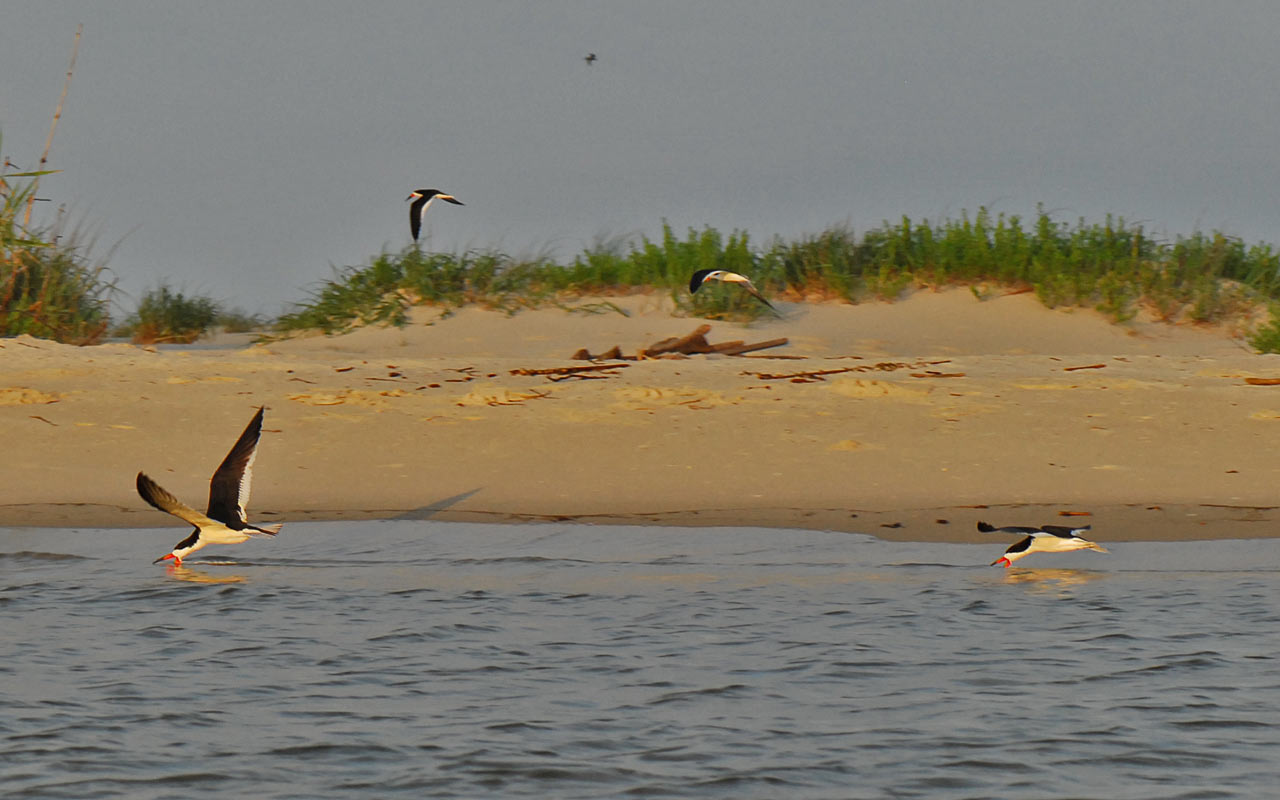
5) Cool looking shore birds like these black skimmers are still abundant along the beaches.

6) Ebullient children can sometimes torment the shore birds.

7) A black skimmer flying overhead.

8) They call them black skimmers because the bird lowers its razor sharp lower jaw into the water and flies (skims) along the water scooping up fish.

9) The hair-do on this great blue heron made it look like had a bit of the devil in it this morning.

10) I've missed kayaking around Sand Island. Sometimes you can get lucky and see unique migratory birds like these beautiful American Avocets. I need to kayak around Dauphin Island more often.

Tuesday, July 20, 2010

07/20/2010 - Loop de Island

Launch: Desoto Park (Dauphin Island, AL)
Launch Cost: Free
Destination: Loop around Dauphin Island via Katrina Pass (which will be soon filled in)
Distance: 22 miles (round trip)
Pedal time: 5-6 hours
Weather: Hot and Humid. Winds out of the east 5-10. 2 foot swells. Distant storms.
GPS Track: To view or download the GPS track of this trip, Click Here.


Header Image


1) Catching a sunrise in order to kayak all the way around Dauphin for my first time, which thanks to Katrina Pass, can be done in half a day. It will take a portage to do this trip in the future after Katrina Pass is filled in.

2) A heavy equipment operator in the process of filling in Katrina Pass.

3) A couple of surfers were riding waves. Mounds of sand have been piled up to protect the Island.

4) The oil spill did not ruin everyone's beach activity. People were fishing off Sand Island.

5) A mother took advantage of the pretty day on the beach of Dauphin Island, south of Audubon Park.

6) Oil spill workers headed out to sea with a well loaded boat.

7) Uh oh, here comes another breaking wave. I got soaked several times today.

8) Getting around the shoal at the southeast end of Sand Island caused some anxiety and is the reason why I've not done this loop before. It might not look bad here, but the steep 3 foot waves were unpredictable and there were breakers involved. I surfed through it for about 3 minutes and hit speeds over 8 mph.

9) An oil worker vehicle scared the birds at the end of Sand Island.

10) Another oil worker vehicle on Dauphin Island.

11) Oil worker vehicle highway on Sand Island.

12) Interestingly, the birds avoided standing on the vehicle paths. Also, I did not see a single pelican on Sand Island which was odd.

13) I was elated to be enjoying the beauty of Sand Island today.

14) To one girl in particular (you know who you are), seeing this reminded me of you. You warm my heart.

15) The oil booms seem to attract birds like these in Billy Goat Hole, near where the Ferry launches.

16) Several egrets.

17) One of these little rooms with a view would be great for viewing sunsets.

18) This great heron is checking to see if it picked up any oil or tar balls during the day - something they are required to do several times a day until all the oil spill is cleaned up.

19) Lovely view for condo owners and renters.