Sunday, November 26, 2006

11/26/2006 – Chickasaw Creek

Launch: Tucker’s Launch on the southwest corner of US 43 at Chickasaw Creek. Launch Cost: $3. Route: Southeast down Chickasaw Creek to the Pumphouse Canal, then east to Mobile River, then southwest to the entrance of Chickasaw Creek, then north to Hog Bayou, back out to Chickasaw Creek, then back to launch site. Distance: 14.7 miles. Average Speed: 2.8 mph. Time: Approx 5.5 hrs. Pace: Slow. Weather: Mostly sunny, temps up into the 70s. Low tide, minimal currents with the exception of the Mobile River where there was a nice downstream current. Winds were calm. This is kayaking weather!

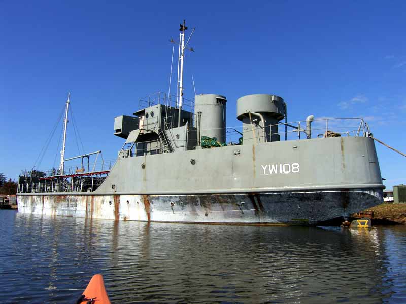
(1) Above left. This old Navy ship was in the same place where the LST-325 used to be docked and it appears to be undergoing some restoration. I could not find out any info on it. (2) Above right. Thanks to low tide, here is another photo of the green fluid coming out of the pipe in Chickasaw Creek. This is apparently treated sewage and today, thankfully, there was no smell emanating from it. I’m glad they fixed the sewage treatment problem.

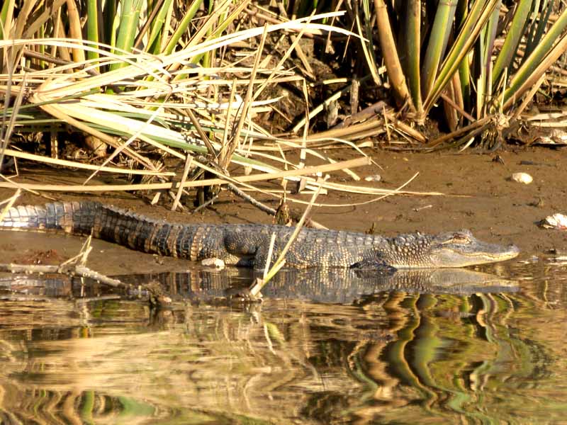
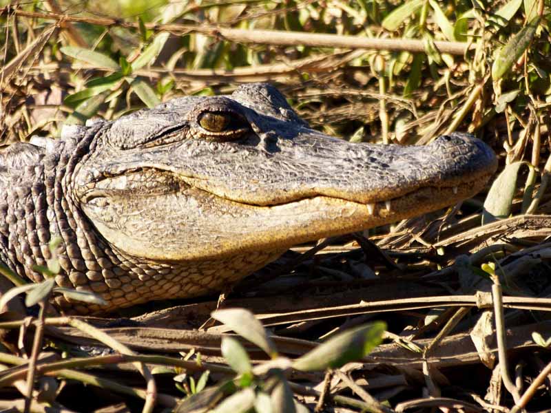
(3) Above left. The Pumphouse Canal is about 2.5 miles long and mostly straight, connecting Chickasaw Creek to Mobile River. Near the railroad trestle, I eased up on this huge alligator that had all of my respect. (4) Above right. I originally planned to kayak to Black Creek today, but due to my slow pace, I had to change plans, so I headed south on Mobile River to loop back to Chickasaw Creek. As you can see, conditions on the water today were perfect, which is why my speed was so slow – I was soaking in the scenery and reflections.

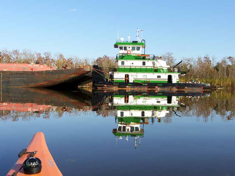
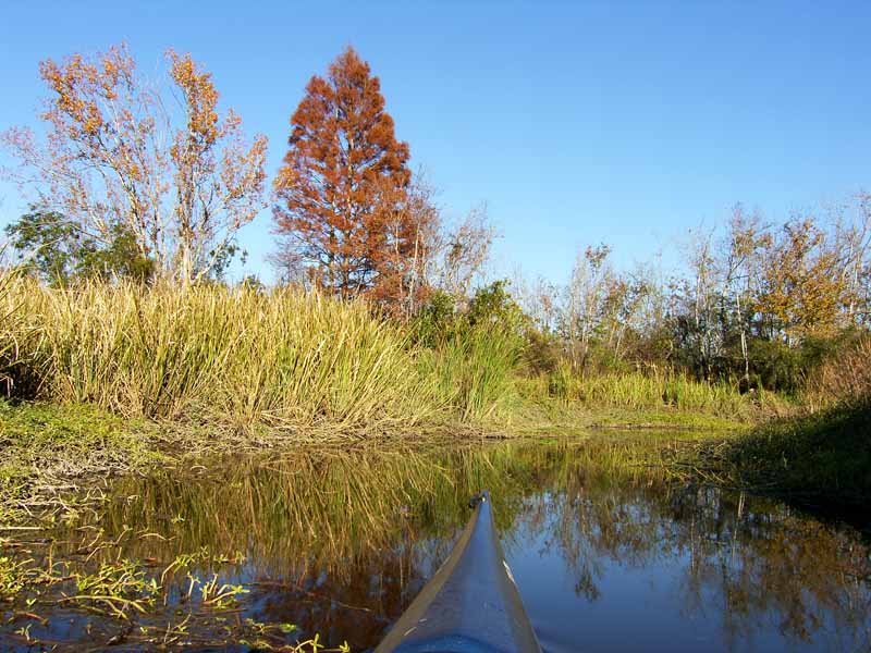
(5) Above left. Back in Chickasaw Creek, the fall colors were outstanding. (6) Above right. A tugboat waits in line for its turn at the loading and unloading dock. It was a nice reflection.

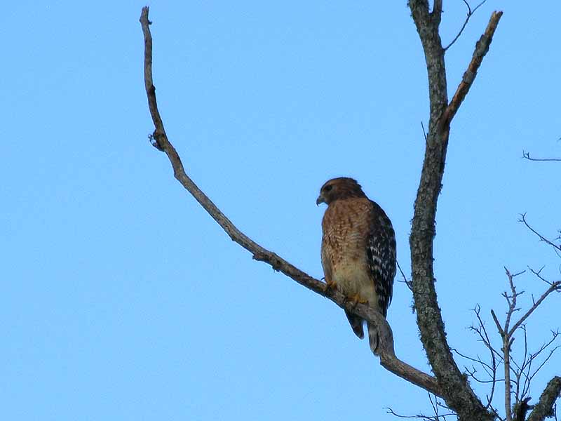
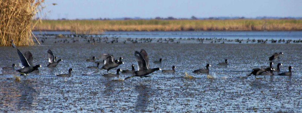
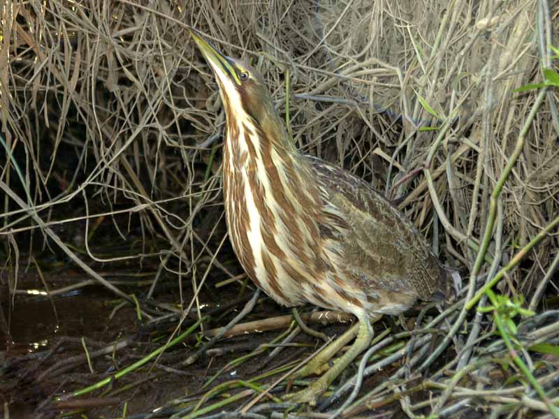
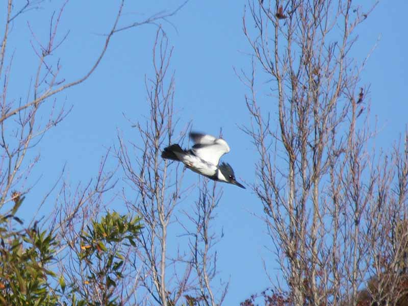
(7) Above left. I explored about half of Hog Bayou and came upon a telephone pole with some interesting contraptions on it. Even the wire leading to it was most unusual. (You can click on any image for a larger view.) I can only speculate that it might be designed to attract lightning in hopes of keeping lightning away from sensitive chemical plants and refineries. (8) Above right. This hawk was the only life I saw back in Hog Bayou which is totally opposite compared to the Pumphouse Canal which was teeming with life like squirrels, birds, armadillos, and raccoons.

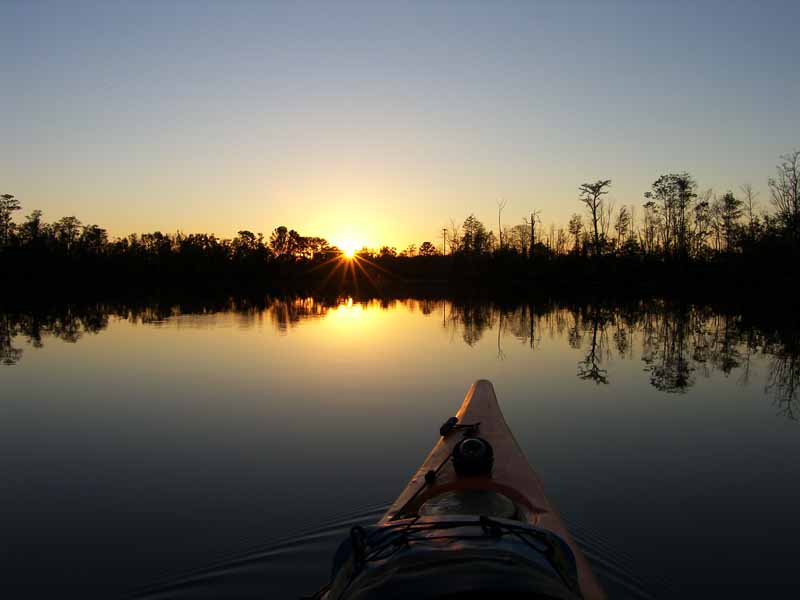
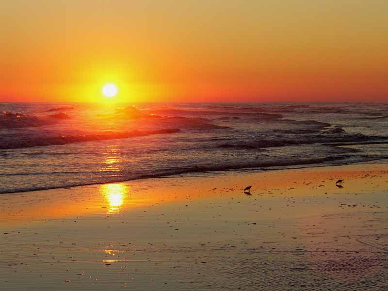
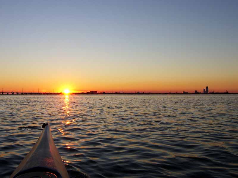
(9) Above left. Back on Chickasaw Creek, the pier that I once said took on the form of a ship, may possibly be the S.S. Latham, an old concrete ship left over from WWI. (10) Above right. This was a golden ending to an absolutely superb kayaking trip. Hope you enjoyed the brief photo journal glimpse of my 4 day kayaking holiday.

Saturday, November 25, 2006

11/25/2006 - Little Lagoon

Launch: Little Lagoon Pass which is about 2.8 miles west of County Road 59 where it dead ends at Gulf Shores. Launch Cost: Free. Route: Explore the perimeter of Little Lagoon east of the Pass, then back to the launch site. Distance: 12.7 miles. Average Speed: 2.8 mph. Time: Approx 5 hrs. Pace: Leisurely. Weather: Sunny and cool, temp from the upper 50s to lower 70s in the afternoon. Low tide and no current. Persistent winds were out of the east about 10-15 mph.

(1) Above left. I wanted to play in the big waters today and decided to put in at Little Lagoon Pass just west of Gulf Shores. Direct entry into the Gulf waters looked futile as the 3 foot waves which I had not expected, were crashing with crushing thuds. It was chilly outside at launch time and I did not want to get soaked. Little Lagoon Pass was also out of the question as it was too shallow for a pedal kayak. So I decided on alternate plan B which was to explore in the sheltered waters of Lagoon Pass and get in a little sailing. (2) Above right. Even in Lagoon Pass, the winds were relentless and they kicked up a little chop. Days like this when there are no motorboats out on the water make for pleasant kayaking and sailing. You won’t find many sailboats in this lagoon because the waters are too shallow.

(3) Above left. Kayak fishing is becoming popular. (4) Above right. Howdy neighbor! Can you imagine what a small beach house owner feels like when their next door neighbor puts up a monstrosity like this?

(5) Above left. On the southeast side of Little Lagoon, there are some canals to explore and they provide a welcome relief to the wind on the open waters. (6) Above right. This home on one of the canals had some nice frosted image type windows.

(7) Above left. Saw my first mermaid today. This mermaid looked like she was watering the flowers. (8) Above right. This was a large sandpiper like bird, only its beak was curved.

(9) Above left. Is there more to life than kayaking? Some people think so. (10) Above right. All good kayaking days must come to an end.

Friday, November 24, 2006

11/24/2006 – Lower Crab / Conway

Launch: Public boat ramps (triple set) just west of the I-10 crossing on the north side of the Causeway (Highway 90). Launch Cost: Free. Route: Northwest across the Tensaw River to Delvan Bay, then up Lower Crab Creek, back across the Tensaw to Conway Creek, then south down Conway back to the launch point. Distance: 14.8 miles. Average Speed: 3.0 mph. Time: Approx 5 hrs. Pace: Leisurely. Weather: Sunny with temps in the 60s to lower 70s. Low tide and minimal current, winds mostly calm.

(1) Above left. Photomerge taken from Delvan Bay looking north toward the entrance to Lower Crab Creek. As shoppers all across the nation were fighting Black Friday crowds and traffic, I was enjoying a most relaxing kayak trip across slick waters with no boats in sight. (2) Above right. Coot were gathered in shallow waters feeding on vegetation. Today was not a good day for water fowl as the duck hunters were out in force. Coot have to run on the water for 50-100 feet before they get enough speed to get airborn.

(3) Above left. The waters in the Delta have their own form of fall foliage. The cypress are all golden brown. (4) Above right. Alligators like to warm up in the sun after a cold night and some would prefer to soak up the rays rather than move when a kayaker goes by. If you want to see alligators, it is on days like this when you’ll get your closest views.

(5) Above left. As if I wasn’t enjoying such a devine day, nature put a white pelican in my path and we paddled together for about 10 minutes until it decided I was getting too close. (6) Above right. Because the tide was quite low, I was about to turn my kayak into a shallow slough so I could stand up and take a break when I came face to face with an American Bittern – a bird I’ve rarely seen around here. It didn’t move a muscle.

(7) Above left. Another small alligator soaking up the warmth of the sun. (8) Above right. This small alligator was at about eye level on a bank of a small tributary, less than a paddle length away and it never budged. I saw about two dozen alligators today.

(9) Above left. A Kingfisher taking off down the river to wait for me to get closer again so it can take off again. It is an odd bird. (10) Above right. A good kayak day must come to an end and I thoroughly enjoy ending a wonderful kayak trip with a good sunset.

Thursday, November 23, 2006

11/23/2006 – Dauphin Island

Launch: Southeast end of Dauphin Island by the rock jetties. Launch Cost: Free. Route: South about 2.5 miles across Pelican Bay to Sand Island, then northwest along the north side of Sand Island, then east along the south side of Dauphin Island back to the launch site. Distance: 9 miles. Average Speed: 3.3 mph. Time: Approx 3 hrs. Pace: Leisurely. Weather: Sunny and cool, temps in the upper 50s to lower 60s. Low tide, minimal current and winds out of the north about 10-15 mph.

(1) Above left. With winds from the north, conditions were nice on the south side of Dauphin Island. Some paddlers in a canoe were checking out the birds on the rock jetties. (2) Above right. A pelican all comfy and happy that it wasn't born a turkey.

(2) Above left. Down on Sand Island, the water was about as low as I’ve ever seen it. (3) Above right. The sand continues to shift away from the Pier. The sand in this photo to the left of the pier is usually under water.

(3) Above left. The only boat in Pelican Bay. (4) Above right. The tide was low enough to allow mountain bikers to ride down the beach - a wonderful way to enjoy the beach. Hey Ruth...

(7) Above left. This heron looked like it had a rough night. (8) Above right. This pelican looked like it had a great morning. Yeehaa!

(9) Above left. As I was leaving Dauphin Island, I noticed a new pier behind the restrooms adjacent to the Ferry. On the pier was the solution to what this bunch of hollow concrete pyramids are. I thought they would one day end up making an off-shore reef. Instead, these concrete pyramids are called WADs, short for Water Attenuation Devices, and they are permanent. They were put there to protect the salt water marsh on the left during storms. (10) Above right. A seagull mesmerized by its own reflection in the water. Kayaking at Dauphin Island can be mesmerizing, too!