Sunday, August 27, 2006

08/27/2006 – Dauphin Island

Launch: Southeast end of the island by the rock jetties. Launch Cost: Free. Route: South to the southeast end of Sand Island, then northwest along the north side of the Sand Island to the Pier, then east back to the launch site. Distance: Approx 9 miles. Average Speed: 3.2 mph. Time: Approx 3 hrs. Pace: Slow. Weather: Partly cloudy. Temps were nice until the sun came out. Had planned on pedaling over to Fort Morgan across the Channel, but developing storms caused me to make a change of plans. One has to be flexible kayaking in this area.

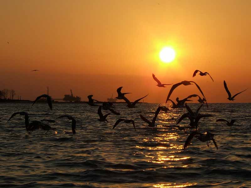
(1) Above left. About half way between Dauphin Island and Sand Island, I got to experience another beautiful sunrise. Life is good! (2) Above right. Here is another photo of the sunrise.

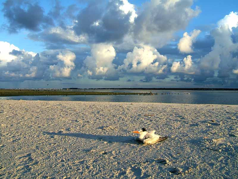
(3) Above left. The FAA would be in panic mode if these were planes. The several moving clouds I saw on the horizon were masses of birds. (4) Above right. This poor tern, though aware of my presence, looked like it was about to expire. We all get old.

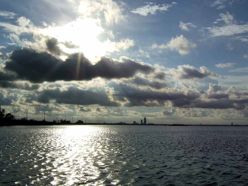
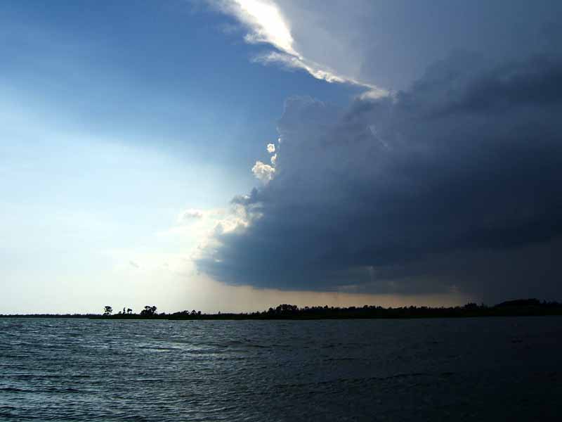
(5) Above left. This was the reason why I chose not to go across to Fort Morgan – you can never tell whether pop up storms will have lightning in them or not. (6) Above right. Back on the Dauphin Island side, the gentleman standing in the water was crabbing while catching a few rays of sun.

(7)(8) Above left and right. Here are a couple of more photos of the clouds to the east. Sure glad I didn’t try to go to Fort Morgan. The clouds were more impressive when you got to see the entire panorama.

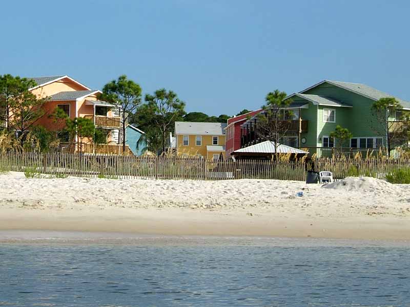
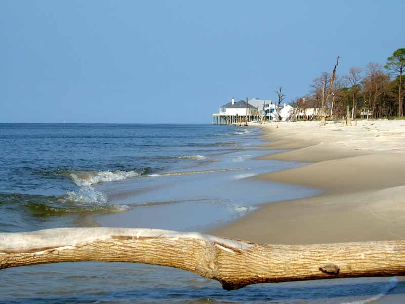
(9) Above left. Looking toward the north, there was not a cloud in sight. More and more of the beach houses and condos are being painted tropical colors like these. You would never see house colors like this in a normal neighborhood. (10) Above right. A fisherman standing in the water on the right side of the photo is trying to catch food away from this hungry dolphin. Dolphins have been rare to see this year, probably because there seem to be no shrimp boats running the area. I thoroughly enjoy every kayak trip in the Dauphin Island area.

I noticed something different this trip – silence. Why hadn’t I heard it before? In the past, horns from nearby Oil Rigs would be blaring beeps so loud that it would be irritating even though the rigs are miles away. If the horns are also off at night, camping on Sand Island might be a pleasurable experience again.

08/27/2006 – Jemisons

On the way back from the kayak trip at Dauphin Island, I stopped to check out Jemison’s, a launch area between Alabama Point and Cedar Point. This is what I saw.

(1) Above left. This young girl is standing there on the rocks and unbelievably a group of mullet or some other type of fish comes swimming right to her. “Here fishy fishy.” (2) Above right. With nothing but a treble hook and no bait, she casts beyond the fish and then quickly reels in the hook hoping to snag a fish, which she did on the first try. “Good fishy.”

Saturday, August 26, 2006

08/26/2006 – Causeway to Pass Picada

Launch: Public boat ramps (triple set) just west of the I-10 crossing on the north side of the Causeway (Highway 90). Launch Cost: Free. Route: East to Pass Picada, south toward the Interstate, and then back. Distance: 6.6 miles. Average Speed: 3.4 mph. Time: Approx 2 hrs. Pace: Leisurely. Weather: Partly cloudy and still hot.

(1) Above left. Decided to go on a sunset pedal kayak trip to avoid the heat of the day. It has been hot lately. There was a small thunderstorm toward the north as two pelicans were heading south. (2) Above right. Near the entrance of Pass Picada, this shot is looking back toward Mobile.

(3) Above left. Some Ibis were headed back to their roost. (4) Above right. A shot of nearby clouds. Photos seem to never capture the full picture.

(5) Above left. There was a lone fisherman at the east entrance to Pass Picada as I rounded the corner to watch the sunset. (6) Above right. Wrong. The sun had already set behind clouds. This was taken near the New Oysterhouse Restaurant.

(7) Above left. A little later, the sun did try to peak out between the clouds. (8) Above right. Last sunset shot before it got too dark to take pictures. I had hoped for slicker waters on this trip, but the evening colors were still quite beautiful.

Sunday, August 20, 2006

08/20/2006 – Dauphin Island

Launch: Southeast end of the island by the rock jetties. Launch Cost: Free. Route: West to the northern end of Sand Island, then southeast along the north side of the Sand Island to the end, then north across Pelican Bay back to the launch site. Distance: 10.6 miles. Average Speed: 3.5 mph. Time: Approx 3 hrs. Pace: Leisurely. Weather: Sunny, 10 mph winds from the northwest, waters smooth and current minimal.

(1) Above left. Nice conditions today for kayaking. Went about a quarter mile west and got out of the kayak to take some photos. (2) Above right. Sea Oats. As always, double click on photos to view a larger image.

(3) Above left. The creeping stems of the common sand dune morning glory, aka Ipomoea stolonifera. (4) Above right. Close up of the morning glory flower.

(5) Above left. This mass of Sandbur grass is something you do not want to be barefooted around – the spiny flower clusters are extremely painful to step on. (6) Above right. This is my first time seeing this unique flower that blooms in clusters of squares – identity unknown.

(7) Above left. There is now enough room to paddle around the pier. Today the winds were out of the north making for smooth water conditions. (8) Above right. I did not realize the immensity of the new condo under construction until seeing the small condos next to it.

(9) Above left. Black Skimmers like to hang out near the north end of Sand Island. (10) Above right. Down near the southeast end of Sand Island, the numbers of birds are unbelievable. Had to end this trip early before the heat of the day set in. I can’t wait for cooler temperatures.

Sunday, August 13, 2006

08/13/2006 – Bay Minette Creek

Launch: Buzbee’s. Launch Cost: $3. Route: I chose to pedal around the Bay Minette Creek area because nearby thunderstorms were kicking up strong winds. Distance: 7.2 miles. Average Speed: 3.5 mph. Time: Approx 2 hrs. Pace: Moderate. Weather: Hot in the 90s, partly cloudy, breezy winds out of the south, little in way of tide or current.

(1) Above left. A nearby thunderstorm kicks up the winds. (2) Above right. After reaching the open waters of Bay Minette Basin, I could tell the small chop would slap waves on the front of the kayak and the resultant spray would get me soaked. Didn’t feel like getting wet, so I turned around to go up the wind protected Bay Minette Creek. The thunderstorm was behind me.

(3) Above left. Cardinal flowers were blooming in Bay Minette Basin. (4) Above right. A pea type plant with yellow flowers grew in sponge thick masses.

(5) Above left. Up in Bay Minette Creek, there were plenty of odd looking flowers, like these inconspicuous flowers in the water. (6) Above right. Some flowers also stood out above all others, like this yellow milkwort (Polygala cymosa).

(7) Above left. Upstream in Bay Mintette Creek, the waters became slick after the storm dissipated. (8) Above right. I did a quick U-turn after passing by a branch sticking out of the water. The ripples in the water are from my wake.

(9) Above left. What caught my attention was something attached to the underside of the branch. I’ve seen a lot of mud dauber (mud wasp) nests, but never one like this. (10) Above right. There were also some shrubs displaying their yellow blooms. This was a nice trip.

Saturday, August 12, 2006

08/12/2006 – Dauphin Island

Launch: Southeast end of the island by the rock jetties. Launch Cost: Free. Route: West to the northern end of Sand Island, then southeast along the north side of the Sand Island to the end, then north back to the launch site. Distance: 9.0 miles. Average Speed: 3.1 mph. Time: Approx 3 hrs. Pace: Leisurely. Weather: Sunny, 10 mph winds from the west, waves about a foot and current minimal. Neap tides today.

(1) Above left. Today I choose to minimize exposure to intense heat by enjoying a wonderful sunrise kayak trip off the southeast end of Dauphin Island (my favorite place to kayak). (2) Above right. Shore birds are out for a morning flight and breakfast.

(3) Above left. There were no shrimp boats in sight today, only this one bait trawler. (4) Above right. Here, the same trawler is setting up occupants of a fishing boat with live bait.

(5) Above left. Since my last trip to this spot, the sands have moved away from the end of the Pier. (6) Above right. Kayakers should stay away from this area. The shallow water can make for treacherous conditions depending on wind and current. I can only imagine what the waves would look like here with 20 mph west winds mixed with strong flowing current. No wonder why the sands keep moving.

(7) Above left. The Alabama Department of Conservation and Natural Resources (ADCNR) has put up signs to protect bird nesting areas on Sand Island. (8) Above right. I’m very fortunate to live near one of the best birding sites in the southeast. The birds in this photo all seem to be keeping equal space from each other – the mating season honeymoons must be over.

(9) Above left. Cannonball jellyfish were out in numbers. Learn about the jellyfish in this area by clicking here. I followed this one for a while. It kept coming to the surface like it was getting air. (10) Above right. Saw this bird that looks like an immature green heron at the launch site. This was a wonderful trip.