Friday, September 30, 2011

09/30/2011 - Lower Dog River

Launch: Home
Destination: Lower Dog River
Distance: 11 miles (round trip).
Time Pedaling: 3 hours
Weather: Sunny, temperature a less humid 70 degrees, winds out of the northwest at 0-10 mph. Tide receding. Current about 0.5 mph. Waves less than 1 foot. Water temp 83 degrees.

Header image is a cropped photo of a juvenile yellow-crowned night heron. If you look closely at its eye, you can make out reflections of a yellow kayak on the right (me taking the photo) and the Dog River Bridge on the left of the pupil.

Two shades of the morning sunrise. One appreciates the marvel of a sunrise if one has waited in the darkness to see it. 

One appreciates the marvel of a sunrise even more if one is holding another person's hand at the time.

A third shade of the morning sunrise. Flocks of ducks were flying with unusual vigor this morning - maybe hunting season has begun or they sense the first cool weather of the season approaching.

It looks like a tri-colored heron.

A great egret ruffles its neck feathers while sitting on top of a popcorn tree.

This great egret was doing a 180 turn on a sweet gum tree branch. Sweet gum trees are in the Witch-Hazel family and have those hard ass spiny ball fruits that hurt when you step on them barefooted.

A juvenile yellow-crowned night heron kindly let me get close to it for a photo. Can you imagine how difficult it is to clean your face without arms?

A mallard duck.

Thursday, September 29, 2011

09/29/2011 - Upper Dog River

Launch: Home
Destination: Upper Dog River
Distance: 8 miles (round trip).
Time Pedaling: 2 hours
Weather: Sunny, temperature 71 degrees, winds out of the north at 5 mph. Tide dropping. Current less than 0.5 mph. No waves. Water temp 83 degrees.

Header Image is a photo of the head of a great blue heron.

View of the sunrise this morning.

Another view of the sunrise.

Morning Glory flowers (Ipomoea) over at Dog River Park.

This is boat called "The Rats Ass" that someone anchored off Dog River Park and abandoned just before Tropical Storm Lee. When the winds come from the south the rear side of the boat bangs against the concrete wall. I reported it to the Coast Guard and they are trying to track down the owner. The last time it was registered was three years ago. This reminds me of the sunken Chris Craft boat that I reported leaking fuel in Alligator Bayou a few years ago. The Coast Guard said it wasn't the first time his boat had sunk. What better way to get rid of it than towing it, anchoring it and claiming it isn't yours anymore. No one can touch it, not even after it sinks. Some people really do not give a Rat's Ass. That is why there are a dozen or two sunken boats slowly shedding their toxic chemicals into the Dog River watershed that flows into Mobile Bay. Truly, our waters are becoming garbage dumps and that is unacceptable.

Meantime, at Dog River Park, trash from the Coastal Cleanup is being picked through by either dogs or aluminum can bandits. I suspect the latter. Notice the loose trash ready to float away into the water... Wouldn't it be nice if there was an incentive like a 5 cent refund for each plastic bottles the bandits pick up and recycle? We need a Deposit-Refund bottle bill passed for plastic bottles and styrofoam cups.

This area was cleaned during the Coastal Cleanup. All it took was one rain yesterday and this is what I have to look at for another 50 weeks until the next Coastal Cleanup. I'm embarrassed to lead paddles in upper Dog River Scenic Blueway.

Sunrise through the moss draped trees.

A great egret utilizes man made bridge bracing for its fishing platform.

A great blue heron backlit from the sun.

Someone had a morning swim before directing its attention to hunting breakfast.

Wednesday, September 28, 2011

09/28/2011 - Lower Dog River

Launch: Home
Destination: Lower Dog River
Distance: 10-1/2 miles (round trip).
Time Pedaling: 2-1/2 hours
Weather: Party Cloudy, temperature a humid 80 degrees, winds out of the west at 0-15 mph. Nearing low tide. Current to 1.2 mph. Waves less than 1 foot. Water temp 85 degrees.

Header Image. On the return trip, a storm building toward Baldwin County seem to draw wind because the winds picked up to a steady 10-15 mph on the way back causing a little chop in the wider areas of Dog River.

The weather radar showed rain south of the area and the rumble of thunder could be heard in the distance - an ominous start to the trip, but I enjoy watching distant lightning from a kayak.

Luckily, the thunderstorm dissipated within thirty minutes of launching and the fading clouds provided good colors at sunrise.

Not much wind so the waters were calm.

The sun tries to emerge as I pass by Mobile Yacht Club.

Down at the mouth of Dog River, Gulls and Terns were in a feeding frenzy for shrimp.

This Tern was a winner as it flies away with a shrimp. It threw its head up a few times and gulped the shrimp down whole.

Three black-crowned night herons stand around watching the sunrise.

A man fishes off the dock at the Rivershack Restaurant while a nearby pelican waits around patiently for the man to throw it a fish.

Raccoons were looking for food in someone's yard near the shore. What a cute couple.

Tuesday, September 27, 2011

09/27/2011 - Mobile River

Launch: Shirley's (US Hwy 90 across from battleship USS Alabama)
Launch Cost: Free
Destination: Mobile River to look see the latest status of the Oil Spill cleanup activities.
Distance: 18 miles (round trip)
Paddle time: 5-1/2 hours
Weather: Temp from 77 to 84 degrees, Winds 0-15 mph from the north. Mostly sunny. Rising tide. Current in Mobile River 1-2 mph. Water temperature about 78 degrees.

Header Image - a heron is already fishing at dawn's first light.

Launching about an hour before sunrise to avoid the afternoon heat.

Watching the sunrise across Delvan Bay.

The kayak would glide up on fish and they would startle me by abruptly bolting out of the way.

Still in Spanish River, a fish jumps out of the water as I'm about to pick up an abandoned fishing bobber. The Pontoon Saloon can be seen in the background.

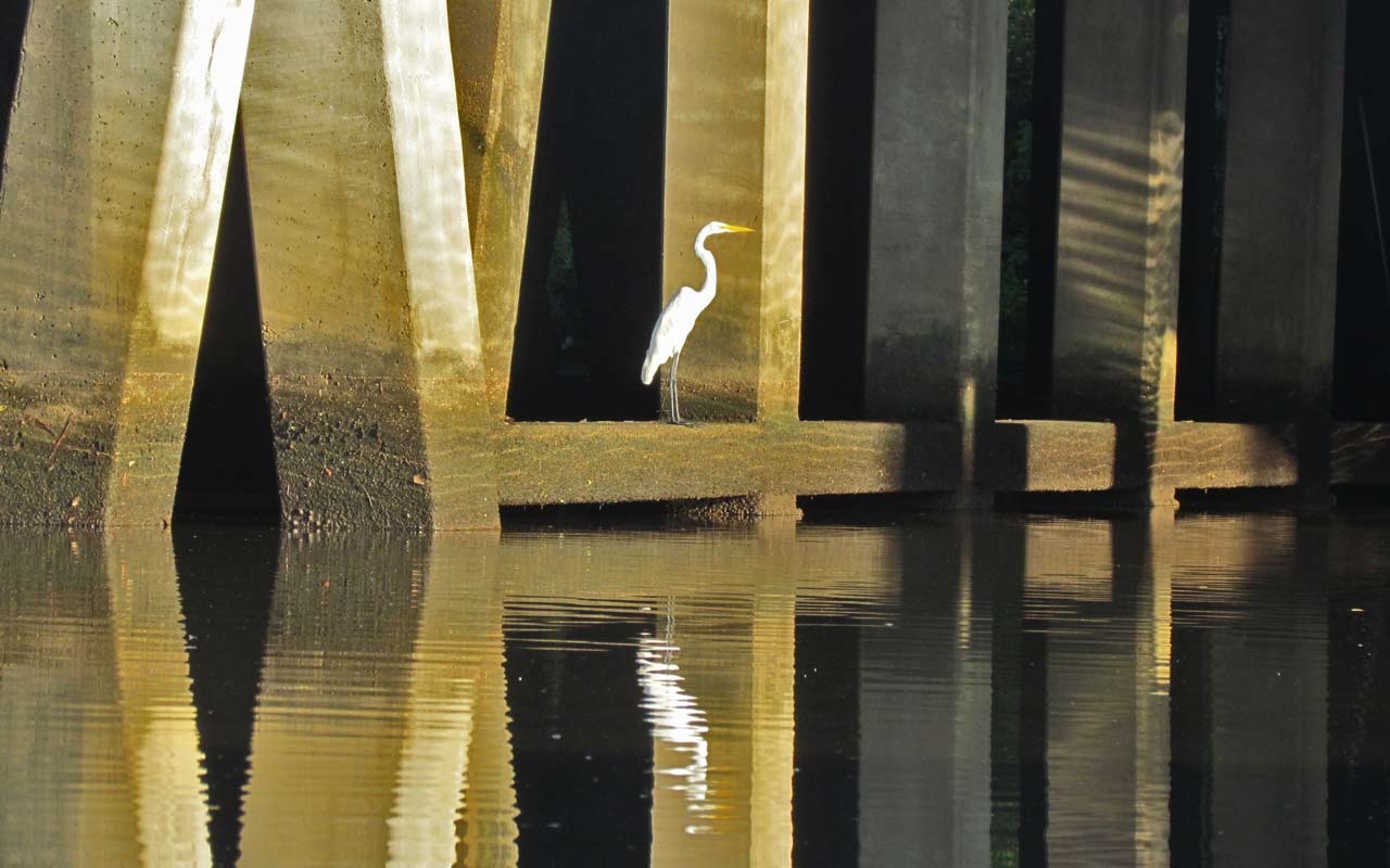
Herons facing off along the shoreline.

A great blue heron awkwardly flies over the water while croaking loudly like a bullfrog with throat cancer.

The forecast called for winds from the southwest. About the time I went under the Cochrane Bridge, a wave of clouds approached and the winds picked up from the Northwest to about 15 mph. It provided a nice tailwind but left the waters choppy. Had to put on a sprayskirt. Current was also running about 1.5-2 mph in Mobile River, well above the forecast.

One of those sandpiper like dowidget sand munching birds.

The cruise ship Norwegian Spirit, out of the Port of New Orleans, carries over 2000 passengers, was getting some work done here in Mobile. Could this be our new cruise ship?

Rear view of the Navy's first Joint High-Speed Vessel (JHSV) christened on Sep 17, 2011 at Austal. The JHSV Spearhead is designed for rapid transport of troops and military equipment. The 338-foot-long aluminum catamaran is fast. I could have paddled under the vessel but I didn't want to go to jail.

A blue-eyed white ibis on the left and a believe this is a juvenile little blue heron on the right.

A juvenile white ibis.

I went down Mobile River to see the status of the Oil Cleanup at Gulf Coast Asphalt. No cleanup activity could be seen and the strong winds out of the northwest made it difficult to take photos near the spill area. No change on the oil caked shorelines - guess they are going to let nature degrade the oiled shoreline. The good news is no petroleum sheens were seen along the east side of the river like I saw last visit. However, at the entrance to Chickasaw Creek (well north of the oil spill), there was some sort of chemical/petroleum sheen on the water. I'm assuming it came from the greased up swing bridge. Unable to trace the source.

On the other end of Mobile River near the entrance to Mobile Bay, another petroleum sheen was seen. There were about a half dozen people working on nearby machinery that overhangs the water at the state dock facility. Unable to trace the source. I'm assuming it came from the machinery. There wasn't enough quantity of spill to justify a call to the National Response Center (NRC). I hope seeing oil in Mobile River doesn't become a regular thing like it is for me in Bayou La Batre.

Monday, September 26, 2011

09/26/2011 - Gaillard Island

Launch: Home
Destination: Gaillard Island.
Distance: 26 miles (round trip).
Time Pedaling: 6-1/4 hours
Trip Rating: Difficult due to distance and open waters.
Weather: Sunny, temperature about 82-85 degrees, winds out of the southwest at 10-15 mph. Neap tides. Current to 1 mph. Waves less than 1 foot on the trip over to Gaillard Island and 1-2 feet on the way back. Water temp 84 degrees.

Header Image. Birds patiently await for the lull in shrimp boat activity to end. A few birds will squeal the alarm call when food is present and then they all fly over to the shrimp boat.

Didn't expect to see much of a sunrise this morning.

This was a pleasant surprise that caused me to stop and watch.

Ahhhh, deep breaths and total relaxation. What a show!

Decided to do a training trip today - a loop around Gaillard Island because it is a rather long trip and I love kayaking around Gaillard Island. The Phatwater Kayak Race is a rather long race - 42 miles, hence the long training trip. Weather pending, I'll be doing Phatwater in two weeks.

I slowed way down while pedaling around Gaillard Island - home of beaucoup pelicans.

Beaucoup of pelicans meaning a lot of them!

Pelicans are enjoyable to watch and if you go to Gaillard Island, you'll see plenty of flying pelicans.

A shrimp boat called Lady of Fatima was working the shipping channel area so I pedaled on over to take some photos. I'm not sure what they do on the shrimp boats, but at certain intervals the gulls, pelicans, and terns go wild. Wow, it is an experience to be near such a feathered frenzy.

Soon as I rounded the southeast tip of Gaillard Island, the wave size increased from 4 inches to 2 feet. You shouldn't paddle to Gaillard Island without expecting to deal with at least 2 foot waves some of which will slap the side of the kayak. You should be comfortable paddling in even higher seas if venturing out into Mobile Bay.

The nice looking sailboat Liza of Fairhope had just came out of Dog River and was heading into Mobile Bay.