50-80 percent chance of rain, but it looked like the storm was splitting up, so I decided to go on a short 3 hour tour. It was cloudy, temp about 60 degrees, winds light, and tide was low. Pedaled at an easy pace, not breathing hard at all.
Launch: Causeway Boat Ramps by Exxon.
Route: Northwest across Chocalata Bay, up Conway Creek, down the Tensaw River to the Battleship, and back to the launch site.
Distance: 11.3 miles.
Average Speed: 3.0 mph.
Time: 3-4 hours.
On the way across Chocalata Bay, there were several groups of Coot paddling around in the water. The tide was low so the passageway up to the Conway Creek turn was narrow. Gulls and sandpipers were plentiful along both sides of the shallow bay. It is a unique experience to be cycling along slowly, getting beneficial exercise, and experiencing nature at its best.
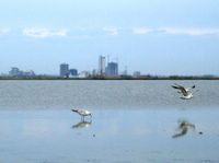 |
| 1) Above photo taken from Chocalata Bay looking back toward the Mobile skyline. Alligators made their presence known as soon as I turned up Conway Creek. |
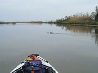 |
| 2) Photo shows an alligator pulling out in front of me to get a better look at the pedal kayak. Saw over a dozen alligators along the three mile strech of Conway Creek, most of them slithering slowly off the banks and into the creek as I pedaled by. |
 |
| 3) The trip down the Tensaw River to the Battleship was beautiful because the waters slicked off, providing some wonderful reflections from the clouds. |
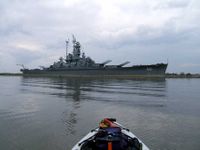 |
| 4) Even though I have seen the Battleship USS Alabama hundreds of times, the sheer size of it is best experienced from the water below and I enjoy pedaling by it time after time. |
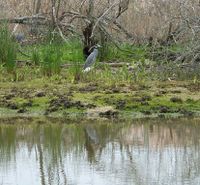 |
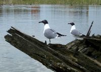
| 6) Then, on the way around Goat Island, a crowned night heron picked up its head to watch the kayak go by. |
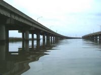 |
| 7) The final photo image shows what Interstate I-10 looks like from the kayak. Sure glad I ignored the forecast for rainy weather. |
No comments:
Post a Comment
Note: Only a member of this blog may post a comment.