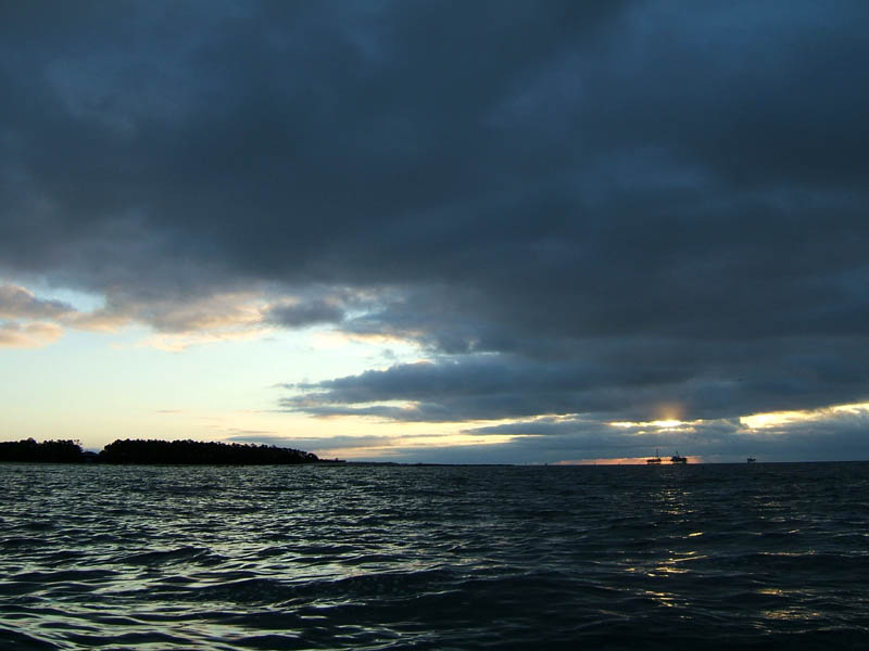
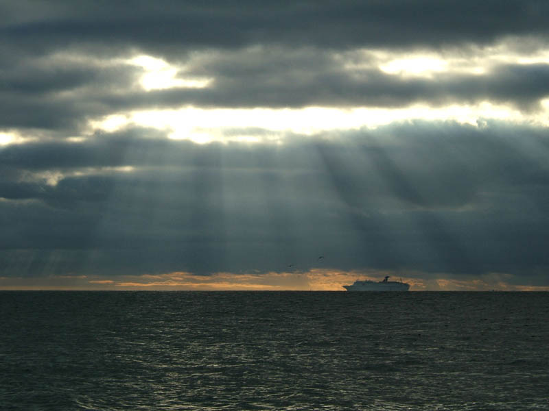
(1) Above left. Morning clouds, actually feeder bands associated with Arlene, darked the morning sunrise. Had expected big waves and was disappointed to see one foot waves coming out of the west. Occasional 2 foot swells were coming out of the southeast. I tested the currents, quite a few times, and they were no worse than average. Why were there no boats on the water, not even a shrimp boat? Leave it to a kayaker to test the waters after a storm. (2) Above right. The first boat I saw was the cruise ship Holiday, about 3 miles away in this photo, was coming into port early in the morning, a day late due to tropical storm Arlene. Guests get to enjoy 10 lounges and bars, three swimming pools, a 115-foot-long water slide, an Internet café, full casino gambling, and a comprehensive golf program. The Holiday is 727 ft long, can cruise at 21 knots, has a staff of 660 and guest capacity of 1452. The Hobie, well, it may not be as long, it can’t cruise that fast, doesn’t have all the capacity, doesn’t have any staff, but it is just as much fun!


(3) Above left. The lingering storm clouds did not want to leave. Abruptly, the skies parted allowing a stunning curtain of sunlight to stretch onto the water’s surface. (4) Above right. My first concern was for the birds currently nesting on Sand Island – did their nests get destroyed? Luckily, winds from Arlene were from the north so Sand Island was actually protected by Dauphin Island. You could see where debris piled up on the shore. The vegetation areas stayed above water so the bird nests were not destroyed. Yea! The poor birds have enough troubles with kayakers, boaters, dogs, ultra-lights, and helicopters – they don’t need more torture from mother nature.


(5) Above left. One of the helicoptors that seemed to be providing service to the offshore oil rigs, decided on taking the scenic route along Sand Island, low enough to probably chop a few birds into atoms. (6) Above right. An ultra-light plane, much quieter than the helicoptor, decided to take a scenic trip along the beaches. That looks like fun – until the gas is all burned up.
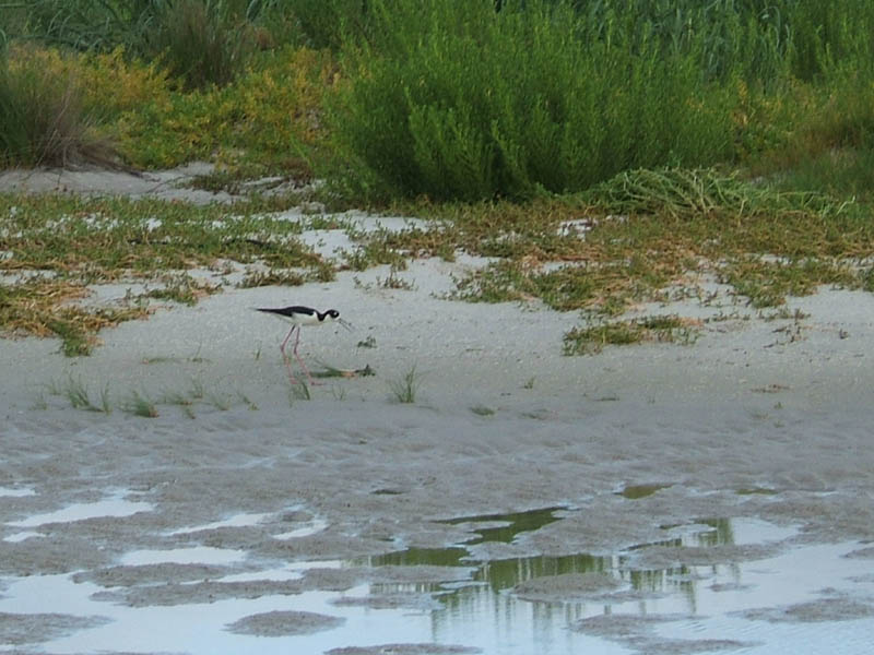

(7) Above left. A black-necked stilt, always an interesting bird to watch because it looks genetically mutated with legs so long compared to the body and neck. It is a sight to behold to watch one sit down and get up. Here is a site to learn more about salt marsh birds. http://www.saltgrassflats.com/birds/black_neck_stilt.html Of course, you don’t have to travel to Texas to experience salt grass flats - we have them here. (8) Above right. Another type of jellyfish in Pelican Bay. I couldn’t figure out what this one was.


(9) Above left. I went west under the public pier and pedaled along the beach to where the houses end. The waves change character west of the pier because the water is no longer protected. There were some swell surfing conditions, but the speed of the waves would have required having a fast kayak like a Seda to ride them. There were some surfers riding waves along the beaches. Just how big were those swells? First photo, looking at the end of the housing on Dauphin Island, you can see the beach. (10) Above right. The next photo, all you can see is the tops of houses. The rolling swells from the south, leftover from Arlene, were about two feet, with some three and four footers to make it more fun. When a wave makes the horizon disappear while you are in a kayak, you can say you were in three foot seas. There were a few shallow areas southwest of the pier that presented awesome surfing waves, but I didn’t want to risk a spill with the photo equipment I was carrying and landing on the beach would have been suicide with the size of those breakers. That is why I like launching and landing in protected areas. My thanks go out to all involved in getting Bienville Blvd opened all the way to the end of Dauphin Island. It makes it much safer for kayaking.
on the job, bro, on the job! "That is why (NOT WAY) I like launching and landing in protected areas.......
ReplyDelete